 Route Editor

| Guide | ♦ | 34 Triplogs | 2 Topics |
details | drive | no permit | forecast | 🔥 route |
stats |
photos | triplogs | topics | location |
| 440 | 34 | 2 |
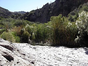
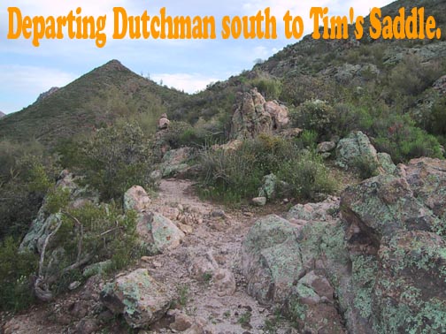
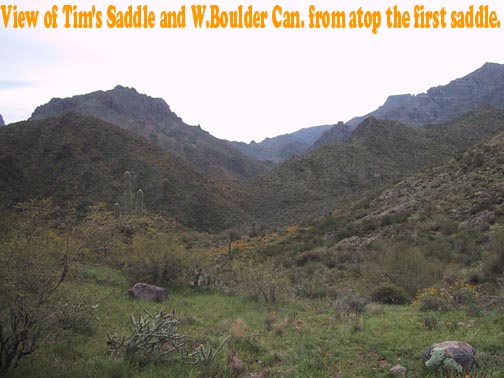
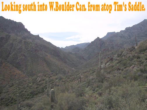
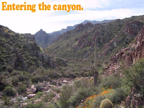
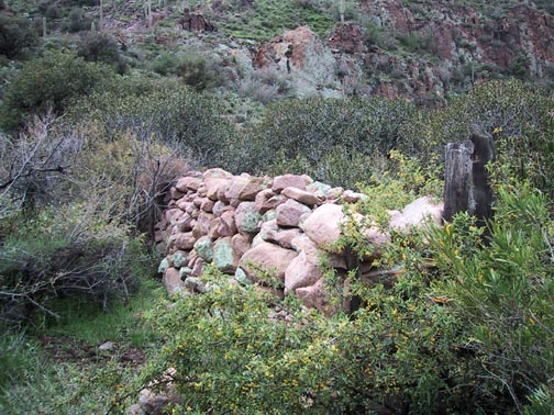
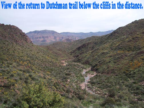
A Hundred Ouncer by Fritzski  This hike has it all. On trail, off-trail, bouldering, bushwhacking, route finding, water features, artifacts, and solitude. This is a fairly long and grueling hike, but I would highly recommend it to those more experienced and motivated hikers (a.k.a. hiking sickos). The itinerary takes you from the First Water trailhead south on the Dutchman trail to Parker Pass. From there you take a secondary trail over to O'Grady Canyon and on over Tim's Saddle and down into W. Boulder Canyon. At this point, you follow the creek bed south to Willow Springs. and a little further to an old stone corral. On the return, I remained in the creek bed and followed it all the way to its intersection with the Dutchman Trail in Boulder Basin and on back to the trailhead.
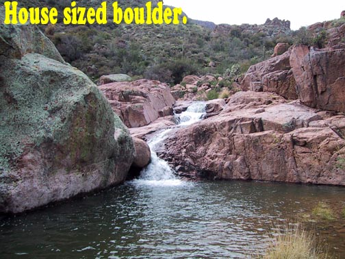
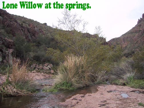
From here you follow a pleasant little trail to the top of a saddle overlooking O'Grady Canyon. Continue to follow it down to where it meets the creek bed. Choose the path that crosses the creek bed and continues straight to the south to the top of Tim's Saddle. At the top of Tim's Saddle, you are rewarded with a great view of W. Boulder Canyon to the south where you will be heading and to the east which is the return route. Continue to follow the trail as it takes you down to the bottom of W. Boulder Canyon. Although hints of trail and cairn abound, don't be fooled - you're on your own from here. Side note: If you should happen to be intending to return by the same route from whence you came, this is a real good time to take careful note of its point of intersection with the creek bed below. Not that it would ever happen to me, but I can only imagine it would be easy to miss on the way back and the unfortunate soul would find themselves unintentionally following my most carefully planned route back. Things definitely begin to decelerate at this point. I happened to go when there was a lot of water, which I prefer, but the going would definitely be easier if there were less. Fortunately, unlike the approach to Willow Springs. from the south, there is ample room to snake your way along the banks beside the creek bed. Although you'll definitely encounter some bush, I believe you'll find it quite whackable. About halfway up the canyon to the Springs you will encounter a giant house-sized boulder blocking the stream and resulting in a rather spectacular little waterfall (at least for the Supes anyway). I recommend climbing right around and over it to get a good close look, but here, as with a couple of other spots along the way, you may notice possible shortcuts for the way back. Moving on, continue to use your imagination and you may find some rather creative little rock ledge routes and such as you make your way through the rugged rock features along the canyon floor. I was fairly proud of myself - I only got my boots soaked about five times. Willow Springs itself is a bit anticlimactic. You'll find a lone Willow tree next to a shallow pool with Cattails indicating a year-round water source. The real reward is a bit further upstream where the creek makes a bend to the left then back to the right creating a small peninsula on the west bank. On this spot there is a bizarre stone circle about a hundred feet across created by the very laborious stacking of rocks to a height of about six feet. Evidently, this was used as a corral by the late Adolph Ruth back in about 1930. Other camps I've seen in the Superstitions make some sense (i.e., Pinon, Piper, Sec. Water Sprgs, etc.), but this one mystifies me in its remote and very rugged location. Not to mention the idea of bringing and keeping horses up there. Whatever. Old Adolph sure put a lot of back-breaking work into his little project and all he got for his efforts, in the end, was a bullet to the back of the head. A fairly predictable fate in that time and place it seems. I would have liked to push on a bit further and close the gap left from the point of my earlier failed attempt at reaching the Springs from the south, but I knew I'd just pay for it "with interest" on the return leg. The return, although long, is very straight forward. Just stay with the creek and it will eventually begin to turn to the east, open up, and eventually run right into the Dutchman trail. As I mentioned earlier, there are a couple of shortcuts available along the way that require climbing up onto the terrain above the creek bed thus allowing you to cut a corner. A nice side benefit is some neat views of the canyon features from above. Someday I may be tempted to try a N/S traverse of the entire length of the canyon, but for now, this will do. I was definitely struck with that kind of eerie sensation you get when you know you're someplace where very few humans have been in a very long time. Totally cool!!! No wonder I'm addicted! Check out the Official Route and Triplogs. Leave No Trace and +Add a Triplog after your hike to support this local community. | |||||||||||||||||||||||||||||||||||||||||||||||||||||||||||||||||||||||||||||||||||||||||||||||||||||||||||||||||||||||||||||||||||||||||||||||||||||||||||||||||||||||||||||||||||||||||||||||||||||||


