 Route Editor

| Guide | ♦ | 34 Triplogs | 1 Topic |
details | drive | permit | forecast | route |
stats |
photos | triplogs | topic | location |
| 245 | 34 | 1 |
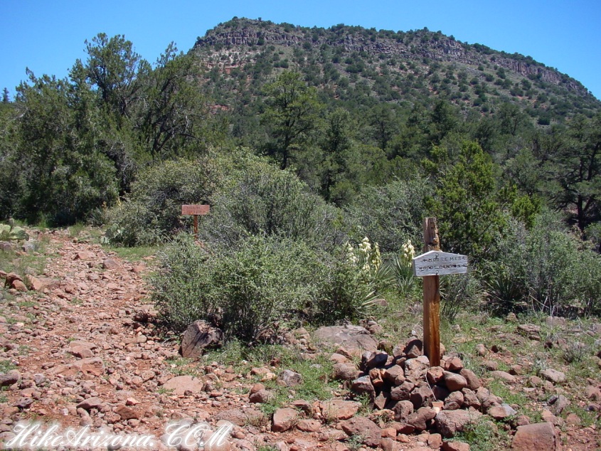
Great in Season! by joebartels  Note NoteThe trailhead has moved slightly since first posted this 2001. Only the first quarter-mile of the hike has changed. All the good stuff remains the same. Download the official route for best results. Overview Woods Canyon is located southeast of Sedona. The canyon is protected by the Munds Mountain Wilderness (sorry, mountain bikers). The canyon begins to etch the surface up near mile marker 316 on I-17 at (you guessed it) the Woods Canyon bridge. From I-17, it slowly snakes out to the west. Then in about 2 miles, it opens up and rips its way down to SR179 below the Village of Oak Creek. This page is dedicated to an out and back hike from SR179 to just past what I call "Red Rock Beach".
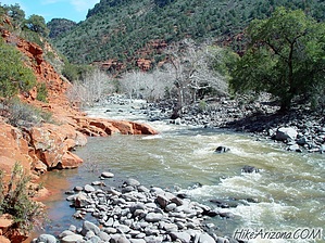
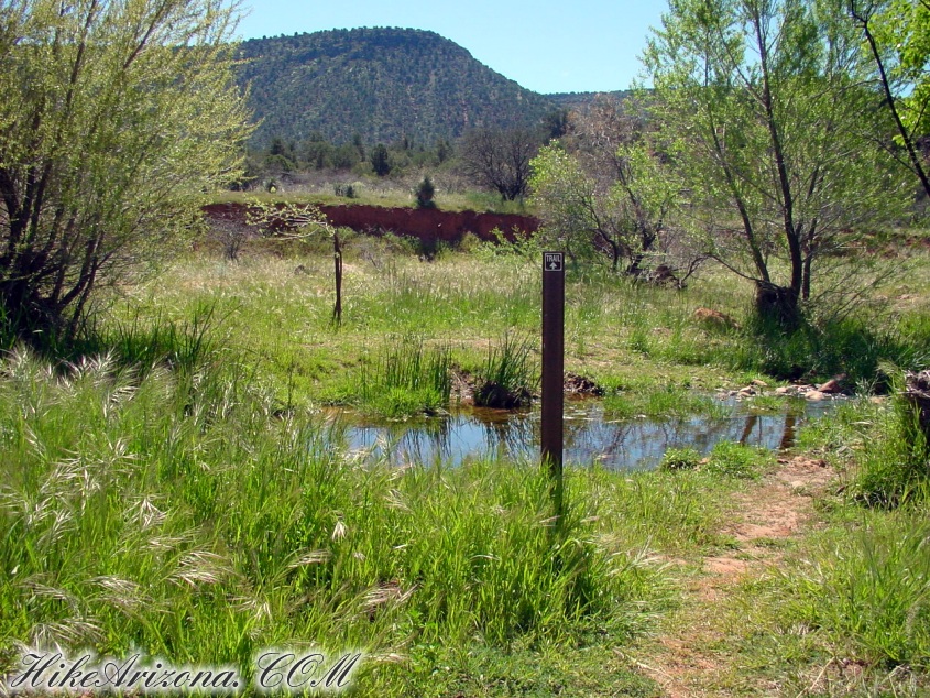
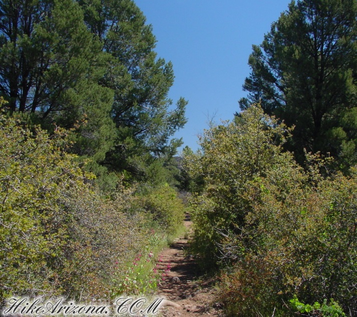
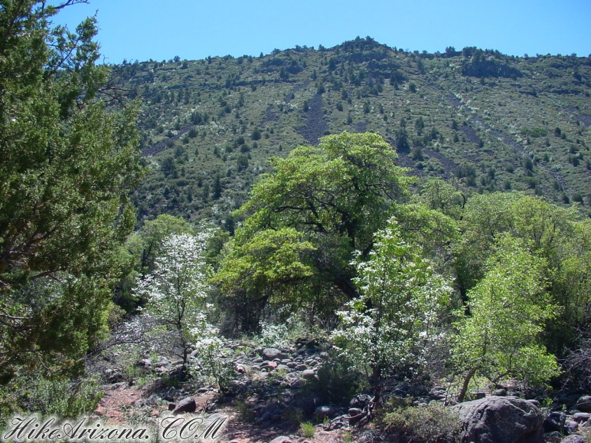
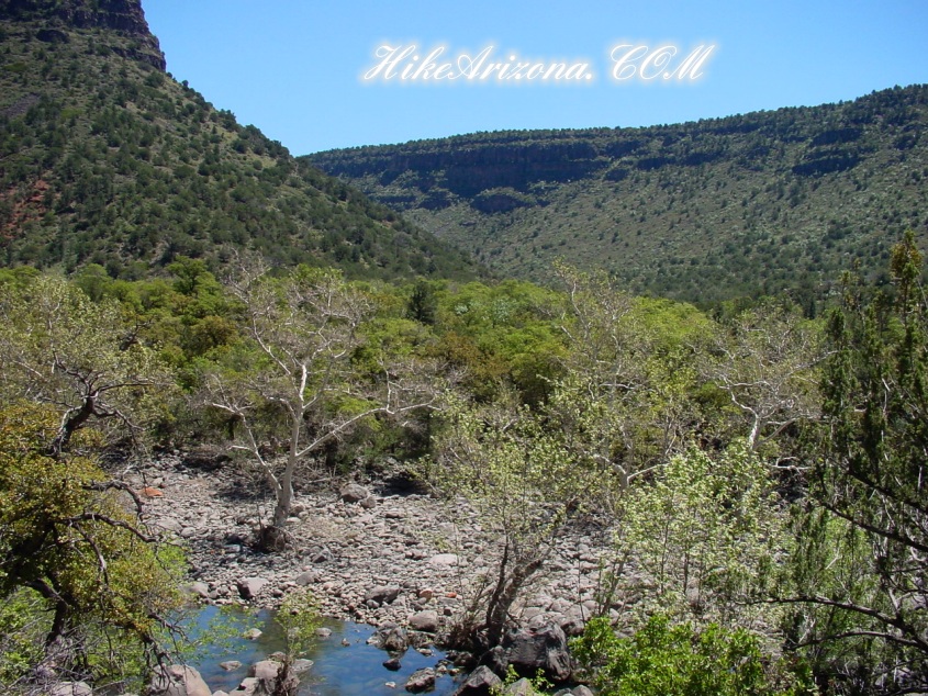
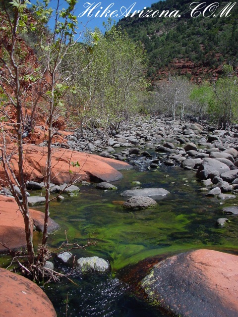
From the trailhead, you head out on a now-closed jeep route. Thankfully, the recently closed route is already becoming less noticeable due to the wet winter of 2000. Tall grasses lining the trail attract a never-ending grasshopper invasion. Since it's only for a short distance, it didn't bother me. It's also unlikely this occurs most of the year. The trail crosses a relatively flat meadow working its way towards Woods Canyon. Across the way you'll see the Beaverhead. I'm not sure why it's called that. That's just how it's labeled on the topographical map. Knowing Wet Beaver Creek is nearby, I'm sure it's related. My best theory so far is the terrain of the area resembles a beaver when viewed on a topographical map. Perhaps someone will fill me in on the whole story someday. The trail stays to the left of the creek. The views of the creek aren't great. There's no need to be disappointed. The trail is remarkably well placed in the foliage of the canyon's namesake . By the way, the creek is seasonal. I've read and been told by friends this trail is much better when the creek is flowing. I did enjoy the sound of the flow. However, it didn't seem to be the highlight of this experience. I hiked on, figuring some spectacular view must be further on. The opposing canyon wall offers some great views. The steep slope is amazingly wooded. Rock slides patched along the wall reassure you it's very steep. At two miles is the junction with the Hot Loop Trail. The Hot Loop jets up onto Horse Mesa. Horse Mesa makes up the canyon wall on your left. Continuing past the junction, there are some views of the creek below. The trail skirts the left wall of the canyon above the creek. Along the way, you see Rattlesnake Canyon forking off to the right. About a mile and a quarter from the Hot Loop junction, the trail finally goes down to the creek. The hike was nice up to this point. I soon found out why everybody recommends hiking this trail when the creek is flowing. Welcome to Red Rock Beach! Sedona red rock sandstone lines the left bank of the creek. Smooth water-flow paths etched into the slab are cool to observe. The pool gathered in the area wasn't deep enough for swimming on this day. Like similar oases, the water level drops by the time it's hot enough to enjoy. The most spectacular sight was the fluorescent algae algae seen against the red rock. 3.4mi here is the end of this description. Further on to the end of the trail at 5.25mi is not exciting for most casual hikers. Rattlesnake Canyon on the right is a three-mile excursion. There's no trail connecting. A big waterfall 2.5 miles in might be to your liking.
Coconino FS Details The trail begins at the signed trailhead beyond the gate. It is level and unshaded as it follows a jeep road into the wide canyon mouth for 1-1/4 miles. The road ends and the trail continues, climbing gradually. There are views of the vegetation-covered slopes of mesas on either side. At 2 miles, the trail crosses a small, dry streambed with red rock pools, climbs out, passes through a cattle gate, and comes to a signed fork. The Hot Loop trail enters Wilderness area and continues its easy climb, passing some redrock formations on the left. It enters the occasional shade of pine and sycamore as it approaches and then follows Dry Beaver Creek. At 3-1/2 miles, the trail emerges on a picturesque expanse of redrock at the edge of the usually dry creekbed which is studded with huge, gray boulders. Continue on for another 3/4 mile for some nice redrock views as the trail climbs on a moderate grade out of the creekbed. This is a good place to turn around although a path continues further into the canyon. Return by the same route. This hike can be hot in summer. Check out the Official Route and Triplogs. Leave No Trace and +Add a Triplog after your hike to support this local community. One-Way Notice This hike is listed as One-Way. When hiking several trails on a single "hike", log it with a generic name that describes the hike. Then link the trails traveled, check out the example. | ||||||||||||||||||||||||||||||||||||||||||||||||||||||||||||||||||||||||||||||||||||||||||||||||||||||||||||||||||||||||||||||||||||||||||||||||||||||||||||||||||||||||||||||||||||||||||||||||||||||||||||


