username
X
password
register
for free!
help
   🔥

Bridal Wreath, AZ

Guide 45 Triplogs  0 Topics
  3 of 5  
Fav
Wish
8
details
drive
permit
forecast
🔥
route  
stats
photos
triplogs
topics
location
158 45 0
Statistics
tap row or icons for details
Difficulty 2.5 of 5
Route Finding 1 of 5
Distance Round Trip 5.9 miles
Trailhead Elevation 2,751 feet
Elevation Gain 1,052 feet
Accumulated Gain 1,121 feet
Avg Time Round Trip 2.5 hours
Kokopelli Seeds 11.51
 Backpack Yes & Connecting
 Dogs not allowed
feature photo
Photos Viewed All MineFollowing
Inaugural Calculation on Button Tap!
7  2023-01-20 Semiferalhiker
14  2022-12-04 wanderingtrails
10  2022-08-19
Douglas Spring Three Tanks Garwood Loop
Jackluminous
13  2021-07-29
Bridal and Ernie Falls
markthurman53
2  2019-05-11
Bridal Wreath Falls Loop
TosaInu
15  2017-07-31 SkyIslandHiker
6  2015-10-15
SNP Hike Bridal Wreath Falls
markthurman53
6  2013-11-02 BiFrost
Page 1,  2
Author
author avatar Guides 15
Routes 0
Photos 403
Trips 17 map ( 75 miles )
Age 45 Male Gender
Location Phoenix, AZ
Associated Areas
list map done
Tucson Region
Historical Weather
Trailhead Forecast
Radar Map
Expand Map
Preferred Nov, Dec, Jan, Feb → 9 AM
Seasons   Late Autumn to Early Spring
Sun  6:01am - 6:40pm
Official Route & 1 Rt
 
7 Alternative
 
Historic Fire Perimeteracres
🔥 1989 CHIVA Fire21.9 mi*


Rincon teaser
by Lizard

Bridal Wreath Falls is a cool little grotto tucked away in the foothills of the Rincon Mountains. To my knowledge, it has not appeared in any guidebook, but it is far from unknown. On a winter weekend, you will share this trail with more than a few people. Nonetheless, it is a pleasant hike and a nice change from the abundance of steeply vertical Tucson trails.


The Douglas Spring Trail is your route into the backcountry. It starts in the low desert of the Tucson valley, quickly passing two junctions, where you bear left and stay on Douglas Spring Trail. The trail then climbs up a hillside to meet a junction with the Carrillo Trail. Bear left. The trail continues climbing into the Rincon foothills, gradually and easily. After dropping to cross a wash, the trail climbs up parallel to the wash, which still held some fall color when I passed in December. At the head of the wash, the trail finally moderates and strikes out across the large field. The vegetation has changed with the elevation, and the trail now crosses large fields of grass and prickly pear. This was by far my favorite section of the hike. You are cut off from the city and surrounded by views of the Rincons and Catalinas. There is a great sense of isolation and wilderness to be found here, only a few miles from the trailhead.
remove free decal offer
After passing a junction with the Three Tank Trail (bear left), you will come to a junction with the spur trail to Bridal Wreath Falls. Turn right here and follow this short trail as it drops into a tree-filled canyon and follows it upstream. Eventually, you will reach Bridal Wreath Falls, where tall canyon walls guard a thirty-foot overhang. Water drops off the overhang and falls through open air to splash on the rocks below. The water was merely dripping when I visited, but I imagine that during rain this waterfall would be impressive.

To return, you can simply retrace your steps back to the trailhead for a 5.6-mile hike. Alternatively, you could follow the Three Tank Trail to Carrillo Trail, then take Carrillo Trail back to the Douglas Spring Trail. This alternative will add about 1.5 miles to your hike but will take you through some different terrain.

2003-12-15 Lizard
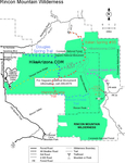
  • Rincon HAZ Map
    area related
    Rincon HAZ Map
  • Rincon Mountain Distric East
    area related
    Rincon Mountain Distric East
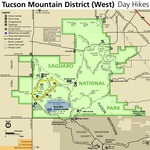
  • Tucson Mountain District West
    area related
    Tucson Mountain District West
  • SNP Cactus Forest Map
    area related
    SNP Cactus Forest Map
  • nps related
  • sub-region related


Check out the Official Route and Triplogs.
Leave No Trace and +Add a Triplog after your hike to support this local community.
WARNING! Hiking and outdoor related sports can be dangerous. Be responsible and prepare for the trip. Study the area you are entering and plan accordingly. Dress for the current and unexpected weather changes. Take plenty of water. Never go alone. Make an itinerary with your plan(s), route(s), destination(s) and expected return time. Give your itinerary to trusted family and/or friends.

 Permit $$
None

Saguaro National Park
2022 $25 vehicle • $20 motorcycle • $15 individual on foot or bicycle
Receipt is valid for 7 days
$45 Annual Park Pass View All

No fee required from Miller Creek Trailhead off Mescal Rd.


 Directions
or
 Road
Paved - Car Okay

To Douglas Spring Trailhead
From I-10 & Speedway Blvd exit #257, travel East on Speedway Blvd 17.4 miles to the trailhead.

The final major crossroad will be Freeman and "Dead End" signs will begin to appear. The trailhead is a small parking area with a picnic table and ample signage at the dead end of Speedway.

From PHX (I-10 & AZ-51) 129 mi - about 2 hours 17 mins
From TUC (Jct 1-10 & Grant) 19.4 mi - about 41 mins
From FLG (Jct I-17 & I-40) 272 mi - about 4 hours 23 mins
 90+° 8am - 6pm kills
helpcorrectionissue

end of page marker