 Route Editor

| Guide | ♦ | 64 Triplogs | 4 Topics |
details | drive | permit | forecast | route |
stats |
photos | triplogs | topics | location |
| 260 | 64 | 4 |
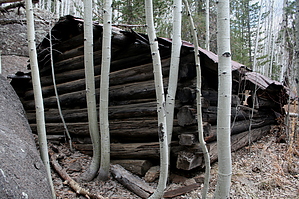
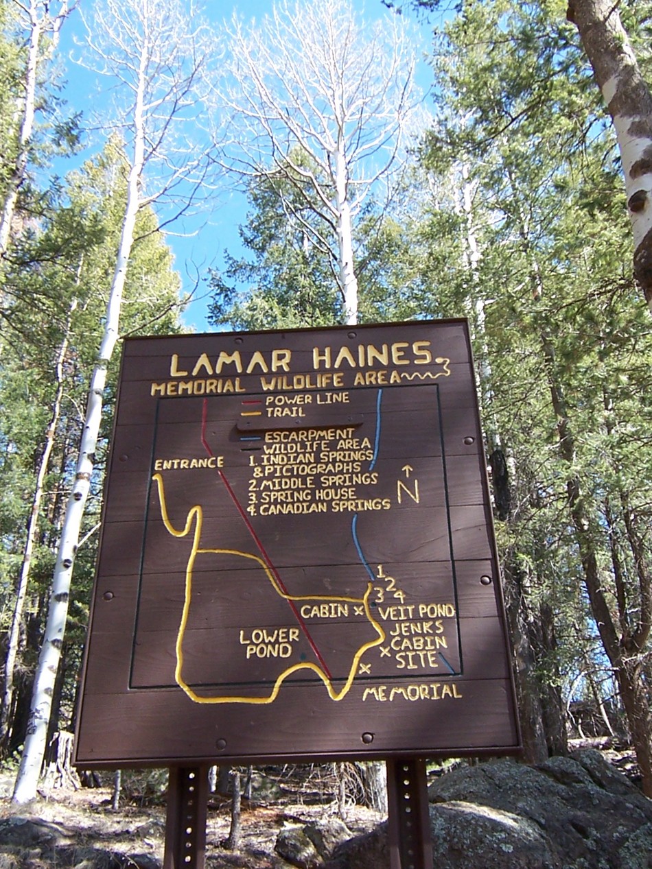
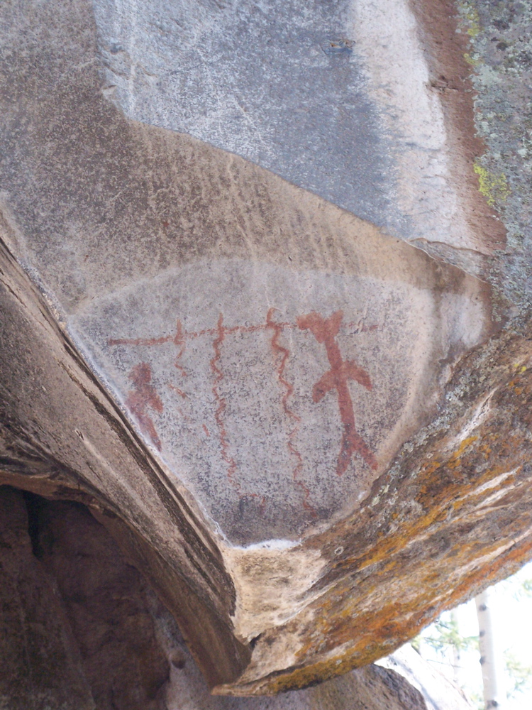
Pretty little hike by aimeeclimbs   To get to the trailhead, take HWY 180 north of Flagstaff to Snowbowl Rd. Turn right and follow the road about 4 miles to a pullout on the right. If it is winter, there will be signs posted that say "permit parking only". The free "Backcountry Permits" are available at the peaks ranger station. To get to the trailhead, take HWY 180 north of Flagstaff to Snowbowl Rd. Turn right and follow the road about 4 miles to a pullout on the right. If it is winter, there will be signs posted that say "permit parking only". The free "Backcountry Permits" are available at the peaks ranger station.This parking area is known as the "Lamar Haines trailhead". After parking, go through the gate and turn right up the hill. You will see 2 signs; one is a map and the other has some info about the area. At about 0.2 miles, you will reach a fork, go right (or downhill here). At 0.7 miles, you will see a plaque for Lamar Haines on a boulder. If you walk past this and head left, you will see an old log cabin and maybe a pond. The last time I was there, there was no water in the summer, and now in March, there was no water either. If you walk around the pond depression to the left of the "spring", you will see some pictographs on the rock face above a small cave. They are quite nice pitctographs.
Veit Springs Trail is a very easy but lovely hike, which is best done in the summer or fall or a very warm spring like this one. We did encounter snow and mud, but nothing not crossable by tennis shoes. Gate Policy: If a gate is closed upon arrival, leave it closed after you go through. If it is open, leave it open. Leaving a closed gate open may put cattle in danger. Closing an open gate may cut them off from water. Please be respectful, leave gates as found. The exception is signage on the gate directing you otherwise.
Check out the Official Route and Triplogs. Leave No Trace and +Add a Triplog after your hike to support this local community. | ||||||||||||||||||||||||||||||||||||||||||||||||||||||||||||||||||||||||||||||||||||||||||||||||||||||||||||||||||||||||||||||||||||||||||||||||||||||||||||||||||||||||||||||||||||||||||||||||||||||||


