 Route Editor

| Guide | ♦ | 133 Triplogs | 13 Topics |
details | drive | no permit | forecast | route |
stats |
photos | triplogs | topics | location |
| 802 | 133 | 13 |
Must See! by joebartels  Warning WarningThe technical canyoneering version coming back through the creek requires beta, gear, and skill. Do not enter the creek without skilled training certified by a reputable source such as the American Canyoneering Association. If you head down the creek unprepared, you may not be able to get out. I've heard some scary stories over the years of serious injury. Overview This is an out-n-back 3.5 mile hike on Jug Trail #61 to Salome Creek. Salome Creek is a major drainage for the Sierra Ancha range. The Jug is the narrow section of Salome Creek just before it widens after Dutchwoman Butte. Dutchwoman Butte looms to your right as seen in this photo. The jug lies in the area below this butte. With that in mind, it's easy to get an idea as to where you are headed.
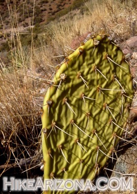
Converted from an old 4x4 jeep track, the trail is wide most of the way. Staying level, the trail follows the contours of Victoria Peak over to Salome Creek. Hugging the mountain, the trail goes in and out of the natural drainages three times. The first is extremely level, and you can look across the wash to your vehicle. The second has very little descent, if any. Finally, the third begins a slight descent. The area covered so far is thin on vegetation. Having hiked the area after nearly four months without much rain period, the desert was looking dry. Shriveled to a pulp the prickly pear cactus was showing signs of drought. Views of the surrounding area make up the excitement for the beginning of this hike. Salome Creek heading on down to Roosevelt Lake, comes into view on your right. Nearing Dutchwoman Butte, the trail starts a more noticeable descent. Take caution where the trail is gravely and steep. Continue until you reach a small coral to the right. The designated FS trail continues about 0.7 mi. It hooks left into a drainage; then you turn around. There are no connecting trails. I'm not sure why it ends on the left hook, maybe an old homestead? I do know this trail is very popular with technical canyoneers. Instead of hooking left, they continue on a use-trail that soon meets the creek or turn right to the creek. You don't need to be a canyoneer to ponder the creek from above. From the coral head off-trail right to the creek. Approach the edge with extreme caution! No trail exists; you just have to make your way along the edge best you can. I believe I found three or four good spots to look down into the gorge of Salome Creek.
Check out the Official Route and Triplogs. Leave No Trace and +Add a Triplog after your hike to support this local community. | |||||||||||||||||||||||||||||||||||||||||||||||||||||||||||||||||||||||||||||||||||||||||||||||||


