Here's a great alternative to the crowded summit trail with many rewards. You can access this trail from all the inner trailheads. The easiest and least crowded being the Hopi Trailhead. That's the first left after the Ranger Station. The trail takes off in either direction behind the ramada. Heading clockwise you will encounter the summit trailhead in a quick 0.4 miles. Next, you will take the summit trail for a half-mile. At the 0.6 mile marker on the summit trail, take a left onto the circumference route. This is the only left-hand turn you take.
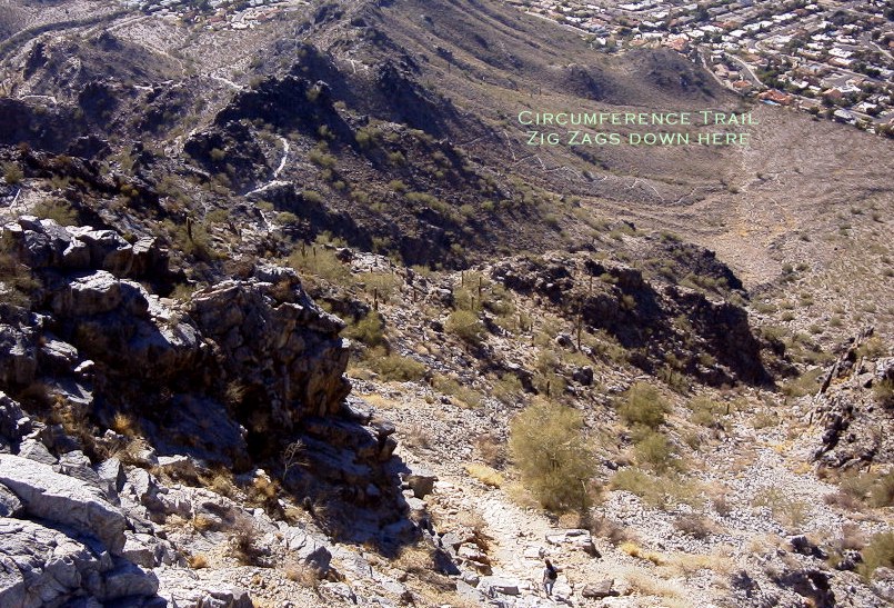
From here on take all the right-hand turns. Which makes perfect sense because you will be circling the mountain. From the 0.6 saddle, the trail drops off immediately. Zig zagging down the slope here gives you a feeling that you have arrived. I say that because I always feel like I've just completed a long journey and the homes below are the destination. Yeah, I know that's a little far-fetched.
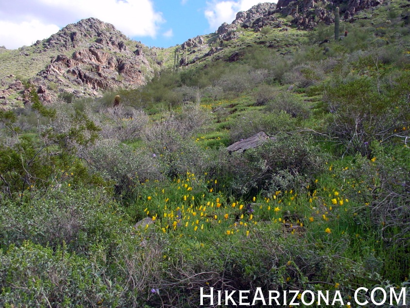
During a good wet season, Brittlebush blooms cover this slope in a sea of yellow. The first junction is encountered after the zig-zagging, continue right (North). The trail roller coasters to the low-lying northwest saddle. Before the saddle is one nice area I call the three saguaros, two switchbacks, and one beautiful skyline. Soon after you'll reach the northwest saddle.
The Perl Charles 1A Trail joins at the saddle from the northwest. From the saddle go down and east. A few steps past the saddle and the noise of the city takes a sudden decibel drop. You are now entering the area I call the desert Andes. This valley is awesome. The slopes of the facing mountains are STEEP! Continue along the roller coaster, now going up over and up.
Midway along the north stretch you might find Mexican Gold Poppies on north-facing slopes. Near the northeast saddle, you'll enter a gully scattered thick with Saguaros. The resurrection plant covers some of the north-facing slopes. The final saddle is near. Recent trail improvements have filled the rutted sections making the going easier.
From the saddle, it is all downhill. Well for most of the remaining trail anyway. The trail goes down fast and is steep in sections. The valley you just entered is totally silent. It's hard to believe you're in the middle of a major city. Continue taking the right-handed turns and you will eventually be paralleling the parking area below. Continue along the trail back to your starting point.
WARNING! Hiking and outdoor related sports can be dangerous. Be responsible and prepare for the trip. Study the area you are entering and plan accordingly. Dress for the current and unexpected weather changes. Take plenty of water. Never go alone. Make an itinerary with your plan(s), route(s), destination(s) and expected return time. Give your itinerary to trusted family and/or friends.
Permit $$
None
Directions
Road
Paved - Car Okay
To hike Between 16th and 24th Streets on Lincoln Drive go North on Piestewa Peak Dr. Follow Piestewa Peak Dr through the neighborhood into the park.
Freedom Trail #302 is accessible from any of the parking areas on the left or the end lot.
 Route Editor

 Here's a great alternative to the crowded summit trail with many rewards. You can access this trail from all the inner trailheads. The easiest and least crowded being the Hopi Trailhead. That's the first left after the Ranger Station. The trail takes off in either direction behind the ramada. Heading clockwise you will encounter the summit trailhead in a quick 0.4 miles. Next, you will take the summit trail for a half-mile. At the 0.6 mile marker on the summit trail, take a left onto the circumference route. This is the only left-hand turn you take.
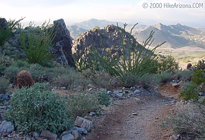


