At 7979 feet, Mount Union is the highest point in the Bradshaw Mountains and Yavapai County. When miners first explored the Prescott area in the early 1860s, some Confederate sympathizers among them named a nearby high peak "Mount Davis" for Jefferson Davis. In retaliation, Union loyalists named the adjacent higher peak "Mount Union". Today, a forest service fire lookout stands upon the peak, keeping watch over the vast woodlands of the Bradshaw Mountains.
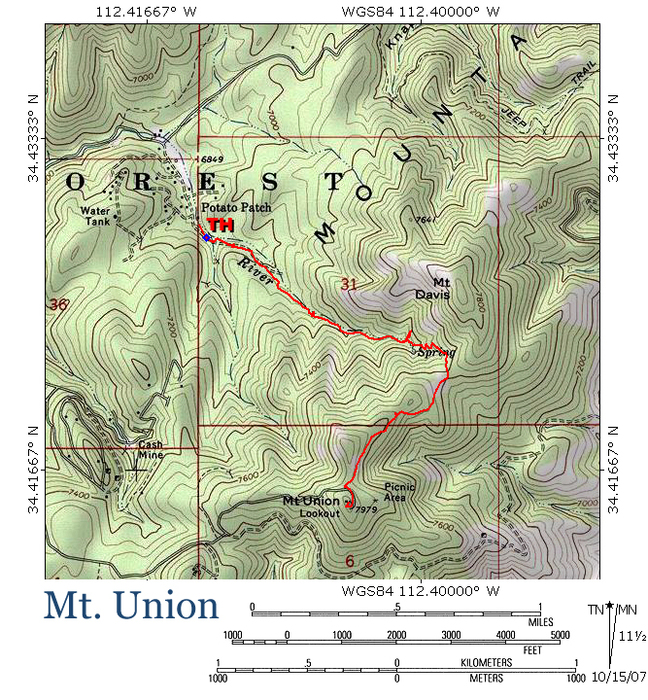
This hike combines forest trails #285 and #284 to bring you to the top of the peak. Be advised that both of these trails allow ATVs. Trail #285 begins on the south side of the Potato Patch cabins area, where Poacher's Row road comes to an abrupt end on forest service land. There is little room to turn around here, so if you have a large vehicle, it might be wise to park along Walker Road and walk the 0.33 miles from there to the trailhead. If you do so, add 0.66 miles to the round trip distance listed for this hike.
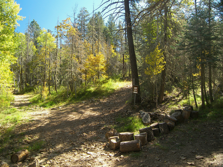
At the trailhead where Poacher's Row road ends, two rough ATV trails take off into the forest. Take the right fork, which is marked as trail #285, and follow it uphill. Almost immediately, trail #285 forks; stay left and continue uphill through the aspens. Around 0.2 miles, the trail forks again. Go right.
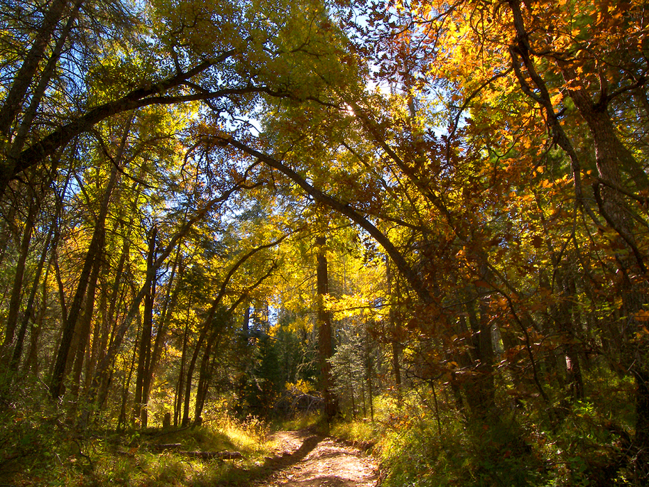
As you hike along the headwaters of the Hassayampa River, tall firs and aspens intermingle, blocking any views of surrounding mountains. Gatherings of large Gambel Oaks occasionally lean over the trail, forming tree tunnels backlit by the sun.
Higher up in the canyon, evidence of the area's rich mining history can be seen in the form of occasional, partially collapsed mine tunnels or overgrown tailings piles.
About a mile in the trail ascends a few switchbacks, as it nears the head of the Hassayampa River. The Prescott area comes into view briefly, just before trail #285 meets trail #284 in an open saddle at the 7600-foot level. Turn right and begin following trail #284.
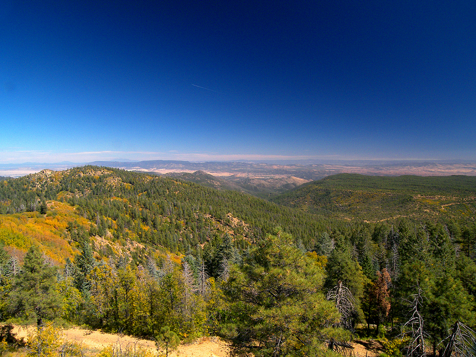
As the trail climbs the ridge to Mount Union, sweeping views from the Rim to Phoenix break through the dense stands of Gambel Oak.
Near the top, at about mile 1.9, trail #284 makes a left (34.41602 N, 112.40439 W), while an unmarked and more primitive trail goes straight. Follow the more primitive trail through the forest. After a few hundred feet, it meets a road. Turn left on the road and follow it a short distance to the top of Mount Union.
A fire lookout and various communication towers greet you at the top of the mountain, as well as jaw-dropping, one hundred miles views of central Arizona. Near the fire tower is a summit register stashed in some rocks.
Have fun on the roof of the Bradshaws, and return the way you came.
WARNING! Hiking and outdoor related sports can be dangerous. Be responsible and prepare for the trip. Study the area you are entering and plan accordingly. Dress for the current and unexpected weather changes. Take plenty of water. Never go alone. Make an itinerary with your plan(s), route(s), destination(s) and expected return time. Give your itinerary to trusted family and/or friends.
Only trailheads with six "amenities" have fees. Amenities are picnic tables, trash, toilet, parking, interpretive signing and security.
Directions
Road
FR / Jeep Road - Car possible when dry
To hike From the highway 69/highway 89 junction in Prescott, head east on Highway 69 for 2.85 miles to the Walker Road stoplight. Turn south on Walker Road (a.k.a. county road 57, which later turns to dirt), and follow it for 10.5 miles to its junction with Poacher's Row road. Turn left and follow Poacher's Row road for 0.33 miles through the Potato Patch cabins area to its end on Prescott National Forest land. There is a brown fiberglass signpost for trail #285 next to a large tree.
 Route Editor

 At 7979 feet, Mount Union is the highest point in the Bradshaw Mountains and Yavapai County. When miners first explored the Prescott area in the early 1860s, some Confederate sympathizers among them named a nearby high peak "Mount Davis" for Jefferson Davis. In retaliation, Union loyalists named the adjacent higher peak "Mount Union". Today, a forest service fire lookout stands upon the peak, keeping watch over the vast woodlands of the Bradshaw Mountains.
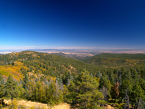


