Route Editor

| Guide | ♦ | 1 Triplog | 0 Topics |
details | drive | permit | forecast | map |
stats |
photos | triplog | topics | location |
| 5 | 1 | 0 |
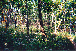
Appalachian Trail favorite by Crzy4AZ  Blood Mountain gets its name either from a bloody battle between the Cherokee and Creek Indians in the 1600's or perhaps from the red lichen that light up the trail. It sounds more exciting to think of bloodshed on the mountain, but no one really knows for sure. The trailhead I've always used to go up Blood Mountain is directly across from the Walasi-Yi Interpretive Center parking lot at Neel's Gap. But it's tricky to park downhill on the edge of the steep road and can be dangerous with weekend traffic to walk back up to the TH.
Once at the summit, look for the shabby but historic shelter built in 1934 by the Civilian Corp of Engineers. This trail is very busy on Spring, Summer, and Fall weekends with all the Atlanta day hikers. There are many options to lengthen this hike with loops or combine it with other features in the area. My top two (day trip length) combinations are: Blood Mtn/DeSoto Falls or Blood Mtn/Lake Winfield Scott. A fun, non-camping base station for a visit would be in Dahlonega, GA which embraces its history as the first gold-rush city in the US reflected in its kitschy shops and B&B's. Check out the Triplog. Leave No Trace and +Add a Triplog after your hike to support this local community. | |||||||||||||||||||||||||||||||||||||||||||||||||||||||||||||||||||||||||||||||||||||||||||