Overview
This TH/TR145 (originally an old asbestos mining road) provides an "alternate" trail connection to the HAZ McFadden Horse Trail #146 hike. This Cienega Spring #145 adds some scenic driving time/distance, adds an additional 2.8 miles R/T hiking distance with an opportunity to view six(6) nineteenth-century Sierra Ancha asbestos mine adits along this 2.4mi route, and also provides some scenic views of the Reynolds Creek Drainage below.
When hiking several trails on a single "hike", log it with a generic name that describes the hike. Then link the trails traveled, check out the example.
WARNING! Hiking and outdoor related sports can be dangerous. Be responsible and prepare for the trip. Study the area you are entering and plan accordingly. Dress for the current and unexpected weather changes. Take plenty of water. Never go alone. Make an itinerary with your plan(s), route(s), destination(s) and expected return time. Give your itinerary to trusted family and/or friends.
Permit $$
no fees or permits reported
if incorrect tell us about it
Directions
Road
High Clearance possible when dry
To hike From the Phoenix area: Take Hwy 60E to Globe (at MP247) turn north on HWY 188 towards Lake Roosevelt. Drive 14.7 miles (at MP229.4) turn right onto HWY 288. Drive 27.6 miles north (at MP286.4) to FR410. Turn right on FR410 and continue for 2.3 miles to its intersection with FR235. Turn Left on FR235 and continue for .50 miles to its intersection with "easy to miss" but signed FR145 (a left turn off of FR235); Continue for approx 50 yards to TH Parking/TR145 Start (Note: parking for a maximum of 2 vehicles... if need more parking, then park across from the intersection of FR235/145 at perennial Ceneiga Spring; Also, see attached GPS Driving Route to TH, dated 10/28/10;
page created by Grasshopper on Oct 29 2010 7:30 pm
 Route Editor


 Overview
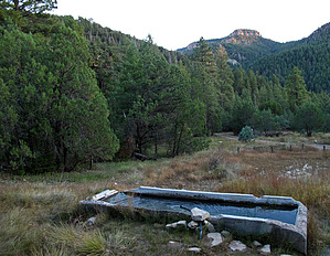


