 Route Editor

| Guide | ♦ | 86 Triplogs | 0 Topics |
details | drive | no permit | forecast | route |
stats |
photos | triplogs | topics | location |
| 167 | 86 | 0 |
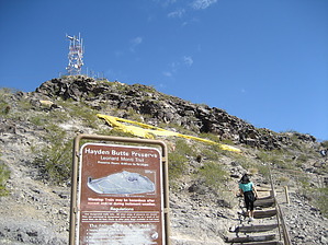
That's a big "A"! by paulshikleejr  Overview OverviewThis is a "must-do" iconic trail for any true 'Zonie. You need to be able to say, "Yeah, I hiked the 'A' mountain. Even sat on the 'A' itself!" Hayden Butte Preserve (HBP), overlooking downtown Tempe and Tempe Town Lake, has always been a favorite spot for hikers. The top of the butte provides spectacular views of Tempe and the surrounding communities. The butte environs itself is also a historic landmark, home to petroglyphs carved by the Hohokam people who inhabited the area between 500 A.D. and 1450 A.D. The butte, overlooking ASU to the south and Sun Devil Stadium to the east, was established as a park in 1973. Because of its significant historical resources and significance, it was designated as a preserve in 2002 to protect its existence into the future while maintaining its connections to the past.
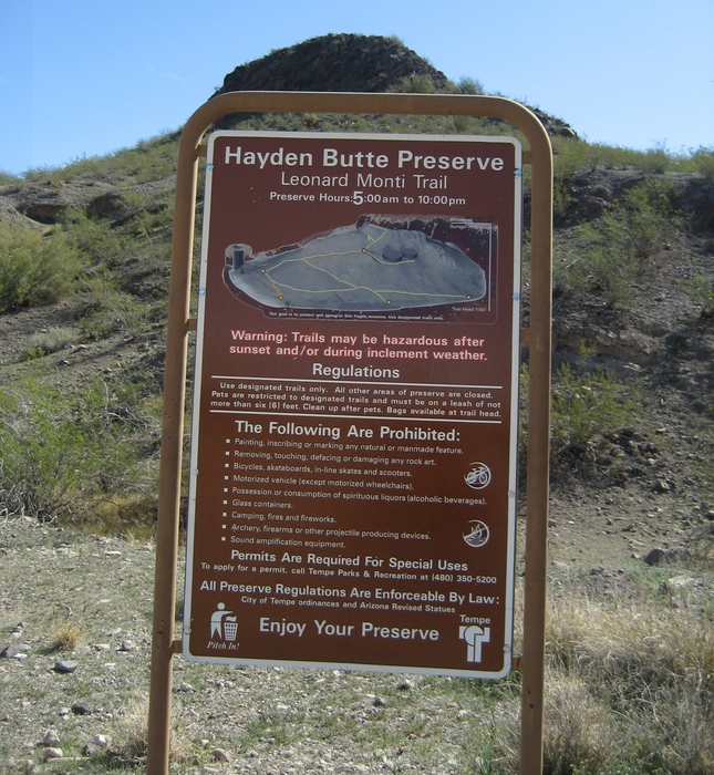
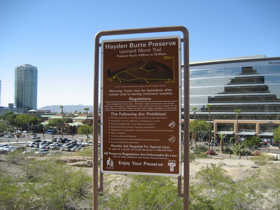
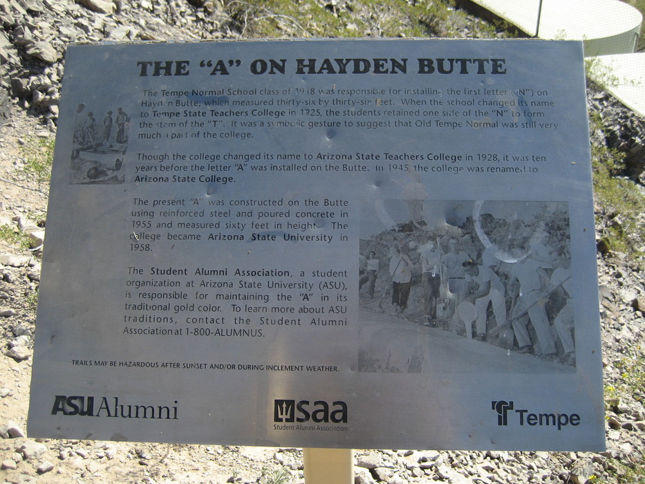
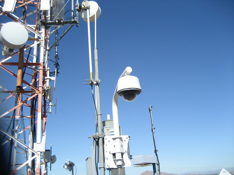
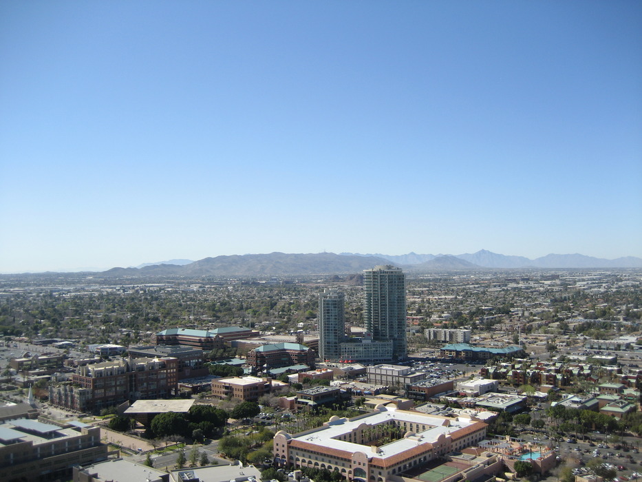
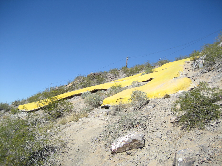
The preserve includes several well maintained, many paved trails. There are numerous scenic view areas with benches. Informational plaques are found at several points of interest. This is a trendy park with more than a few individuals using the slope of the "green" trail as a training tool. Because of its preserve status, hikers are required to use designated trails. Thank you for helping us to protect this fragile resource. To get to the preserve from central Phoenix, take Loop 202 east and exit south onto Rural Road. Continue south to Rio Salado Parkway, where you turn right to head west. At Mill Avenue, turn left and proceed south for 0.15 mile to turn left into a parking lot on the butte's eastern flank. Hike According to the City of Tempe, the Hayden Butte Preserve comprises eight relatively short legs of varying length. The trek to the summit of Hayden Butte includes the "green" leg and the "darker blue" leg. The "trailhead" for this trek is the northwestern access point behind the ruins of the mill (roughly 33.429077, -111.938683). Walk up the path about 200 feet, pass a sign, and follow to the left and you'll come to the intersection of the "green" and "purple" legs. Now begins the journey upward. Although the distance from the "purple" intersection to the end of the "green" leg at (33.427703, -111.936292) is only about 0.17 mile, the roughly 19% grade makes it a decent hike. My wife and I alternated between walking frontwards and backwards to work the totality of our legs. Along the way, you'll pass the insertion point of the "black" trail into the "green" trail. At the end of the "green" trail is a nice viewing and resting area. This is also where the "blue" and "orange" trails break off. To get to the summit, you need to go up the "blue" trail. From the foot of the "blue" trail to the summit is only 0.11 mile. Looking up the trail, you can see the "A", the transmission towers at the summit, and concrete stairs to help you along. Apparently, much of the concrete work was accomplished in 1996. Along the way up, you'll pass a plaque that describes "THE 'A' ON HAYDEN BUTTE." You make your up and way east, with the assistance of the metal railing, if needed, and then turn northwest for the final section of the "blue" trail to the top. To get to the "top," you need to scramble up five to ten feet of pretty smooth rock, but there are many footholds and handholds to help you. Within the fenced antenna thicket, you can see big brother's eyes. Wave "Hello!" to them. Once at the top, you can take a look around. To the east, you can see Sun Devil Stadium, ASU Karsten Golf Course, and, in the distance, the Superstition Mountains and the Four Peaks. To the southwest, you can see Mill Avenue and, in the distance, South Mountain and the Estrella Mountains. On the way down, don't forget to examine the "A" up close. Portions of this description have been adapted from other sources.
Check out the Official Route and Triplogs. Leave No Trace and +Add a Triplog after your hike to support this local community. One-Way Notice This hike is listed as One-Way. When hiking several trails on a single "hike", log it with a generic name that describes the hike. Then link the trails traveled, check out the example. | ||||||||||||||||||||||||||||||||||||||||||||||||||||||||||||||||||||||||||||||||||||||||||||||||||||||||||||||||||||||||||||||||||||||||||||||||||||||||||||||||||||||||||||||||||


