 Route Editor

| Guide | ♦ | 3 Triplogs | 0 Topics |
details | drive | no permit | forecast | 🔥 route |
stats |
photo | triplogs | topics | location |
| 1 | 3 | 0 |
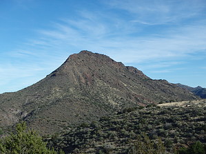
  Overview OverviewAn intermediate and completely off-trail hike to access a remote and scenic, fishing and swimming section of Fossil Creek between Deadman Mesa Tr#17 intersection with Fossil Creek and Hardscrabble Creek/Canyon intersection with Fossil Creek; Please note the attached GPS Route dated 8/9/11 (drawn not field data) attached to this hike description for reference and download with two hiking track options and ref waypoints: Track 1 = 2.6mls one way with -1379 elevation and AEG of +1379; Track 2 = 1.3mls one way with -1306 elevation and AEG of +1306; Check out the Official Route and Triplogs. Leave No Trace and +Add a Triplog after your hike to support this local community. One-Way Notice This hike is listed as One-Way. When hiking several trails on a single "hike", log it with a generic name that describes the hike. Then link the trails traveled, check out the example. | |||||||||||||||||||||||||||||||||||||||||||||||||||||||||||||||||||||||||||||||||||||||||


