Route Editor

| Guide | ♦ | 148 Triplogs | 1 Topic |
details | drive | no permit | forecast | route |
stats |
photos | triplogs | topic | location |
| 1.3k | 148 | 1 |
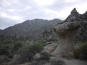
Ice age rock avalanche by Crzy4AZ   500,000 years ago, around the peak known as East End, highest in the McDowell Mountains, a rock avalanche of granite, vegetation, and soil flowed to the present-day area known as the Marcus Landslide. The 5.5 million cubic meters of debris is 1650 feet wide and 4000 feet long and rests 100 feet above the valley floor.1 The estimated weight of the landslide was 25.8 billion pounds and likely reached speeds of 16 to 44 miles per hour, releasing energy equivalent to one atomic bomb (46 Tera-Joules). 500,000 years ago, around the peak known as East End, highest in the McDowell Mountains, a rock avalanche of granite, vegetation, and soil flowed to the present-day area known as the Marcus Landslide. The 5.5 million cubic meters of debris is 1650 feet wide and 4000 feet long and rests 100 feet above the valley floor.1 The estimated weight of the landslide was 25.8 billion pounds and likely reached speeds of 16 to 44 miles per hour, releasing energy equivalent to one atomic bomb (46 Tera-Joules).The area was first described and recognized in 2002 by Dr. John Douglass and Dr. Ronald Dorn of Arizona State University and the Arizona Geological Society. It is named in honor of former ASU Professor of Geography Melvin Marcus, a world-renowned physical geographer and student favorite. Professor Marcus died in 1997 while leading a class field trip in the Rocky Mountains.2
In the last 500,000 years, streams have eroded clay while leaving the granite boulders standing in their original position. This erosion from underneath creates grottos and caverns popular with hikers and rock climbers. Experts believe some of the native plants and animals of the time are buried underneath the landslide, including mammoths, giant sloths, saber-tooth cats, camels, and horses. The trail begins at the newly constructed Tom's Thumb Trailhead and is well marked. Hikers, trail runners, mountain bikers, rock climbers, and equestrians will find this wide and smooth pebble trail appealing. Your attention is torn between eye-catching boulder formations above and cholla "forests" along the trail's edge. In the distance lies a horizon of jagged mountain ranges, including the Superstitions and the Mazatzals. You won't find many saguaros which do not grow well on north-facing slopes. If your destination is one of the dozen or so rock climbing sites in the area, follow the newly marked side trails (0.3-mile mark Sven slab access route, 0.5-mile mark Rock Knob trail). There is very little elevation change on the first part of the hike, and only when you reach the actual landslide (1.5 miles in) do you climb straight up for 125 feet to see the rock avalanche landmarks: the breakaway scar, the fall zone, the slide mass edges. There are no signs up right now, but I expect by the time the trail opens around the end of October that historical and geological interpretive signs will be up. Looking at the aerial views of the landslide helped me get oriented before the hike. After looping around the landslide, return back along the same 1.5-mile trail back to the trailhead. There are incredible views all around you with no houses in sight and much less congestion than south side McDowell trails. The boulders start to look like frozen people or animals after staring at them for a while. Other loop linking options with Marcus Landslide: (1) Marcus Landslide 0.3 miles to Feldspar Trail then 0.75 miles to Tom's Thumb Trail and top of ridgeline. Up there, you will find branch points for East End Trail, Look Out Trail, and Windgate Trail that could be connected in a monster hike with a car shuttle at the Gateway Access trailhead. (2) Marcus Landslide 0.4 mile to Rock Knob trail then 0.5 miles to McDowell Mountain Regional Park (County) links to Pemberton Trail and the rest of the area's trails. Lots of small and large loops are possible. (3) Marcus Landslide 1.5 miles to landslide edge to connect with Pemberton Trail to County trail system. References 1. Brian Gootee, AZ Geological Society, azgs.arizona.edu 2. Virtual Tour Marcus Landslide, AZ Geographic Alliance, http://alliance.la.asu.edu/slides/introduction.html Additional Reading PDF - A large landslide on the urban fringe of metropolitan Phoenix, Arizona
Check out the Official Route and Triplogs. Leave No Trace and +Add a Triplog after your hike to support this local community. | ||||||||||||||||||||||||||||||||||||||||||||||||||||||||||||||||||||||||||||||||||||||||||||||||||||||||||||||||||||||||||||||||||||||||||||||||||||||||||||||||||||||||||||||||||||||||||||