 Route Editor

| Guide | ♦ | 6 Triplogs | 0 Topics |
details | drive | no permit | forecast | route |
stats |
photos | triplogs | topics | location |
| 87 | 6 | 0 |
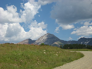
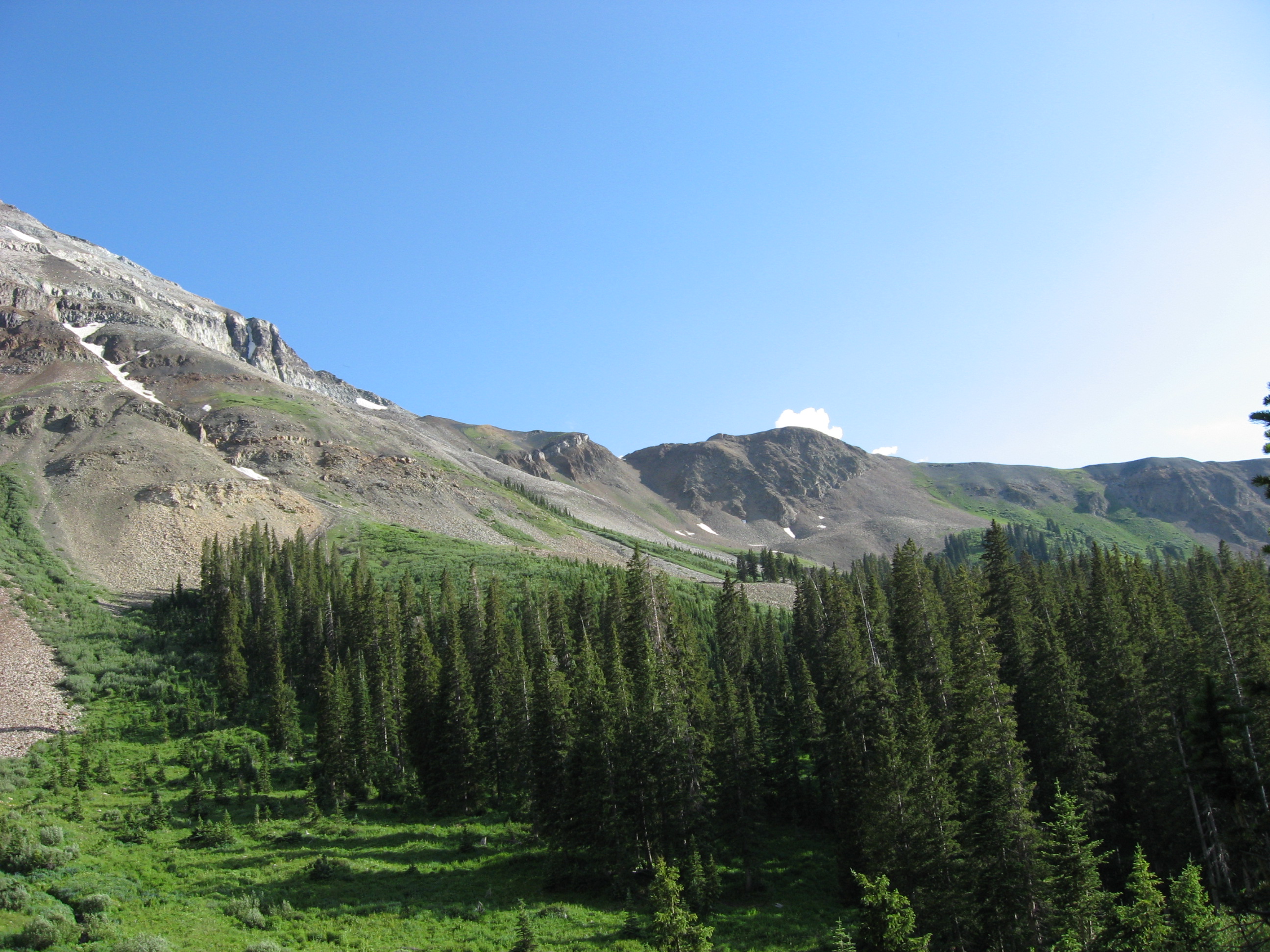
Sacred, seldom climbed mountain by Jim Climbing Hesperus is difficult largely because of the lack of a trail. A large part of the climb is on relatively steep scree or talus slopes. From the trailhead at the end of forest road 346 you will want to take the West Mancos Trail #621, not the Sharkstooth Pass Trail. Follow trail 621 south to the river crossing and then cross the West Mancos River. It's not very big, but a small bridge is built to cross it. It's also the main source of water for the hike. Keep on the trail for 1/4 to 1/2 of a mile before you begin your ascent to the west ridge of Hesperus. You will lose elevation as you continue further down the trail, but it might make for a safer and faster ascent of the west ridge. Once you feel you have reached a desired spot, turn left and head upslope into the spruce forest. You will want to head as far up in the dense spruce as you can because shooting for an opening may bring you to pockets of dense willow and other shrubs that have colonized some of the many avalanche chutes that occupy the north slope of Hesperus.
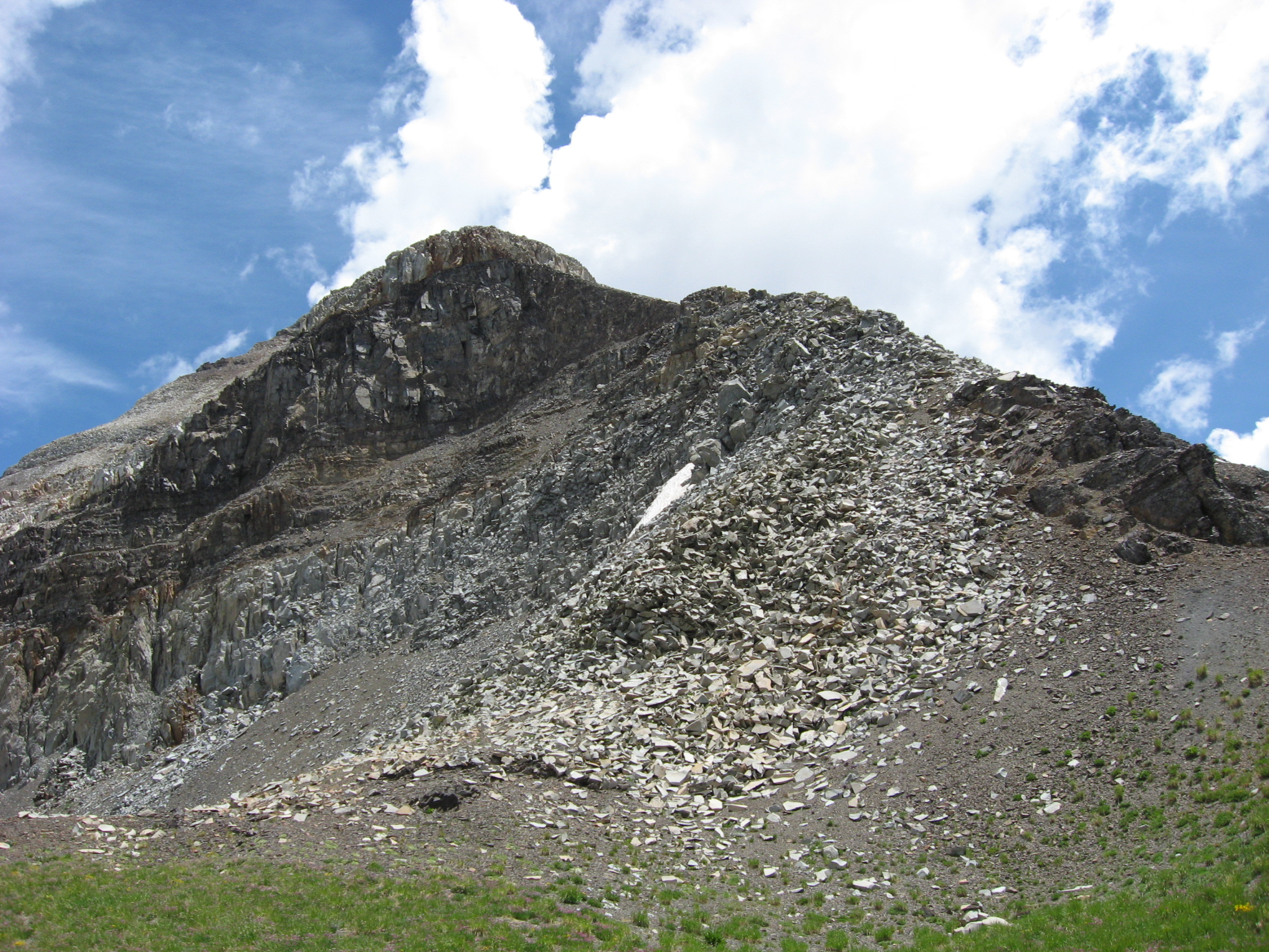
By using one of the routes I describe, or another one that you found, you should make the top of Hesperus's west ridge. Depending on where you come up, you may encounter a social climber's trail that leads to the saddle. Follow it. From the saddle you have two options to get to the peak. The first is the route I took (sorry I have no pictures). Look for another lightly worn trail that heads east out of the saddle on the south side of the west ridge. Follow this trail as it heads up the large flat pieces of rock that make the south side of Hesperus. You will have some small steep areas that you go through, but its nothing too dramatic. Eventually, the trail will head up for a wall, and a gully that ascends the first ledge to the summit from the saddle. You will have to climb this gully. It's the crux of the climb and a very steep class 3 with pieces of rock that when dislodged will fall for some time and possibly off the south face of the mountain. Going up is fairly easy, but down can be tricky. You may want to ditch a pack below this point to make coming down easier. The gully is no more than 50 feet, and I think it's more like 35 to 40 feet in height. Now the second route: from the saddle immediately begin to head up the rock that is falling into the saddle. It is a class 3 climb that isn't very long or steep. I was told that it was easier than the gully route I used. Still, that rock looks pretty loose and may be unstable. You will rejoin the gully route on top of the first ledge. As I recall, that ridge is pretty narrow there isn't much room for error. Once on top of the gully, look to the right for a ledge and climb up that, or straight ahead if you came up directly from the saddle. You will once again be able to find a climbers trail. It's not well built or built at all really, and it has loose slate like pieces of talus on it in places, but it will get you to the summit of Hesperus. Follow it for about 1500 feet to the summit. You will need to climb up a few small sections to gain ledges and climb along some steep exposed terrain. Be careful on this section, especially on the descent. You will come to the summit and can look back on the path you took. It's not really all that bad, but you do need to exercise caution, especially when going down. On the summit you can see quite a bit on a good clear day. Mesa Verde National Park is nearby, as is Ute Mountain near Cortez, CO. You can see the Wilson group of 14ers near Telluride, CO, and the Chicago Basin group north of Durango. If you know what to look for you can also see the Lizard Head, the Animas River Valley, and may be able to see Uncompahgre Peak. The next peak east from Hesperus is Lavender Peak. It looks pretty wicked and I can't imagine climbing it from that view. Some claim it's actually higher. I don't know, but it looked lower to me. Either way, Hesperus is the more noticeable peak and it's the one the Navajo regard as sacred, which is why I climbed it in the first place. To descend, follow the way you came up, or use my scree slope route marked in red. Lean back a bit to get the hang of the slide and balance yourself with one had on the scree. It's fun once you get going. If you climb this peak I think you'll find it was well worth the effort and will enjoy it quite a bit. It gets little attention so you'll probably have it all to yourself. If you haven't already done so, you can climb the other 3 and do something most Navajo probably won't ever do. Between the end of May and late July, 2008 I did all 4 sacred peaks. Check out the Official Route and Triplogs. Note This is a difficult hike. Arrive fit and prepared or this could get ugly. Leave No Trace and +Add a Triplog after your hike to support this local community. | |||||||||||||||||||||||||||||||||||||||||||||||||||||||||||||||||||||||||||||||||||||||||


