 Route Editor

| Guide | ♦ | 5 Triplogs | 1 Topic |
details | drive | permit | forecast | map |
stats |
photos | triplogs | topic | location |
| 80 | 5 | 1 |
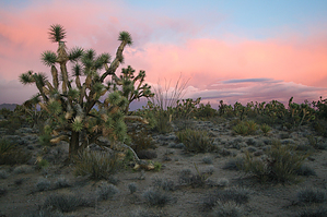
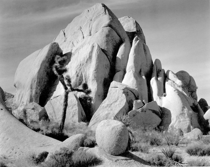
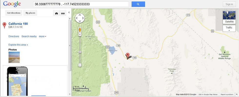
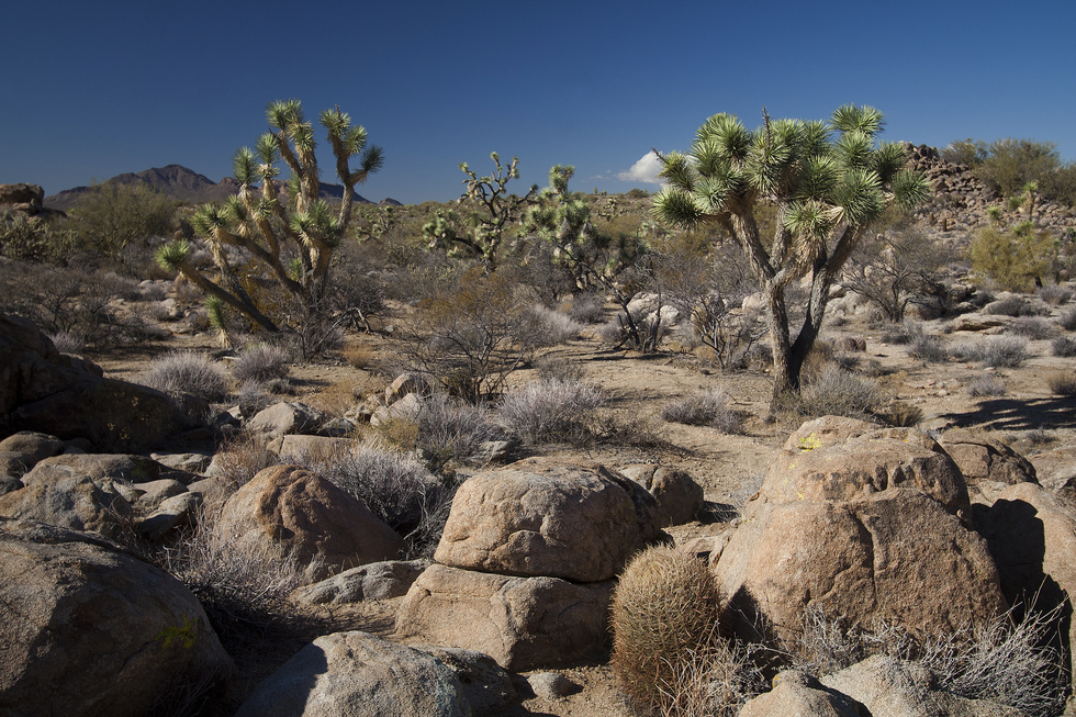
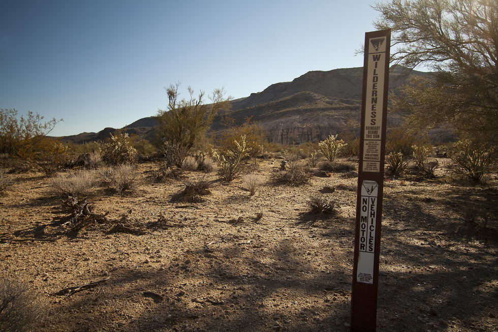
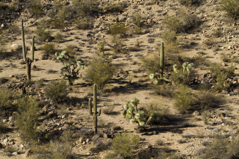
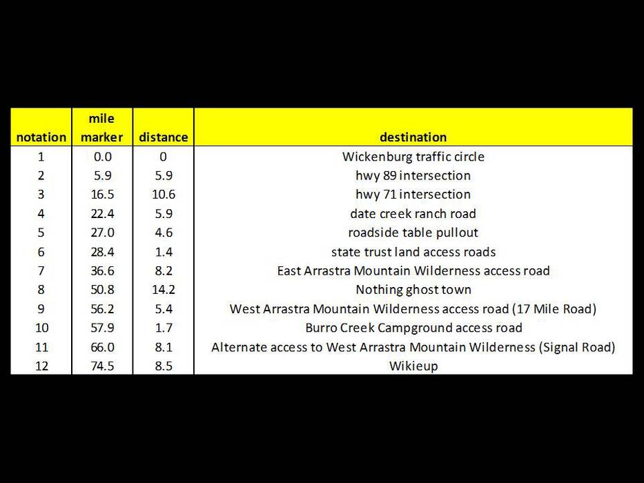
U2's Joshua Tree in AZ? by Randal_Schulhauser  Some History Some HistoryThe Mojave, Serrano, Cahuilla, and Chemehuevi Indians knew and made use of Joshua trees (Yucca brevifolia) for centuries before the colonials encroached. Its more fibrous matter was woven into baskets, shoes, nets, and traps, while its seed-filled pods were broken open and eaten. The seeds are large berries. Captain John C. Fremont is credited in 1844 with the first recorded observation of a Joshua tree when he noted to his guide Kit Carson; "This is the most repulsive tree in the vegetable kingdom." With its shaggy bark, ungainly limbs, and clusters of dagger-like leaves, the Joshua tree is truly an odd-looking plant straight out of a Dr. Suess book.
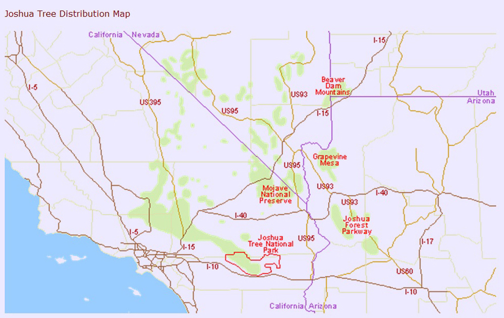
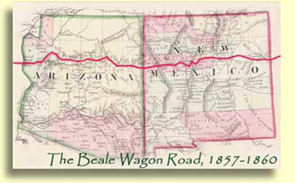
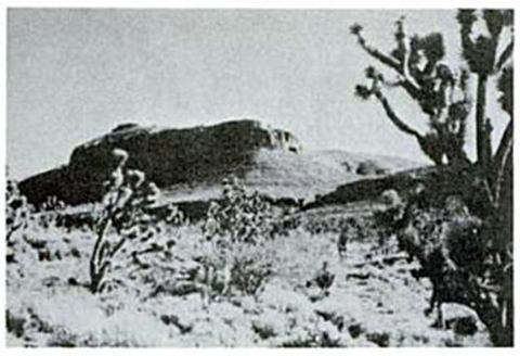
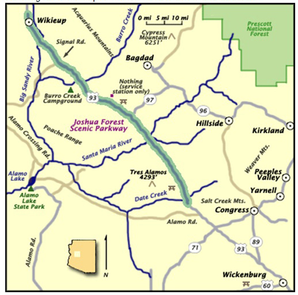
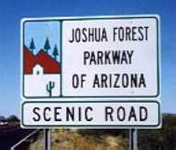
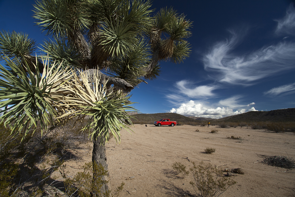
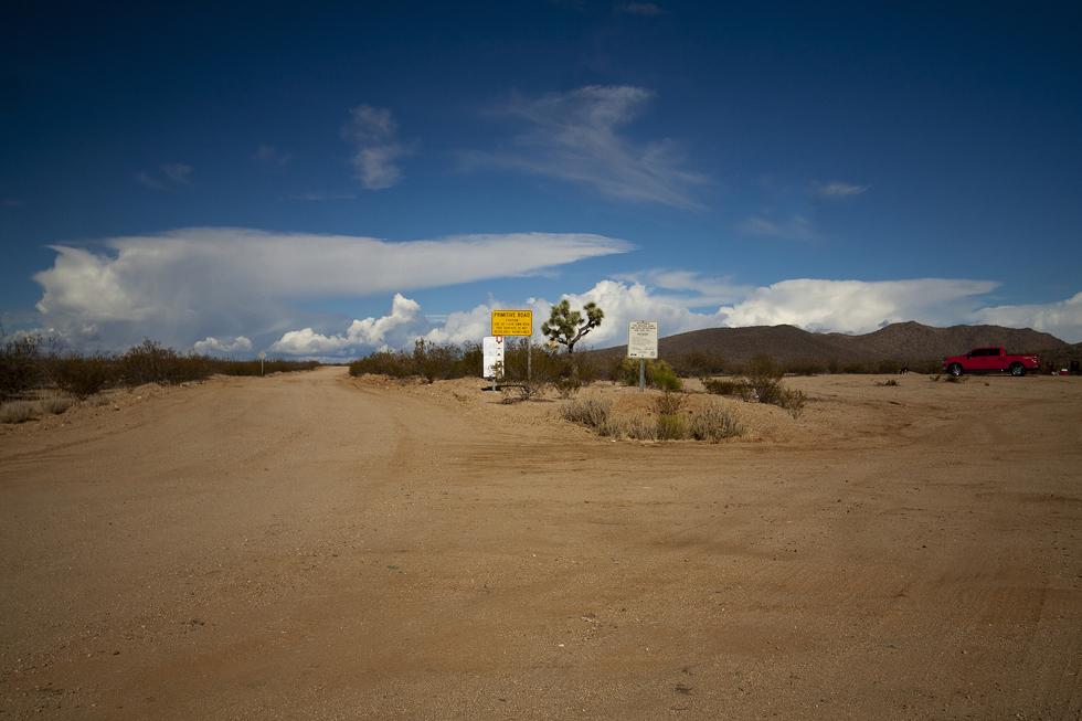
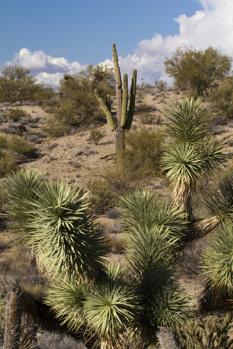
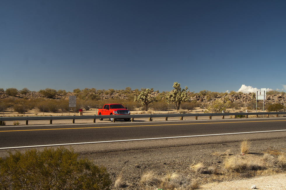
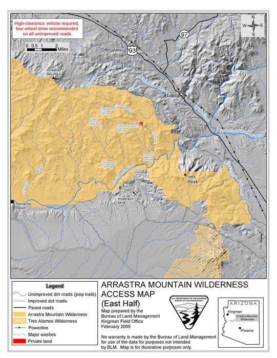
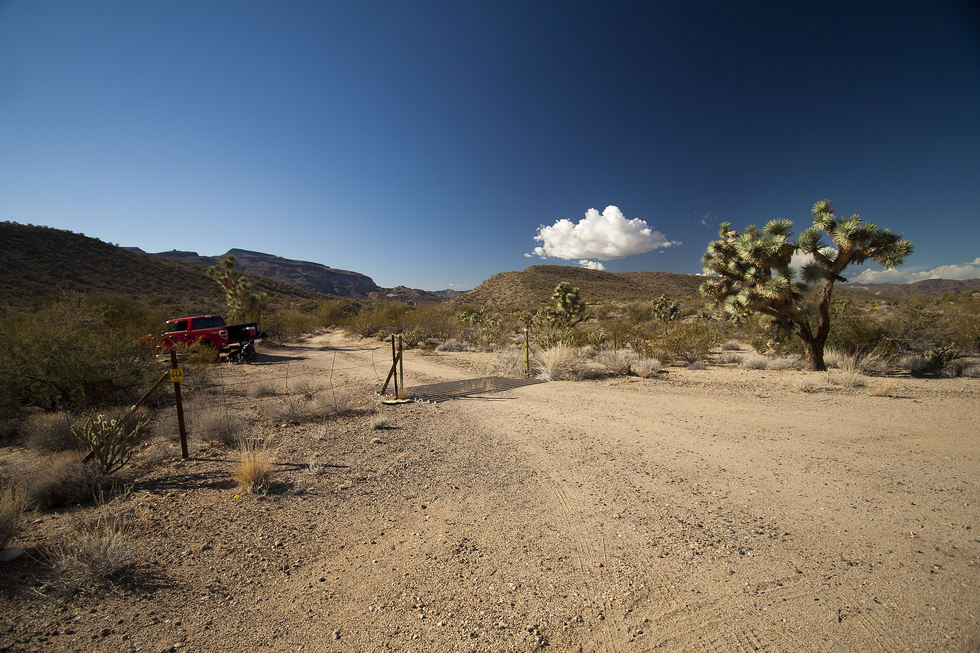
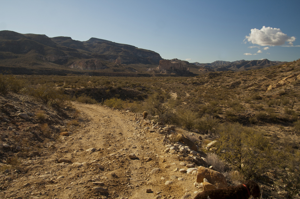
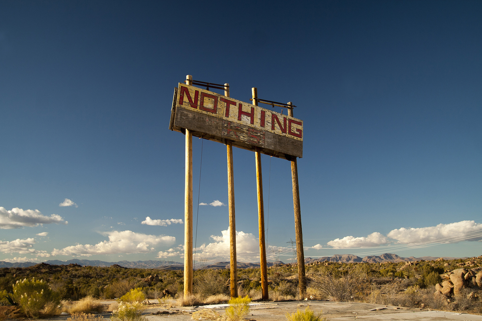
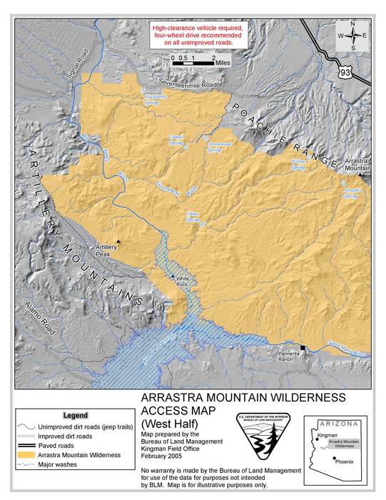
It's an interesting aside that the military careers of Captain Fremont and Lieutenant Beale were frequently interwoven. Beale testified at Fremont's court-martial in 1847. One of the trails pioneered by Fremont and Carson (and ultimately surveyed by Lt. Amiel Whipple ) was to later become the Beale Wagon Road (see description). Although I haven't trekked the western sections of the historic Beale Wagon Road near Kingman, Oatman, and the Colorado River crossing, vintage photos reveal the presence of Joshua trees near Sitgreaves Pass. I had this vintage photo in my research file collection preparing the Beale Wagon Road HAZ hike description. To Present Day Joshua Tree National Park in the California Mojave Desert was championed by Minerva Hoyt and became a national monument in 1936. It seems imprinted on the mind, if you want to see a Joshua tree, go to JOTR ( see HAZ Joshua tree flora description and a cool Joshua tree photo on HAZ ). While flipping through one of my Ansel Adam's landscape photography books, I came across some of his iconic Joshua tree images. For some reason, this triggered a memory from a couple of years ago when I stopped at Joshua Tree NP. The Park Ranger informed some enquiring visitors that; "Sorry to disappoint, but you won't find U2's Joshua Tree in the park, the album photos were actually taken in Arizona". This triggered the next thought - just where in Arizona would you find this U2 Joshua tree? The Joshua Forest Parkway along Hwy 93 between Wickenburg and Wikieup immediately comes to mind. A little bit of internet searching reveals that CA180 towards Death Valley NP was the U2 photo location. Google Maps location 36.330877N, -117.745233W. Another mystery solved - JOTR doesn't have a monopoly on Joshua trees, U2's Joshua tree is no more, Joshua trees inspired Dr. Suess - so let's go explore Joshua Trees Arizona and connect this smorgasbord of thoughts together... The Hikes Along Joshua Forest Parkway Joshua Forest Parkway along Hwy 93 between Wickenburg and Wikieup is noted by the roadway sign near mile marker just beyond the Hwy 71 intersection. This 75 mile stretch of highway was designated a "Scenic Road" by the Arizona Department of Transportation on April 20th, 1992 noting that the density of Joshua trees probably exceeds that of Joshua Tree National Park. This corridor represents access to a variety of hiking options, a small sample as noted below. Mix and match to suit your desire. 1. Mile 0.0 - Hwy 60/93 traffic circle in Wickenburg - start of our Joshua tree trek. Travel 5.9 miles to next notation. 2. Mile 5.9 - Hwy 93/89 Intersection - continue towards Kingman/Las Vegas on Hwy 93. Travel 10.6 miles to next notation. 3. Mile 16.5 - Hwy 93/71 Intersection - continue along Hwy 93. "Joshua Forest Parkway of Arizona - Scenic Road" is noted by the roadway sign near the mile marker just beyond the Hwy 71 intersection. As you approach the roadway sign, notice the two ragged-looking specimens on the west side of the road. Travel 5.9 miles to the next notation. 4. Mile 22.4 - Hwy 93/Date Creek Ranch Road - our first close-up encounter with Joshua trees. This primitive road heads north about 4 miles towards Date Creek Ranch and a substantial apple orchard. Near the highway is a clearing with remnants from roadside campers. We took advantage of the clearing to break out the chairs and have an early lunch. Some faint trails are radiating towards the hills to the northeast. We followed one to capture our first Joshua tree/Saguaro side-by-side. HIKING DISTANCE ~1.5 miles round trip. Travel 4.6 miles along Hwy 93 to next notation. 5. Mile 27.0 - Roadside Picnic Table - walk to the west and north. As the Joshua forest becomes denser, there is a pullout on the west side of the highway with some roadside tables. If you pass through the gate, you will discover another network of faint trails radiating up and over a boulder ridge. As you pop up over the ridge and head parallel to the highway to the northwest, the Joshua trees are frequent albeit smallish. HIKING DISTANCE ~1.5 miles round trip. Travel 1.4 miles along Hwy 93 to next notation. 6. Mile 28.4 - State Trust Land access roads. A relatively short distance away from the Roadside Picnic Table pullout is double-track access roads on both sides of the highway. A valid permit is required to access the State Trust Land (info in directions section). Plenty of off-trail hiking options here in the thickest Joshua tree forest we saw all day. Travel 8.2 miles along Hwy 93 to next notation. 7. Mile 36.6 - East Arrastra Mountain Wilderness access road (Arrastra Border Map). As the hydro lines cross Hwy 93 and you begin your descend to the Santa Maria River, there is a relatively hidden double track on the west side of the highway. We parked the truck near the highway and hiked the double track towards Ives Peak and Black Canyon Wash. Wilderness Signs can be seen on the south side of the road as you continue towards the Santa Maria River. There is frequent Saguaro/Joshua tree side-by-sides as you approach Black Canyon Wash. The Joshua trees seem to disappear as you reach the Santa Maria River. HIKING DISTANCE ~6.5 miles return from Hwy 93 to Santa Maria River. Travel 14.2 miles along Hwy 93 to next notation. 8. Mile 50.8 - Nothing AZ ghost town. You have access to the boulder fields via the forest road beside the ghost town. HIKING DISTANCE ~0.5 miles. Travel 5.4 miles along Hwy 93 to next notation. 9. Mile 56.2 - West Arrastra Mountain Wilderness access road. Access via 17 Mile Road on the west side of Hwy 93. My 4WD book "Backcountry Adventures Arizona" by Massey and Wilson describes this off-road trek. Travel 1.7 miles along Hwy 93 to next notation. 10. Mile 57.9 - Burro Creek Campgrounds access road. HIKING DISTANCE ~1.5 miles. Travel 8.1 miles along Hwy 93 to next notation. 11. Mile 47.7 - Alternate access to West Arrastra Mountain Wilderness. Access via Signal Road on the west side of Hwy 93. My 4WD book "Backcountry Adventures Arizona" by Massey and Wilson describes this off-road trek. Travel 8.5 miles along Hwy 93 to next notation. 12. Mile 74.5 - Wikieup AZ - end of Joshua Forest Parkway. Summary: Although the Joshua Forest Scenic Parkway may be advertised as the 55 mile stretch of road between Wickenburg and Wikieup, the reality is only a 20-mile portion between Date Creek and the Santa Maria River seems to contain Joshua Trees. The 30 mile stretch between the Santa Maria River and Wikieup, although scenic, is best described as a "boulder zone", particularly around the ghost town of Nothing AZ. With Saguaro cacti the defining flora of the Sonoran Desert and Joshua trees the defining flora of the Mojave Desert; this area represents a transition area where you can find both of these subjects side-by-side. Enjoy! Enjoy! Gate Policy: If a gate is closed upon arrival, leave it closed after you go through. If it is open, leave it open. Leaving a closed gate open may put cattle in danger. Closing an open gate may cut them off from water. Please be respectful, leave gates as found. The exception is signage on the gate directing you otherwise. Check out the Triplogs. Leave No Trace and +Add a Triplog after your hike to support this local community. | |||||||||||||||||||||||||||||||||||||||||||||||||||||||||||||||||||||||||||||||||||


