 Route Editor

| Guide | ♦ | 13 Triplogs | 0 Topics |
details | drive | permit | forecast | 🔥 route |
stats |
photos | triplogs | topics | location |
| 23 | 13 | 0 |
 History HistoryThe Knagges' are a relatively well-known Arizona pioneer family, having arrived in Tucson in the winter of 1908 and homesteading near Ft. Lowell. The family was originally known for selling and installing furnaces but later became known for the pack train into Soldier Camp near modern-day Sumerhaven that the family operated. The Knagge pack train took goods and pioneer families to their summer retreats atop Mt. Lemmon from the Tucson valley through Sabino and the Box Camp trail for almost a decade. The train operated from 1913 until the completion of the Oracle Control Road in 1921. During this time, and for nearly a decade thereafter, the Knagges' also worked a mining claim near Kellogg Mountain. The principal takings were silver ore; how rich the mine was has been lost to history. A spartan cabin was erected near a spring in the vicinity of the claim, along with a corral to house the Knagge pack animals. The remains of the cabin are still present today, as is the mine. The area where the corral once stood is still identifiable. The trail that steeply descends into their workings from Incinerator ridge appropriately bears the family's name; the Knagge Trail, #18. The Knagge trail once connected to Peck Basin not far from Araster spring, but this is no longer the case. As of the first edition of the Trail Guide to the Santa Catalina Mountains (circa 1970), Glendening and Cowgill were calling the trail the "Edgar Canyon" trail for the canyon into which it descends. They had also concluded that the trail effectively ends at the 2.6-mile point, which seems to hold true today. The Forest Service overhauled the Knagge trail in 1993, but it is unknown whether they restored the section after this point that connects to Peck Basin. Were it restored, it very likely vanished into the Aspen Fire in 2003 (Along with whatever remained of the cabin). Recent work has clearly been done on the trail, but only on the section leading to the cabin site.
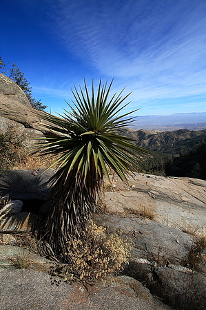
The trail departs 0.1 miles east from the Incinerator Ridge trailhead on Incinerator Road off Catalina Highway. The trail begins to descend immediately into the pine. Evidence of the Aspen Fire still lingers, and many downed trees litter the track ahead. Fortunately, many of the larger logs have been sawed in half or trimmed to allow passage. This section of trail is marked with engineer tape and cairns, as it becomes easy to lose in the underbrush. After a short while, the trail crosses Edgar canyon, marked by a kind of gate between two large cairn piles. Not long after the canyon crossing, the trail circles back northward and enters a side drainage. This area is predominated by a large stand of pine spared by the fire. Soon after that, the trail heads east again and descends a scree-riddled ridge as it approaches the remains of the Knagge cabin (about 1.4 miles). The trail splits after the cabin, the track on the left goes to a spring; follow the track on the right for another one-tenth of a mile, and the mine is reached. The mine has been backfilled and is now the site of a small waterfall. The maintained portion of the trail effectively ends here at the mine. Another 1.2 miles of trail continue down to a ridge overlooking Peck Basin and the San Pedro valley. The trail continues due north past another spring in a side drainage and descends slowly as it circles east along the rim of Edgar canyon. The trail is heavily overgrown, and route finding will be a challenge. The trail soon approaches an obstacle that requires one to climb over a large downed tree and then immediately climb beneath another to continue; footing in this section is tenuous. The trail then approaches another small spring and begins to switchback down a grassy slope into Edgar canyon. The switchbacks are challenging to follow as the track is lost in the underbrush. The views from this section of the trail are phenomenal. The trail enters the canyon bottom, which is lined with large slabs of granite. The view to the east here is breathtaking. After crossing back across the canyon, the trail begins to descend along the canyon wall again and approaches a large juniper with old blaze marks cut into the side. This section of the trail is easily lost and heavily overgrown. The trail climbs here to a series of switchbacks that briefly ascend the ridge above the canyon before crossing northward into a large thicket of manzanita and juniper (roughly 2.9 miles). This area is probably a popular backpacking destination, as evidenced by the numerous old fire rings constructed in rock. The views from this site span north to east to south and are worth the extra effort. The trail ends at this point. Two or three faint tracks leave this point, but all quickly disappear or become game trails. Return by the same route. Gate Policy: If a gate is closed upon arrival, leave it closed after you go through. If it is open, leave it open. Leaving a closed gate open may put cattle in danger. Closing an open gate may cut them off from water. Please be respectful, leave gates as found. The exception is signage on the gate directing you otherwise. Check out the Official Route and Triplogs. Leave No Trace and +Add a Triplog after your hike to support this local community. One-Way Notice This hike is listed as One-Way. When hiking several trails on a single "hike", log it with a generic name that describes the hike. Then link the trails traveled, check out the example. | ||||||||||||||||||||||||||||||||||||||||||||||||||||||||||||||||||||||||||||||||||||||||||||||||||||||||||


