Route Editor

| Guide | ♦ | 2 Triplogs | 0 Topics |
details | drive | no permit | forecast | route |
stats |
photos | triplogs | topics | location |
| 5 | 2 | 0 |
Dr. Suess was here! by azbackpackr  Overview OverviewThis hike is in the Gila Mountains just east of Yuma, a forbidding-looking range. It has many canyons, which are reasonably easy to hike up, however. Its peaks are very steep and rugged. Access After parking the car on "14 1/2 E," follow north to Maria de Fortuna. Then access the wash between these streets as seen in this map. Do not cross anything marked private. Follow this trail / old road into the canyon.
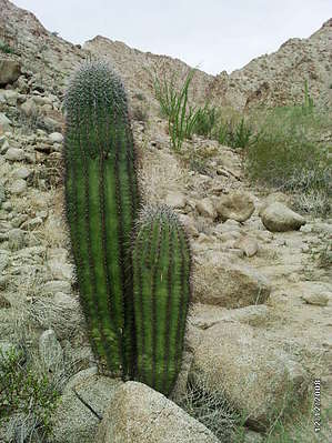
Once the trail dips down to the wash, follow the wash right to a pronounced split. You can choose either the left or the right fork. The right fork is 1/2 mile longer than the left, and the beginning is not BLM land. Following ATV tracks at first, eventually, you will get to an area where they can't go anymore, and you are boulder-hopping up the bottom of a usually dry creek, which runs only briefly during rainstorms. By now, the geology has changed from gloomy black to a beautifully sculptured tan granite, with formations reminiscent of Dr. Suess's drawings. Little mini-caves abound, looking like Lilliputian dwellings. There are a few turrets and hoodoos as well. Vegetation includes paloverde, ironwood, saguaro, cholla, and the occasional small elephant tree. Smell the elephant tree leaves if they are green, delightful aroma. The left fork has a split at the very end, but you can see that both forks box out. Return the same way. Take binoculars along to enjoy the interesting rocks. There may be petroglyphs here and there, but I didn't see any but have heard there are some. There isn't a lot of wildlife in the Gila Mountains, but there are quite a few birds and reptiles.
Check out the Official Route and Triplogs. Leave No Trace and +Add a Triplog after your hike to support this local community. | ||||||||||||||||||||||||||||||||||||||||||||||||||||||||||||||||||||||||||||||||||