username
X
password
register
for free!
help
 This is likely a great time to hike this trail!  Check out "Preferred" months below, keep in mind this is an estimate.
 

Slippery Rock Gorge Trail, PA

Guide 1 Triplog  0 Topics
  5 of 5  
Fav
Wish
0
details
drive
no permit
forecast
route  
stats
photos
triplog
topics
location
38 1 0
Statistics
tap row or icons for details
Difficulty 1.5 of 5
Route Finding 1 of 5
Distance One Way 7.05 miles
Trailhead Elevation 1,152 feet
Elevation Gain 41 feet
Accumulated Gain 903 feet
Avg Time One Way 3 hours
Kokopelli Seeds 10.06
 Interest Historic, Seasonal Waterfall, Perennial Waterfall, Seasonal Creek & Perennial Creek
feature photo
Photos Viewed All MineFollowing
Inaugural Calculation on Button Tap!
38  2015-06-19 kingsnake
Author
author avatar Guides 117
Routes 339
Photos 11,415
Trips 895 map ( 8,146 miles )
Age 63 Male Gender
Location Sunnyslope, PHX
Associated Areas
list map done
Pittsburgh Region
Historical Weather
Trailhead Forecast
Radar Map
Expand Map
Preferred May, Oct, Sep, Apr
Sun  5:56am - 6:39pm
Official Route & 1 Rt
 
0 Alternative


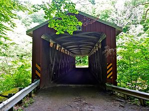
The Highline Trail With More Water and Mosquitoes
by kingsnake

 Likely In-Season!
Located in McConnells Mill State Park, you can hike Slippery Rock Gorge from either end, but hiking from west (Hells Hollow) to east (the Mill) will more often put the sun at your back, or at least side. Plus, you won't dilly-dally as long at the covered bridge / Mill / falls site. (Interesting though they are.) Park signs state it is a vigorous hike of 7.2 miles, and both statements are accurate. They also state it takes 4.5 hours, one way; more like 3, walking time. (With maybe an extra 30 minutes for the many picture taking opportunities.) One way is a great workout; out & back will leave you drenched in sweat, and not just because of Pennsylvania's high humidity.


About those pictures ... if you hike in May or June, you could easily, no exaggeration, cross 50 waterfalls during your hike. Most are very small, but all are scenic. Plus, there are the more significant falls at Hells Hollow and McConnells Mill. The entire hike, you will be accompanied by the sound of rapids and falls on Hell Run and Slippery Rock Creek. If you hike in autumn, there will be fewer falls, but the colors will be fantastic.
remove free decal offer
Regardless of season -- other than winter -- the entire route is exceedingly lush. There are very few flowers, but more green than you can imagine. It is a mix of mostly deciduous, with some evergreen, and generous helpings of undergrowth. The trail is likely to be very muddy, other than in the evergreen areas where the pine needles provide a clean trail surface. The surface, itself, varies from mostly muddy, to rooty, with some areas of dry natural gravel. It is very up & down, with several strenuous short climbs, particularly in the miles west of Eckert Bridge. (Which could be an alternate pickup point.) You will see very few, if any, people between Hells Hollow and Eckert Bridge.

If you are hiking one way, and want to add a scenic extra mile, hike a half mile down the south bank of Hell Run to the lime kiln and Hell's Hollow Falls. (See alternate route.)

The mile between Eckert Bridge and McConnells Mill is rocky, like creek hiking in Arizona.

Upon reaching McConnells Mill, proceed across the road, slightly left, up a twisty stair to the parking area. Do not follow the road, it is twisty, and narrow, and cars will likely not be expecting pedestrians on it.

Warning: Liberally douse your self and clothes with bug spray before hiking: You will be glad you did. (The mosquitoes are numerous, plus there is always the threat of ticks.) Also, watch out for poison ivy / oak / etc.

Signal: Hells Hollow is 1-bar reception. Most of the hike is no service, including at Eckert Bridge.

2015-06-21 kingsnake


    Check out the Official Route and Triplog.
    Leave No Trace and +Add a Triplog after your hike to support this local community.

    One-Way Notice
    This hike is listed as One-Way.

    When hiking several trails on a single "hike", log it with a generic name that describes the hike. Then link the trails traveled, check out the example.
    WARNING! Hiking and outdoor related sports can be dangerous. Be responsible and prepare for the trip. Study the area you are entering and plan accordingly. Dress for the current and unexpected weather changes. Take plenty of water. Never go alone. Make an itinerary with your plan(s), route(s), destination(s) and expected return time. Give your itinerary to trusted family and/or friends.

     Permit $$
    None


     Directions
    or
     Road
    Paved - Car Okay

    To hike
    From Pittsburgh, head north on I-79 to the PA-488 / Portersville exit. Go west for .5 miles to U.S. 19. You are in Portersville. The McConnells Mill falls, covered bridge and historic site are north; Hells Hollow is west. For the purposes of this hike, I assume a drop off in Hells Hollow and a pickup / shuttle at McConnells Mill. Head north on U.S. 19 for 1.5 miles. Left on Kildoo Rd. for 1.0 mile to the McConnells Mill parking area. Drop off your shuttle vehicle, if any. With your other/only vehicle, proceed down the one way twisty road to the covered bridge, watching out for the many pedestrians. After driving across the covered bridge, continue west on McConnells Mill Rd. for 1.9 miles. Turn left on Trusel Rd. for 1.1 miles. Turn right on Fairview School Rd. for 1.5 miles. Turn left on Shafer Rd. for .5 miles to the Hells Hollow TH, on the east side of the road.
    page created by kingsnake on Jun 21 2015 7:50 pm
    helpcorrectionissue

    end of page marker