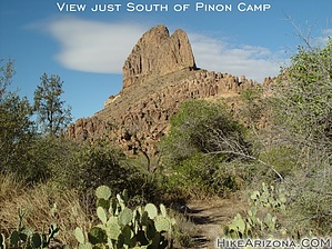
Here's a popular loop hike around Weavers Needle from Peralta Trailhead. The direction of this loop is up the Bluff Springs Trail #235 for 2 miles. Take the Terrapin Trail #234 north through Needle Canyon on the east side of Weavers Needle for 2.9 miles. Crossover on the Dutchman Trail #104 ( 1.1 miles ) to the Peralta Trail #102 ( 6.2 miles ) and bring it home.
The whole loop is a rollercoaster ride with two minor ascents to note. First comes the immediate haul up the Bluff Spring Trail. I prefer to take this loop counter-clockwise, as stated above. On warmer days, you get a shady return down Peralta Canyon. If you go clockwise and first head out on the Peralta Trail... you will encounter a minor ascent on the north end of the Terrapin Trail.
The trail on the south end of Black Top Mesa used to be called Needle Cutoff Trail. Now it's just a section of the Dutchman Trail. Old topographical maps are incorrect near the Peralta / Dutchman junction. The trail on the old topos appears to cut straight down and back up East Boulder Canyon (this canyon runs between Black Top Mesa & Palomino Mountain) Now the trail takes a more gentle approach. It zig-zags down and back up, so it's not as strenuous.
A couple of things to think about... The first is on the Bluff Springs Trail. You want to take a right on the flat slab of rock in the creek. Get a topographical map. Otherwise, you'll end up heading up Barks Canyon. Next... you might be thinking of cutting this trip short with a crossover immediately north or even shorter immediately south of Weavers Needle. Fritzski wrote up some clues to the south shortcut. For the north approach, get a topo and think Terrapin Pass. Beware, off-trail adventures in the area can be hellish.
WARNING! Hiking and outdoor related sports can be dangerous. Be responsible and prepare for the trip. Study the area you are entering and plan accordingly. Dress for the current and unexpected weather changes. Take plenty of water. Never go alone. Make an itinerary with your plan(s), route(s), destination(s) and expected return time. Give your itinerary to trusted family and/or friends.
Permit $$
None
Directions
Road
FR / Dirt Road / Gravel - Car Okay
To Peralta Trailhead 7.6 miles east of the junction Idaho Rd / US-60. Turn Left on to FS77 which is Peralta Road. Follow FS77 5.6 miles to a left and up turnoff. Continue 1.9 miles to Peralta Trailhead.
The trailhead has restrooms minus running water. The parking lot is enormous. It does fill up in season on weekends. Since there are no lines, the rangers ask that you park straight between the posts in the main lot. Please do your part with this simple request and make room for the next guy. 0.5 miles before reaching the trailhead is an overflow lot, which is also suited for horse trailer parking.
From PHX (Jct I-10 & AZ-51) 45.2 mi - about 1 hour 8 mins From TUC (Jct 1-10 & Grant) 97.0 mi - about 2 hours 16 mins From FLG (Jct I-17 & I-40) 192 mi - about 3 hours 15 mins
 Route Editor

 Here's a popular loop hike around Weavers Needle from Peralta Trailhead. The direction of this loop is up the Bluff Springs Trail #235 for 2 miles. Take the Terrapin Trail #234 north through Needle Canyon on the east side of Weavers Needle for 2.9 miles. Crossover on the Dutchman Trail #104 ( 1.1 miles ) to the Peralta Trail #102 ( 6.2 miles ) and bring it home.