 Route Editor

| Guide | ♦ | 106 Triplogs | 3 Topics |
details | drive | permit | forecast | route |
stats |
photos | triplogs | topics | location |
| 1k | 106 | 3 |
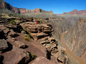
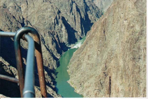
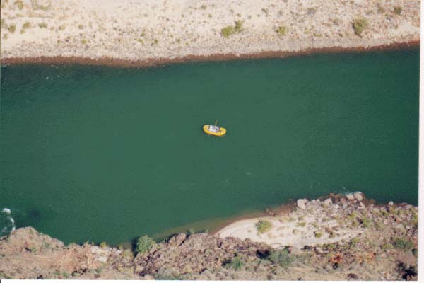
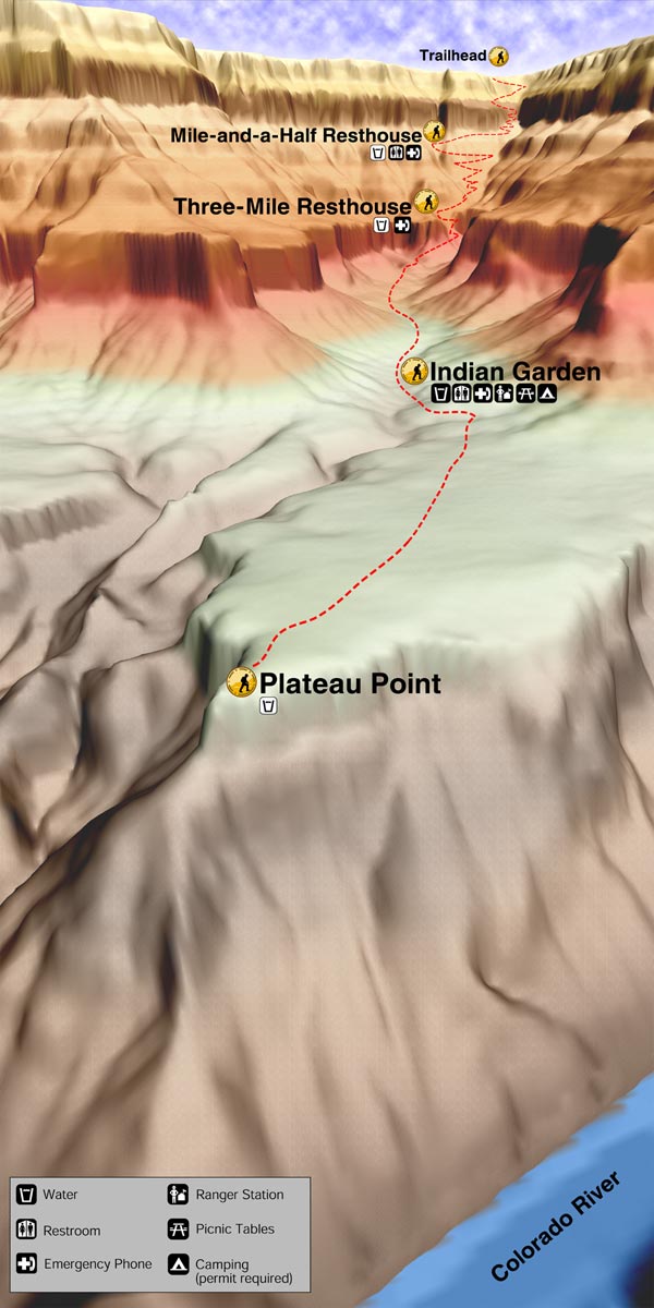
Boring Walk to Great View by evenstarx3   For the good news, Plateau Point Trail is only 1.6 miles and relatively flat; For the bad news, you gotta hike 4.6 miles, one way, EC of 3,060 feet to get to the trailhead; more good news... that 4.6-mile hike is the Bright Angel from where you can see Plateau Point trail as you descend. For the good news, Plateau Point Trail is only 1.6 miles and relatively flat; For the bad news, you gotta hike 4.6 miles, one way, EC of 3,060 feet to get to the trailhead; more good news... that 4.6-mile hike is the Bright Angel from where you can see Plateau Point trail as you descend.From Indian Garden the Bright Angel continues to the right following Bright Angel Creek to the river while the Plateau Point trail goes to the left crossing Bright Angel Creek. After a few switchbacks you're on the plateau itself (Don't have any idea what the name of the Plateau is) with pretty much a straight shot to the Point. From here the trail is really more of a 12 to 15 inch deep rut worn into the plateau by the daily mules trips. You have the choice of walking the bottom of the rut in heavy dust or trying to walk the edges which slant in towards the rut and put you at risk of getting nailed by the numerous prickly pear. The payoff comes at Plateau Point itself with a spectacular view of the river about 1,600 feet below and nearly straight down. I was lucky enough to catch river rafters directly below the point. Numerous warnings say the hike to Plateau Point from the rim and back is not a day hike, but I did it in 7hrs, 20ms with time to take in the sights. I wouldn't wanna do it during the summer when inner canyon temps soar into the 100's, but this October hike found temps fairly mild. There's water available at Indian Garden and there's no shade at all on the trail so take plenty.
Check out the Official Route and Triplogs. Leave No Trace and +Add a Triplog after your hike to support this local community. One-Way Notice This hike is listed as One-Way. When hiking several trails on a single "hike", log it with a generic name that describes the hike. Then link the trails traveled, check out the example. | |||||||||||||||||||||||||||||||||||||||||||||||||||||||||||||||||||||||||||||||||||||||||||||||||||||||||||||||||||||||||||||||||||||||||||||||||||||||||||||||||||||||||||||||||||||||||||||||||


