 Route Editor

| Guide | ♦ | 73 Triplogs | 1 Topic |
details | drive | no permit | forecast | route |
stats |
photos | triplogs | topic | location |
| 875 | 73 | 1 |
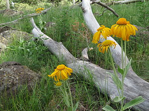
Super easy scenic loop by Mountain Ginger  July 2024 July 2024The current Official Route may or may not be permanent. July 2020 This trail is being rerouted. The route is projected.
This 1.5-mile hike through Hart Prairie is excellent for those short on time or those who prefer scenery over adventure. It's also a good test route for elevation acclimation. Warnings This hike is on the western face of a gigantic mountain range and is more prone to inclement weather than the southern and eastern faces. Check the conditions before you head out. If rain/ snow is forecasted, head out early. If strong winds are forecasted, stay home, or be very, very cautious. I rated this hike as 1.5 out of 5 for difficulty assuming you're acclimated to elevations above 8,000 ft. Bring water, Tylenol, caffeine, and a snack if you're not used to high elevations. My genius friend swears by smoking a cigarette before a high-altitude hike because nicotine increases blood flow. Don't try it if your under 18 or if you're not a fan of lung disease. Hike Start at Humphreys Summit/ Aspen Nature Loop TH (North side of the parking lot - West of Hart Prairie Lodge at Snowbowl. Kendrick, Sitgreaves, and Bill Williams mountains are visible from the trailhead and throughout the hike. The initial decline snakes westward in and out of aspen, cork bark fir, and pine for 0.5 mi until its fork (this is the loop) head left (Southwest)for 0.4 mi until you reach the Arizona trail junction. Head right (north)for about 0.25 mi to the Aspen Loop junction - make another right at the junction, and it's 0.8 mi back to the trailhead. This is a technical description for such an easy hike, so follow the signage clockwise, bring your binoculars, and enjoy the view! Water sources / history lesson The Spanish Explorers called this place "Sierra sin agua" translation: mountain without water. Just about every significant water source on the mountain is the property of the Flagstaff municipalities. Don't expect any along the trail. However, agua and carbonated sugar water can be purchased at Snowbowl's Hart Prairie Lodge just East of the parking lot and trailhead. Camping It's possible to continue north or south along the Arizona trail from the Aspen nature trail, in which case camping is possible, permitted, and praised. Car Camping Consider nearby FR 522, Freidlein Prairie. Designated sites are available. Check out the Official Route and Triplogs. Leave No Trace and +Add a Triplog after your hike to support this local community. | |||||||||||||||||||||||||||||||||||||||||||||||||||||||||||||||||||||||||||||||||||||||||||||||||||||||||||||||||||||||||||||||||||||||||||||||||||||||||||||||||||||||||||||||||||||||||||||


