|
tap row or icons for details
|
| Difficulty |
|
1 of 5 |
| Distance Round Trip |
|
2.1 miles |
| Trailhead Elevation |
|
3,699 feet |
| Elevation Gain |
|
110 feet |
| Accumulated Gain |
|
150 feet |
| Kokopelli Seeds |
|
2.85 |
| Interest Ruins, Historic & Seasonal Creek | |
| | |
|
|
4 |
2021-11-27 | FOTG |
|
|
13 |
2021-03-20 | John10s |
|
|
3 |
2021-01-10 | rcorfman |
|
|
15 |
2017-05-04 | SteveHall |
|
|
23 |
2014-11-16 | Uberdroog |
|
|
19 |
2014-02-01 |
Pueblo LaPlata Ruins and vicinity |
Hansenaz |
|
|
|
8 |
2013-11-03 | burntlizard |
|
|
8 |
2013-09-28 | FOTG |
| | Page 1, 2 |
| |
|
|
|
list |
map |
done |
Camp Verde Region |
| | |
|
| |
|
|
Historical Weather |
| Trailhead Forecast | | |
|
 |
|
|
| Preferred Mar, Nov, Apr, Feb |
|
|
| | |
| |
Named Locations Coordinate Links
| |
|
|
Pueblo La Plata Ruins
|
3.63 mi
334 ft |
 |
|
Pueblo La Plata Ruins
|
2.16 mi
159 ft |
|
| Pueblo La Plata Ruins
|
3.34 mi
142 ft |
|
|
| Pueblo La Plata Ruins
|
2.11 mi
0 ft |
|
|
| Drive to Pueblo La Plata Ruins TH
|
9.8 mi
0 ft |
|
|
| | |
| |
|
|
Overview
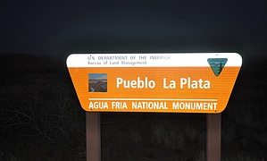
On the east side of Hwy 17, north of the Sunset Rest Stop and south of Dugas Road, resides the 71,000 acre AGUA FRIA NATIONAL MONUMENT(created by Pres. Bill Clinton in YR2000) spread over a high mesa and split down the middle by the upper Agua Fria River canyon. Within this AFNM are the now documented Perry Mesa Ancient "Seven Cities"(1300 to mid-1500 century) with rooms numbering between 100 to 300 once supporting a thriving culture. This guide is for one of these above described "Seven Cities"- The PUEBLO LA PLATA RUINS. TH Start & Parking: N34 15.047 W112 01.670; Main Ruins Site: N34 15.107 W112 01.963 (a .30ml one way "trail" hike from TH Start); Ruins Outer Fortress Site: N34 15.153 W112 02.581 (a .85ml additional "off trail" easy hike from the Main Ruins Site);
|
 Route Editor