 Route Editor

| Guide | ♦ | 37 Triplogs | 1 Topic |
details | drive | permit | forecast | 🔥 route |
stats |
photos | triplogs | topic | location |
| 532 | 37 | 1 |
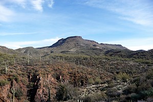
A neat stroll in the desert !! by gpsjoe  2018 Notice 2018 NoticeThe 247A portion of this hike is now signed closed on the Spur Cross side. The trail is still in good shape and appears currently used. To be legal, you will need to hike to the Tonto Forest boundary then over. If you can read a map, you will see it's a slight adjustment. If you can not figure it out, then this hike is not currently for you. The Spur Cross and neighboring Cave Creek trail systems offer great hiking in mountainous terrain featuring some creeks and streams and all the varieties of low desert vegetation you can imagine. The trails are reasonably close to home for those in the Phoenix metro area. Winter and maybe late fall and early spring are the preferred seasons for hiking this area. It is just too hot at other times.
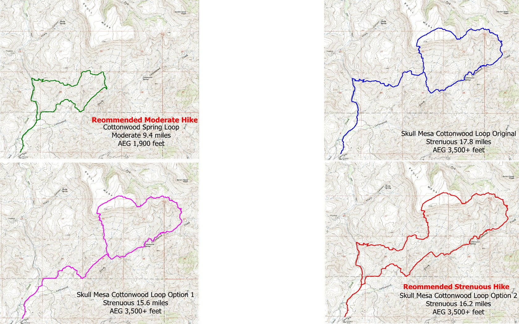
Using 247A in the Skull Mesa - Cottonwood Creek Loop Standard Route - 17.8 miles with 10 miles out and back plus a 7.8-mile true loop. Option 1 fewest miles - At one mile from the parking lot, use Unofficial Trail 247A out and back. This results in 7.8 miles of out and back hiking plus a 7.8-mile true loop. Total miles is 15.6 Option 2 Maximum true loop - Hike standard route 5 miles to the intersection of Skull Mesa and Cottonwood trails, then hike the entire Skull Mesa trail and turn right on the Cottonwood trail and take it to Unofficial Trail 247A (at the Cottonwood Spring with the post with 247 on it). Take 247A back to your car. This has only 2 miles of out and back and 14.2 miles of a true loop for a total of 16.2 miles. This is my personal favorite. In his two trip reports, Al_HikesAZ mentions the tricky navigation on the Skull Mesa trail between the Cottonwood and Quien Sabe trails, and I will confirm that and urge the use of a GPS with the track file loaded for this piece of about 2 miles in length. There are GPS track files posted for the Cottonwood Spring Loop (includes 247A), the original Skull Mesa & Cottonwood Creek Loop, Option1, Option 2, and separately for the mostly unknown trail 247A as well. For a moderate hike, do the 9.4 mile Cottonwood Spring loop (AEG about 1,900 feet). For a strenuous hike, I recommend the 16.2-mile Option 2 (AEG about 3,500 feet plus) but be aware of difficult navigation in the section mentioned above. You can compare all four loops in this graphic.
Check out the Official Route and Triplogs. Leave No Trace and +Add a Triplog after your hike to support this local community. | |||||||||||||||||||||||||||||||||||||||||||||||||||||||||||||||||||||||||||||||||||||||||||||||||||||||||||||||||||||||||||||||||||||||||||||||||||||||||||||||||||||||||||||||||||||||||||||||||


