 Route Editor

| Guide | ♦ | 78 Triplogs | 2 Topics |
details | drive | no permit | forecast | 🔥 route |
stats |
photos | triplogs | topics | location |
| 646 | 78 | 2 |
HAZ Super Loop! by joebartels  pronounced day-sight pronounced day-sightNote No trail in sections, scrambling and route finding skills necessary. Written from a wide-eyed semi greenhorn perspective. Here it is, the Dacite Super Loop! My oh my, this is a killer loop. With the emphasis on killer! This hike is for experienced hikers only. Route finding is not only necessary but very difficult in sections. I can't imagine just hitting the trail hoping for a good day, the results could be horrifying. First, I recommend hiking several other Superstition trails in various seasons. Then you'll have a better feel for what you're tackling. I'm talking about trails in the west section like Peralta, Cave Trail, Dutchman, Bluff Springs, Flatiron, Terrapin, etc. The Cave Trail is a must, or you will have to take a variation on the Peralta.
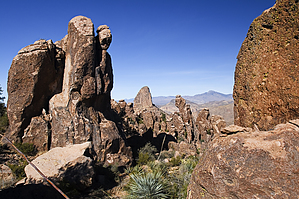
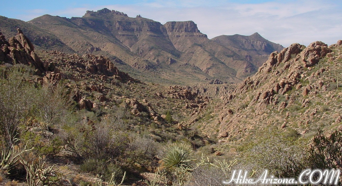
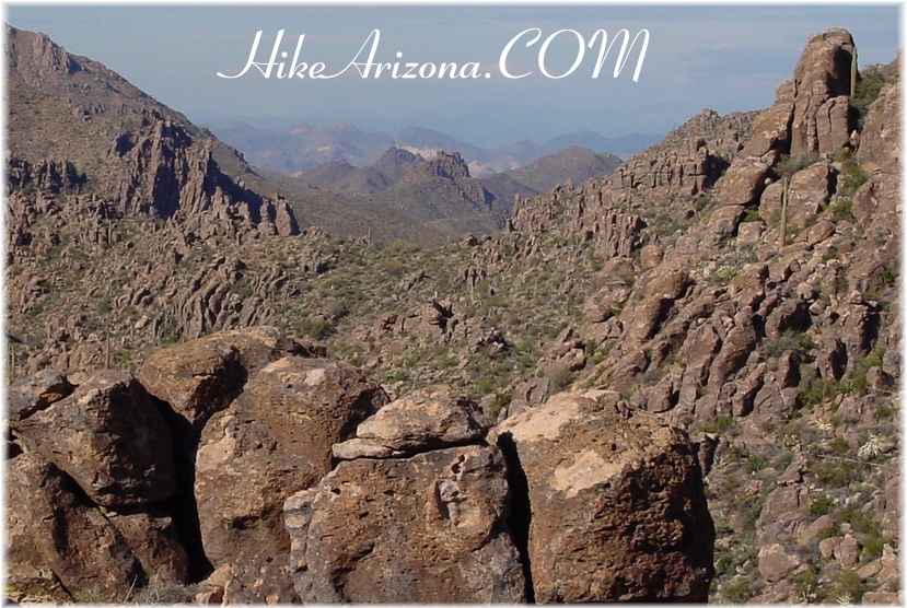
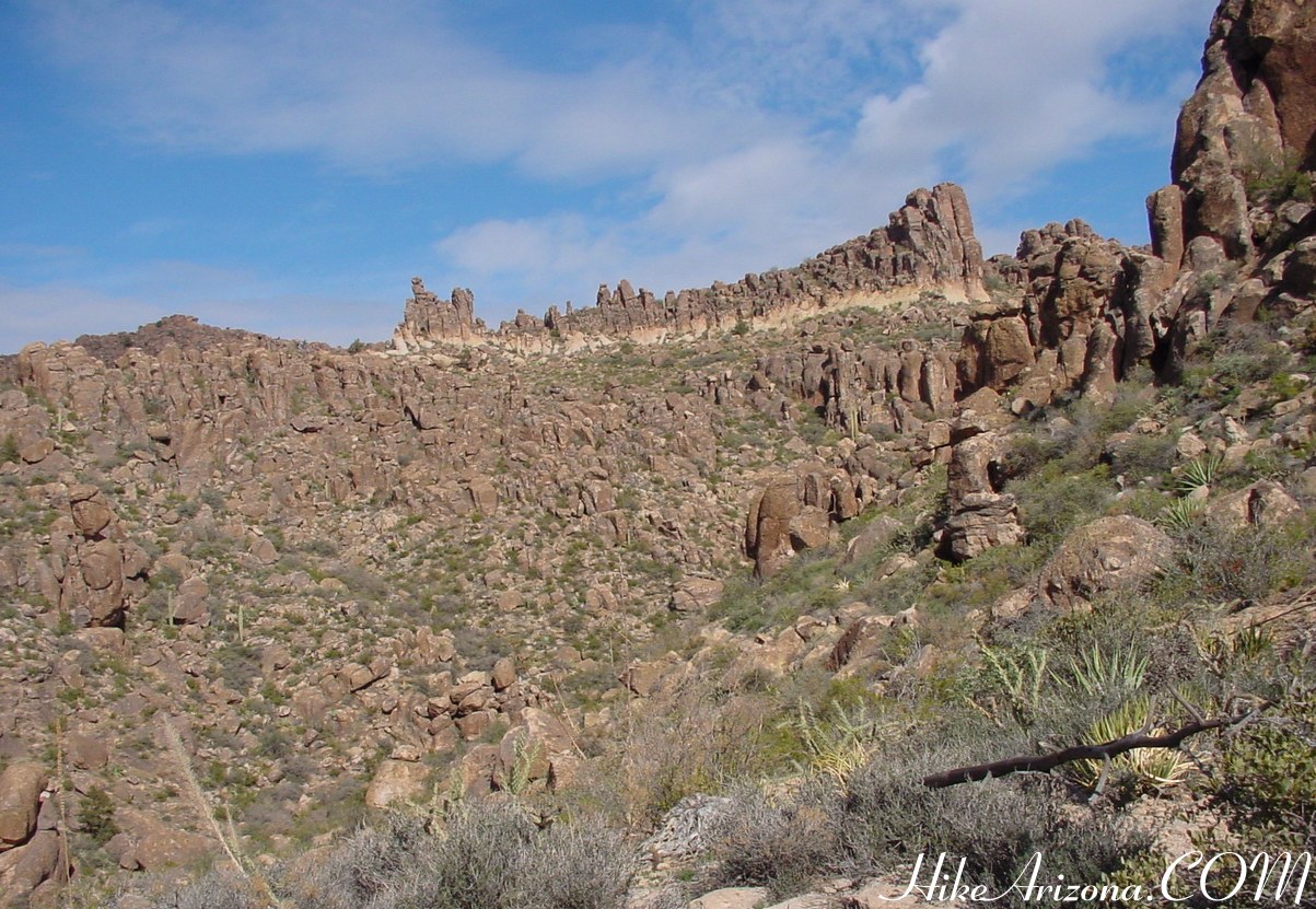
Upon reaching the saddle, check out the view! You are looking into West Boulder Canyon. A use-trail goes down through the canyon. You could follow it to Parker Pass and then onto the First Water Trailhead for a shuttle hike. Of even more interest, to the west is Superstition Peak and the ridgeline fanning out to the northwest. This takes you over to Superstition Mountain and on to the Flatiron. I'm told and have read the ridgeline is extremely difficult. You may have seen stories on the news over the years about lost hikers in the Superstitions. This is usually it. The Ridgeline Trail takes off to the left past the room size boulder on the saddle. On one of my several trips up here, I checked it out a little way. Within fifteen minutes of hiking, you can see much further north. I also spotted a general land section-marker, according to "Hiker's Guide to the Superstition Wilderness". If you're interested in the Ridgeline Trail, keep in mind it's extremely tough. Okay, so you're at West Boulder Saddle. This is where it begins to get tough. Check out the rock spires, which are known as Hoodoos on top of Dacite Mesa. First, you need to get around the yellow streaked spire ledge on the north (left). A decent cairned trail takes you there with one dip through a small drainage, which is only brushy in the bottom of the drainage for maybe 5 to 10 feet. Continue following the cairns up to the north/left of the yellow streak. There's a couple of pinon pines just before rounding the corner. Once on the other side, GO SOUTH. Cairns should take you across the backside. What looks like a bigger drainage isn't much to cross if you follow the cairns far enough south. Cairns again take you up but peter out. The mind tells you to go north around the next set of spires. Don't do that, GO SOUTH =) I've lost count on the number of times I've done this hike. To date, I'm sad to admit I've gone too far north on countless occasions. Once I came out nearly PAST Weavers Needle...lol, but true! Finally, on down to Fremont Saddle. As stated above, you need to be familiar with the Fremont Saddle area, or this trip isn't happening. Okay, this is your task. You need to get down to the popular Fremont Saddle. There is a cairned trail if you're lucky enough to find it. Otherwise, just do your best as I have on many occasions. Be careful though, you can cliff out and get into trouble. If you've ever been lost going down on the Flatiron trail, you'll know the feeling. Don't go down into something you can't get back up. An air rescue starts at about one grand and goes up to three from what I've heard. From Fremont Saddle, go over to the Cave Trail, which is somewhat tricky to find. Check out the Cave Trail trip for more info on this. You could take the Peralta down. I guess that would make it "just" the Dacite Loop. Who can resist the feeling of completing the Dacite Super Loop? So check out the Cave Trail ahead of time and get that section familiarized. Okay, from the Peralta Trailhead parking area, you have a couple of options. The quickest way back to your car is by bicycle if you set up that option in advance. The recommended option is to download the Official Route and follow it. Otherwise, follow the SR77 to the Lost Goldmine Trailhead. Check out the Official Route and Triplogs. Note This is a moderately difficult hike. Leave No Trace and +Add a Triplog after your hike to support this local community. | |||||||||||||||||||||||||||||||||||||||||||||||||||||||||||||||||||||||||||||||||||||||||||||||||||||||||||||||||||||||||||||||||||||||||||||||||||||||||||||||||||||||||||||||||||||||||||||||||||||||||||


