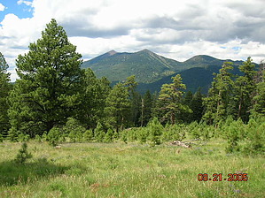
Views of the San Francisco Peaks, the volcanic fields east of Flagstaff, Sunset Crater, and even the Painted Desert are yours to enjoy along this high country trail. The route starts near Schultz Tank, a rare water body here in these mountains Spanish explorers called sin agua (without water). It then climbs gradually to a high ridge where you'll find good views of Arizona's tallest mountain before continuing to the east edge of Mount Elden's summit plateau. From this high perspective, you can look down on Sunset Crater and the vast Bonito Lava Flow that borders it.
As you hike along this trail, take time out to check for black bear tracks in the dust. A few of these shy animals live in this area, but usually, all you see is their tracks. You have a much better chance of seeing elk and mule deer, which are more plentiful and much less shy.
Along its highest reaches, the Sunset Trail traverses an area devastated by a fierce wildfire in 1977. At one point, there was concern that the city of Flagstaff might even be consumed by this campfire gone wild. Here, among the burned-out hulks of a once-thriving forest, you can see how nature recovers from such an all-consuming disaster. Pioneer plants such as aspen and Gambel oaks are already well established in the burned-over area.
Sunset Trail provides a connecting route to Schultz Creek, Brookbank, Little Bear Trail, Upper Oldham, and Elden Lookout Trails.
When hiking several trails on a single "hike", log it with a generic name that describes the hike. Then link the trails traveled, check out the example.
WARNING! Hiking and outdoor related sports can be dangerous. Be responsible and prepare for the trip. Study the area you are entering and plan accordingly. Dress for the current and unexpected weather changes. Take plenty of water. Never go alone. Make an itinerary with your plan(s), route(s), destination(s) and expected return time. Give your itinerary to trusted family and/or friends.
Permit $$
None
Directions
Road
FR / Dirt Road / Gravel - Car Okay
To Schultz Trailhead Location: 7 miles north of Flagstaff on graveled Forest Roads.
Access: Drive north out of Flagstaff on US 180 to FR 420 (Schultz Pass Road). Drive 6 miles east on FR 420 to the trailhead at a parking lot on the south side of the road.
Road Condition: FR 420 is graveled and suitable for passenger cars except during winter when it is closed because of snowpack.
From PHX (I-10 & AZ-51) 158 mi - about 2 hours 35 mins From TUC (Jct 1-10 & Grant) 263 mi - about 4 hours 5 mins From FLG (Jct I-17 & I-40) 10.1 mi - about 24 mins
 Route Editor


 Views of the San Francisco Peaks, the volcanic fields east of Flagstaff, Sunset Crater, and even the Painted Desert are yours to enjoy along this high country trail. The route starts near Schultz Tank, a rare water body here in these mountains Spanish explorers called sin agua (without water). It then climbs gradually to a high ridge where you'll find good views of Arizona's tallest mountain before continuing to the east edge of Mount Elden's summit plateau. From this high perspective, you can look down on Sunset Crater and the vast Bonito Lava Flow that borders it.
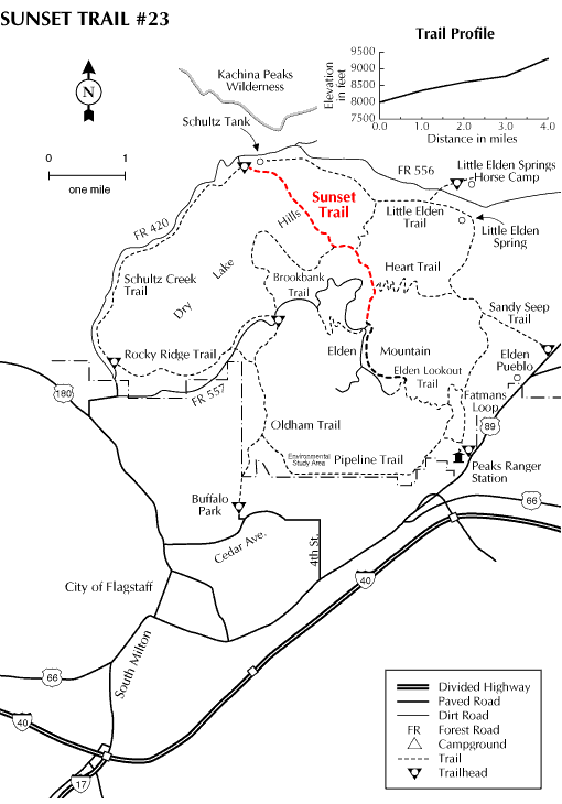


