Note
Page data reflects the entire trail from the horse staging area to the Goat Trail. Few, if any, do this full stretch, adjust your distance accordingly when posting triplogs.
Hike
Here's a trail with many options. This summary reflects a one way 4.5mi/1140AEG trek. Starting at the middle Waddell Trailhead, looping counterclockwise to the junction with Mesquite Trail. See the map below for a better understanding. Choose one of the following options. Most hike 2.5 miles to the white granite slabs. Others loop back on the Mesquite Trail for a 7.7 mile journey. Any trek along this trail on a 70-degree day would be enjoyable.
From the Waddell Trailhead, you'll soon be heading north. To the left, a good size mountain looms close. It's a good landmark to remember for those taking on the 7.7-mile loop. A big wash is crossed before the junction with Ford Canyon Trail. The first mile of the Ford Canyon Trail takes you through a beautiful stretch of desert. The trail makes its way, dodging cacti along the way. If, by chance, you get bored with the beautiful desert scenery, an ascent helps change the pace. As I hadn't read anything about the trail, my eyes searched for everything. I caught a glimpse, in the distance, of a dry waterfall. That became the drive. What was it all about? Did it come close to the trail? How tall was it? Surprisingly the trail came closer than expected. Only to turn and climb to the real gem of this trail. The canyon stream bed turns to white granite slabs. It's white. Having hiked other trails in the White Tank Mountains, it's now apparent how the name came about. I could only imagine a summer swim in one of the many pools. Undoubtedly a very popular day-hike after monsoon rain, summer hike.
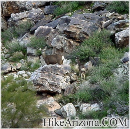
Not usually like myself, I forged on."The trail leaves the stream bed just after the 3-mile mark." A sign on the left bank leads you out and up. The trail switchbacks up the canyon slope. You're heading towards a saddle with Willow Canyon. The vegetation, now in a third stage, is light desert terrain. Surrounded completely by mountains, this is a very peaceful area. I nearly jumped (okay, I jumped) when two bucks or whatever they are ran by me. Ocotillos greet you coming to the first saddle. Cross over the saddle and now your looking into Willow Canyon. Radio towers can be seen in the distance. The trail goes down to the Mesquite Trail junction. The Ford Canyon Trail goes about another mile where it hooks up with the Goat Camp Trail. You could make this into one huge loop with the Goat Camp Trail. If you do, consider a short side trip to Willow Springs.
When hiking several trails on a single "hike", log it with a generic name that describes the hike. Then link the trails traveled, check out the example.
WARNING! Hiking and outdoor related sports can be dangerous. Be responsible and prepare for the trip. Study the area you are entering and plan accordingly. Dress for the current and unexpected weather changes. Take plenty of water. Never go alone. Make an itinerary with your plan(s), route(s), destination(s) and expected return time. Give your itinerary to trusted family and/or friends.
To hike From the 303 & Olive, go west on Olive 4.5 miles to the park entrance. Olive turns into White Tank Mountain Rd. Continue 2.1 miles, turn right, and it's 250 feet to the Mesquite/Ford Trailhead.
You get a map when you pay your entrance fee, so that should help you figure it out if you have any concerns.
 Route Editor

 Note
Note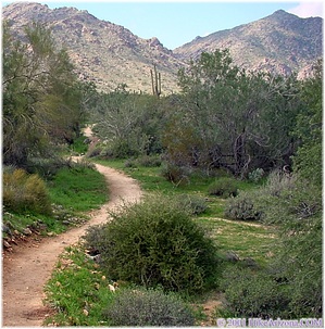


