 Route Editor

| Guide | ♦ | 39 Triplogs | 2 Topics |
details | drive | no permit | forecast | 🔥 route |
stats |
photos | triplogs | topics | location |
| 513 | 39 | 2 |
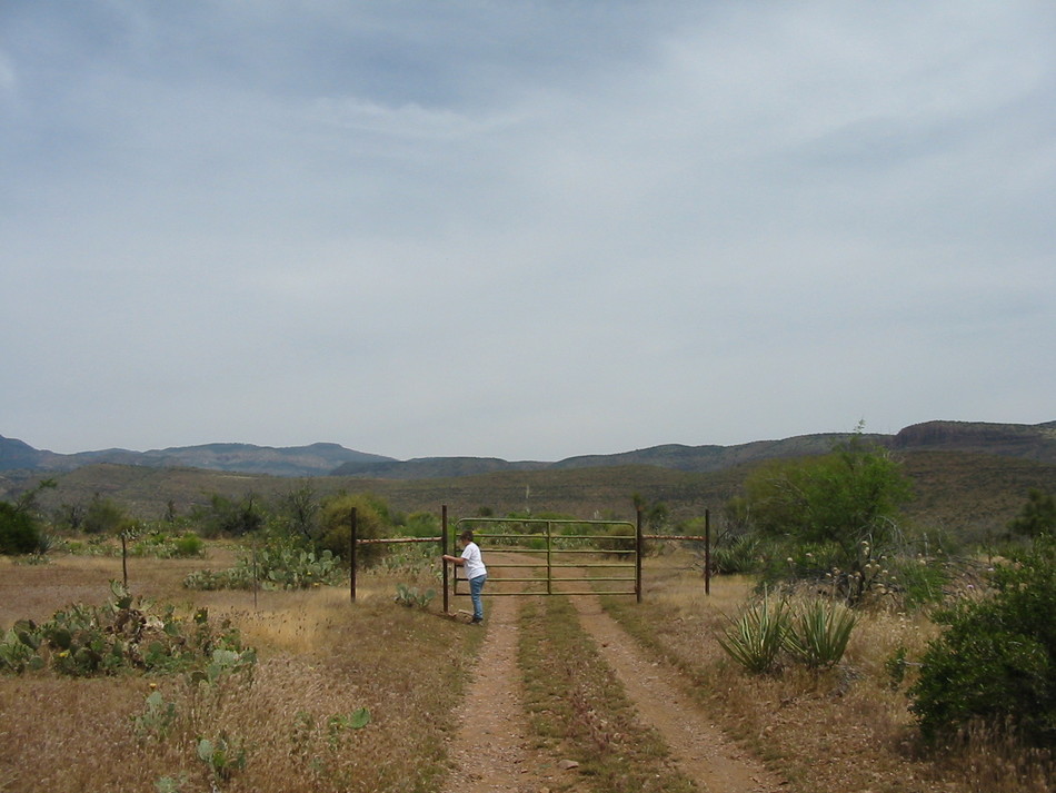
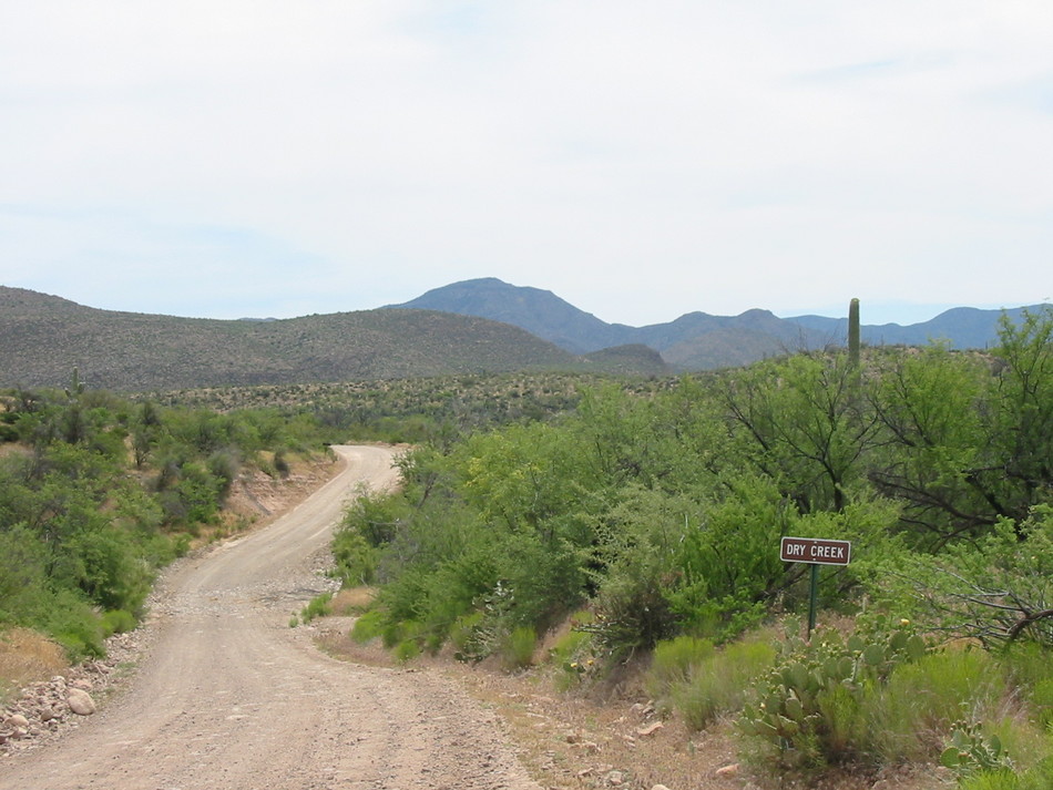
1934 inspiration by Randal_Schulhauser   A recent read of Emil W. Haury's 1934 archeological paper entitled "Canyon Creek Ruins and Cliff Dwellings of the Sierra Ancha" has spurred me to visit even more cliff dwellings. I'll describe a recent hike to one of the lesser-known cliff dwellings near the Cherry Creek region of the Sierra Anchas. A recent read of Emil W. Haury's 1934 archeological paper entitled "Canyon Creek Ruins and Cliff Dwellings of the Sierra Ancha" has spurred me to visit even more cliff dwellings. I'll describe a recent hike to one of the lesser-known cliff dwellings near the Cherry Creek region of the Sierra Anchas.Starting from the  junction of FR203 and FR38, follow the 4WD trail north for 1.04 miles until you reach a cattle gate. Pass through the gate, closing it after you. There are multiple mud holes along the way that could make for a very stuck vehicle after wet weather! Continue along FR38 until you reach a fork in the road at mile 1.56. The 4WD trail to the east is FR1076. There is no signage indicating FR1076, but it does appear on my topo map and GPS. Don't let the photo fool you; FR1076 rapidly deteriorates as a passable road from here on in. junction of FR203 and FR38, follow the 4WD trail north for 1.04 miles until you reach a cattle gate. Pass through the gate, closing it after you. There are multiple mud holes along the way that could make for a very stuck vehicle after wet weather! Continue along FR38 until you reach a fork in the road at mile 1.56. The 4WD trail to the east is FR1076. There is no signage indicating FR1076, but it does appear on my topo map and GPS. Don't let the photo fool you; FR1076 rapidly deteriorates as a passable road from here on in.
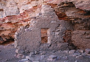
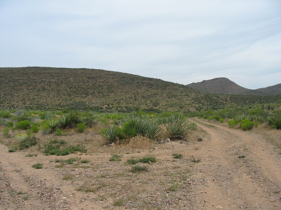
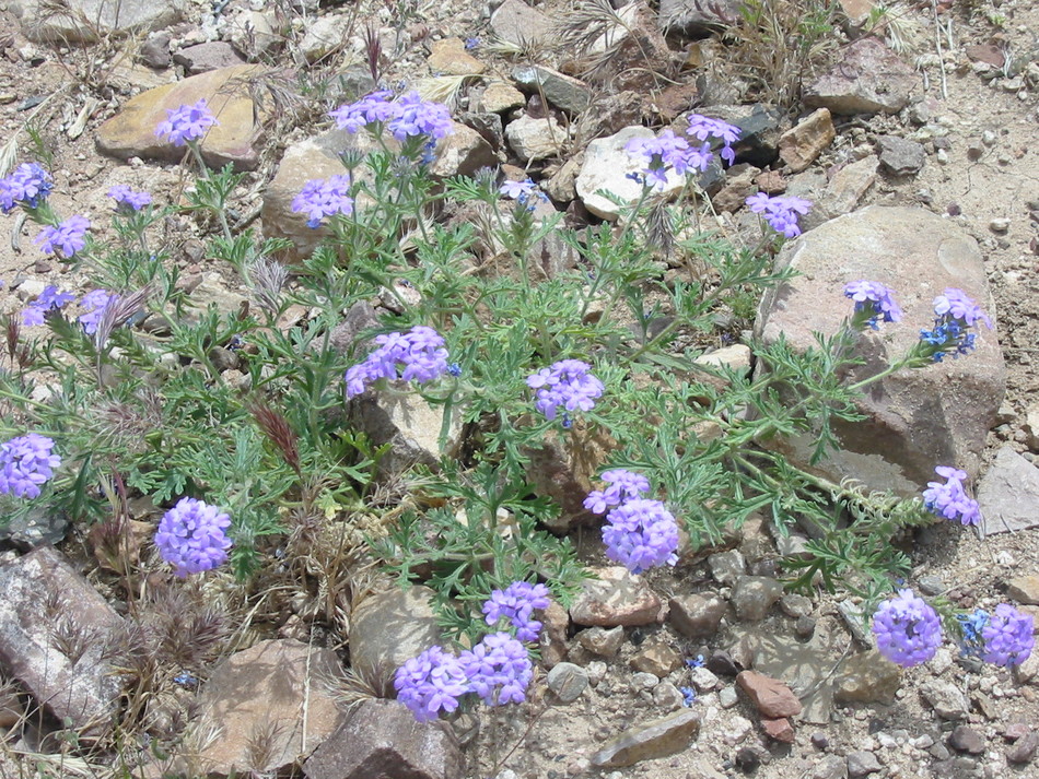
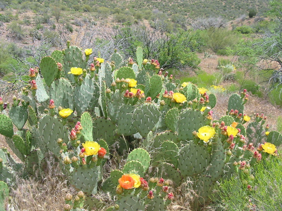
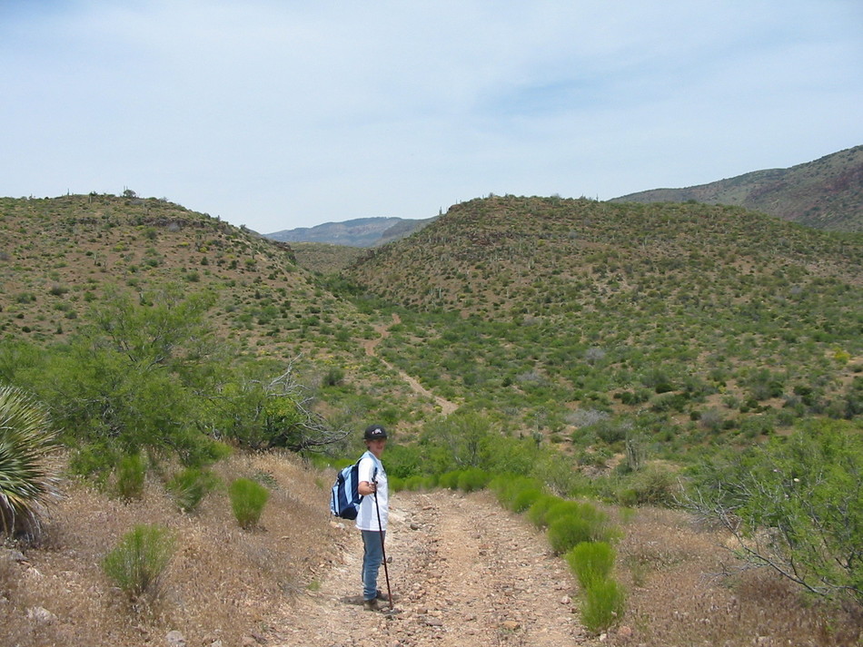
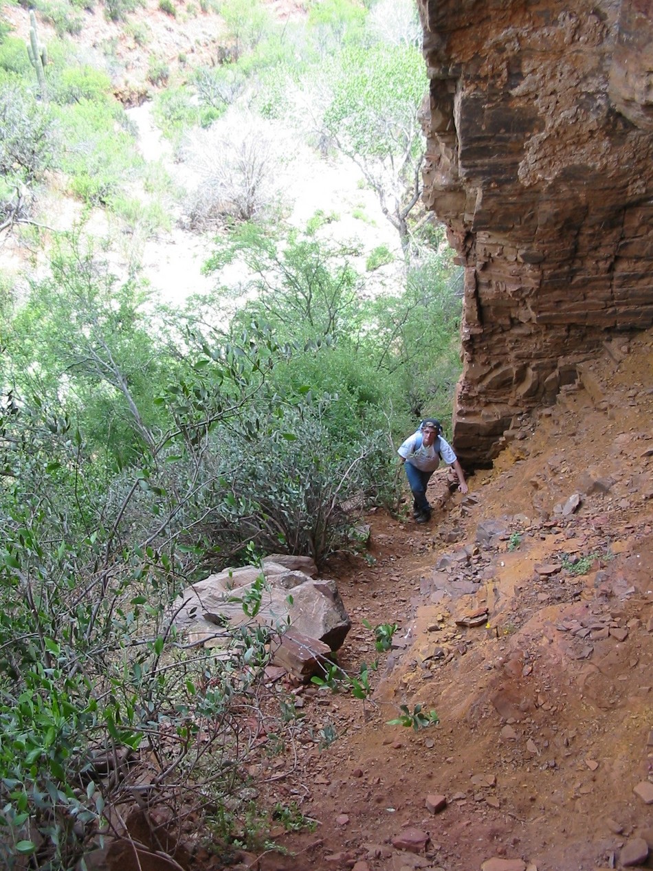
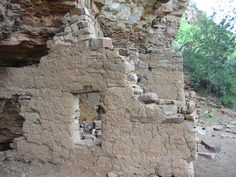
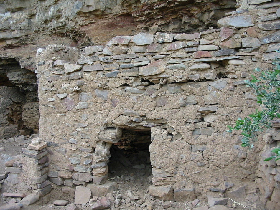
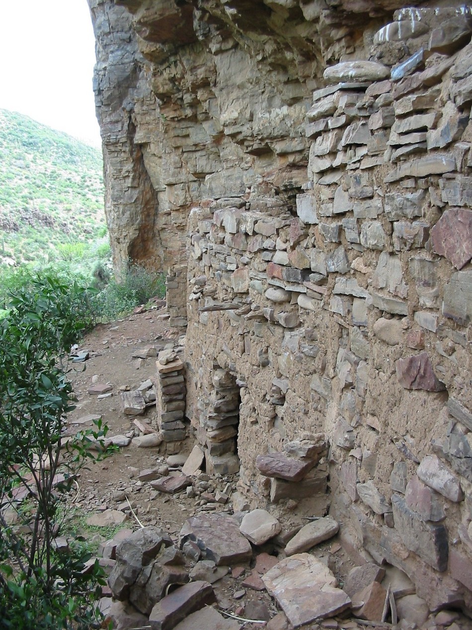
1.89 along FR1076, you will encounter another fork in the path. Bear left at this fork and you will drop down into a dry wash. Climb out of the wash and rise up the hillcrest to mile 1.96. This will be followed by a steep descent into another wash and another rise up a hillcrest to another cattle gate at mile 2.18. On the southwest side of the gate there is evidence of a small mining operation. The trail along FR1076 will bend to the north once you pass through the cattle gate.On this mid-May day there are still a variety of blooms along the route including purple flowering desert verbena and yellow flowering prickly pear cacti. As you look to the east, you can see Coon Creek valley. As you look to the north you will see how the canyon will begin to box up forming cliffs on both sides. This is where the cliff dwellings are located. FR1076 will follow the contour along the west side of Coon Creek valley towards a mountain pass. Follow the FR1076 trail though the mountain pass. At mile 3.27 on the north side of the pass you will notice a side trail heading east towards Coon Creek. This side trail follows a tributary into Coon Creek. At mile 3.39 the path dips down into the tributary bed. This soon joins into Coon Creek.At Coon Creek, boulder hop downstream looking for an overhang in the cliffs on the west side (your right hand side as you head downstream). You can catch glimpses of the ruins through the thick brush. At mile 3.71, as Coon Creek makes a turn towards the western cliff of the canyon eliminating any more vegetation on the western bank, there will be a pathway comprised of loose scree heading up from the south to north along the western cliff face. Scramble up this path and at mile 3.77, you will be rewarded with a first hand look at the remains of an ancient cliff dwelling.Some notes about the ruins are based on miscellaneous readings. Some archaeologist reports refer to this ruin as Hematite House due to the iron-oxide mineral deposits called hematite. As you look at the cliffs surrounding the ruin you will notice the red hematite along with the yellow hematite deposits. The Coon Creek cliff dwellings were constructed by the Salado whereas Cherry Creek cliff dwellings were constructed by the Anchans (a culture often associated with the Mogollon). I could not find any exact dates for the construction and subsequent abandonment of the Coon Creek cliff dwellings. In general, these ruins are thought to be 700 years old. If you are looking for a remote cliff-dwelling hike that doesn't require the same effort as a Devil's Chasm, Pueblo Canyon, or potential vertigo, this hike is for you. Enjoy! Gate Policy: If a gate is closed upon arrival, leave it closed after you go through. If it is open, leave it open. Leaving a closed gate open may put cattle in danger. Closing an open gate may cut them off from water. Please be respectful, leave gates as found. The exception is signage on the gate directing you otherwise. Check out the Official Route and Triplogs. Leave No Trace and +Add a Triplog after your hike to support this local community. One-Way Notice This hike is listed as One-Way. When hiking several trails on a single "hike", log it with a generic name that describes the hike. Then link the trails traveled, check out the example. | |||||||||||||||||||||||||||||||||||||||||||||||||||||||||||||||||||||||||||||||||||||||||||||||||||||||||||||||||||||||||||||||||||||||||||||||||||||||||||||||||||||||||||||||||||||||||||||||||


