 Route Editor

| Guide | ♦ | 53 Triplogs | 13 Topics |
details | drive | permit | forecast | route |
stats |
photos | triplogs | topics | location |
| 1.1k | 53 | 13 |
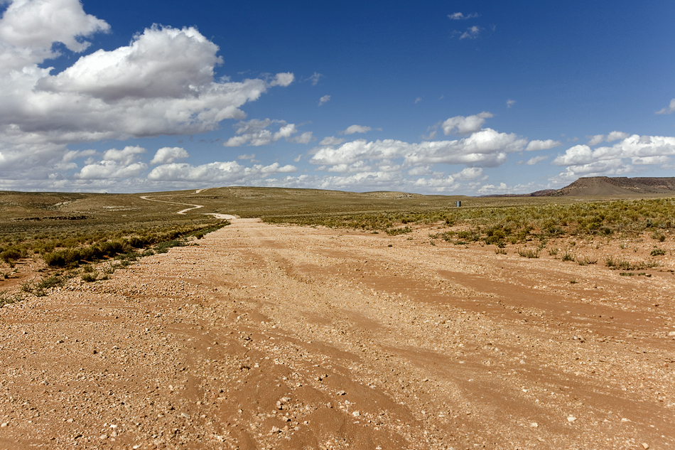
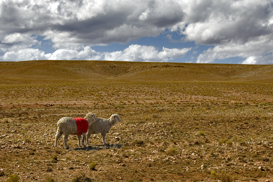
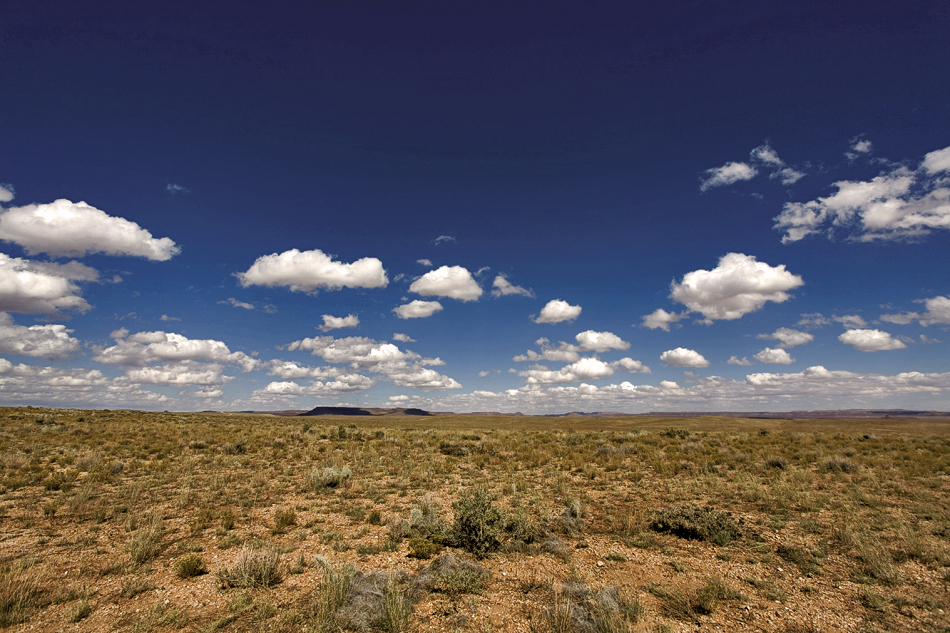
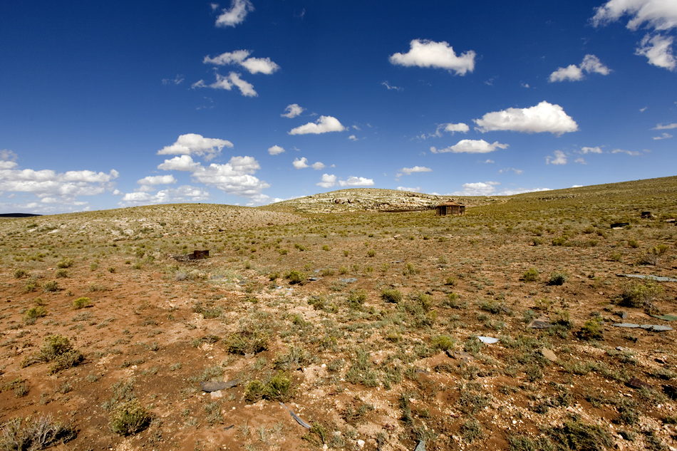
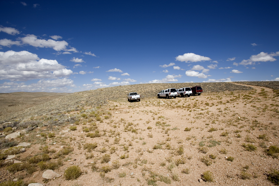
Into the Blue by joebartels  Overview OverviewThis old Hopi route goes 3 miles down Salt Trail Canyon to the Little Colorado River referred to as LCR. The route is slightly rough at the beginning and end. Route finding is necessary to the point where you simply need to pay attention to cairns. Approach The drive in over Navajo land is subtly grand. If you're lucky you might spot a sheep herder in the vast land sparsely dotted with hogans. You've reached the trailhead when your GPS indicates it. Little else distinguishes that you have arrived.
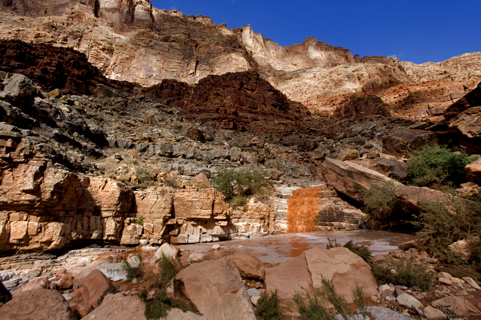
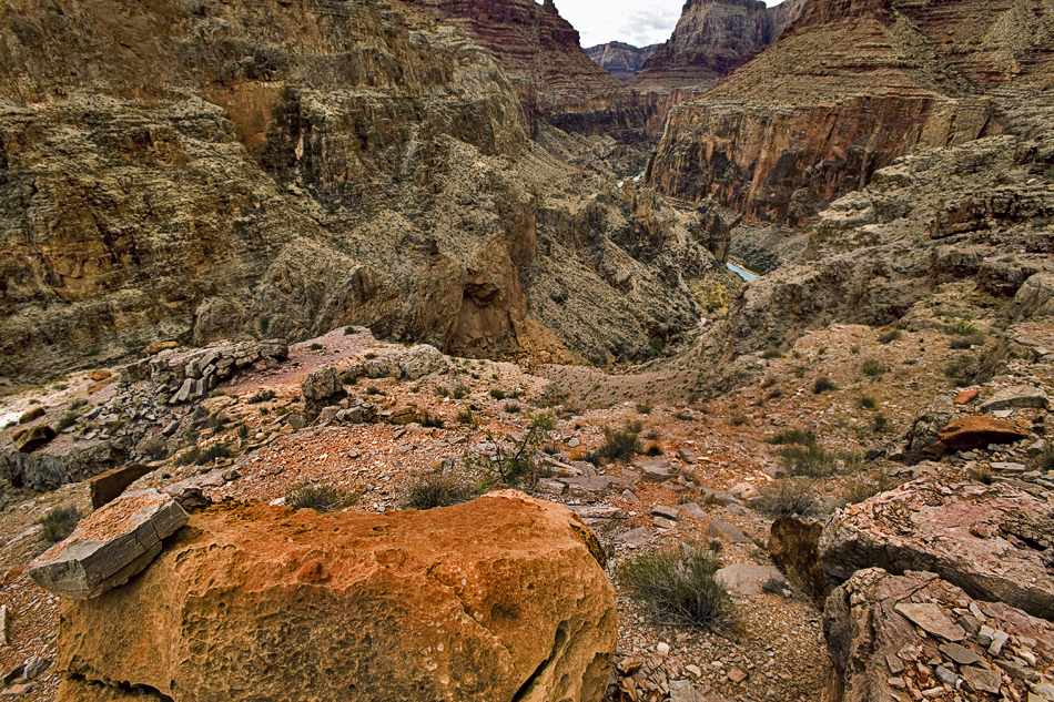
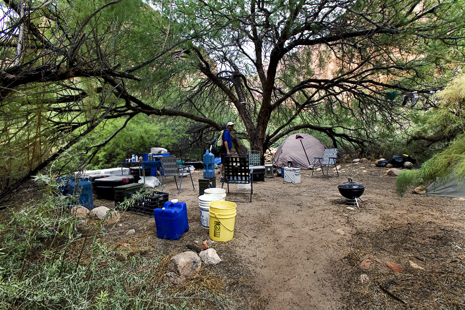
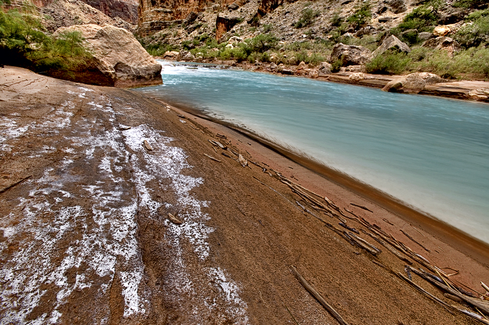
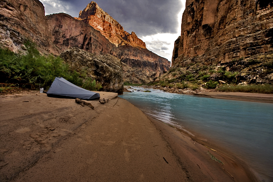
From the trailhead, it's a 180ft soft drop down a hillside to the edge of the canyon. A large cairn marks the spot. It's an immediate drop off the edge down-climbing boulders. Fear not, as this isn't technical nor scary. I believe this is the most physically demanding part of the hike, and it goes by quickly. The rocks are firm. Only one or two rocks had enough play to get my attention the entire trip. When I heard Harvey Butchart hiked the route in 1964 with an arm in a cast, I knew it couldn't be as difficult as the rumors. Once you get down to the totem pole, it's time to get serious about spotting cairns. If you hike for a few minutes without seeing a cairn, stop. Think it over and figure out where the next cairn is located. You may have to backtrack a tad, but your life is worth it. From this point on, a single trekking pole is the way to go. Two becomes cumbersome as you occasionally need to use a hand. The cairns will lead you down through the layers of the Supai Group to ledges in the Redwall Limestone. This is about 1,400 ft down from the start. You follow the ledges for a short distance. At one point in the middle, you'll likely need to crawl a couple of feet if you have more than a daypack. After the ledges, you come to the crossover. Crossing over, you pass a staircase waterfall after heavy rains. The remainder of the hike down will now be on the right side of the canyon. If it took you three hours to get to the crossover, it'll be about two more hours to the river. It's about a 1,900ft drop to the crossover and another 800ft to the river. For the next mile, you skirt ledges with some sheer drop-offs. It's easy to travel until you get near the end. Approaching which you'll have nice views of the soft blue river unless it's rained in recent weeks. The cairns will lead you down at the end. You cross the creek and come up to a bare spot, which is the helipad. Take the main trail left off the helipad and through the vegetation to Calcium Carbonate Beach. A little further gets you to Teva Joe Beach just before spring rock. Water The beautiful blue water is loaded with calcium carbonate. It's drinkable, but you'd likely rather not. I used it in some freeze-dried chili, and it tasted fine. One of the USFWS biologists mentioned it's loaded with parasites and will likely give you the runs if you drink it in quantity. Take a Platypus collapsible water container and let it sit overnight. It still has the taste, but the bite isn't as repulsive. All the springs I tested heading up the canyon including Big Canyon were loaded too. Permit A permit to enter the area is available at the visitor center in Cameron. It's located at the junction of Highway 89 and Highway 64. Believe they open at 8 am. Call ahead for the current procedure. The system has been known to change. One time we couldn't find anyone to help us... Timing If you're interested in seeing blue water, then timing is everything. Prime season is late September through October. May is also a popular choice. When this stream gauge at Cameron reads zero for ten days nor any surrounding storms for ten days, it is a pretty safe bet the water will be blue. Seven may suffice; fourteen is pretty much guaranteed.
Check out the Official Route and Triplogs. Note This is a moderately difficult hike. Leave No Trace and +Add a Triplog after your hike to support this local community. | |||||||||||||||||||||||||||||||||||||||||||||||||||||||||||||||||||||||||||||||||||||||||||||||||||||||||||||||||||||||||||||||||||||||||||||||||||||||||||||||||||||||||||||||||||||||


