 Route Editor

| Guide | ♦ | 173 Triplogs | 2 Topics |
details | drive | no permit | forecast | route |
stats |
photos | triplogs | topics | location |
| 351 | 173 | 2 |
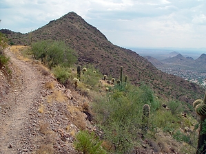
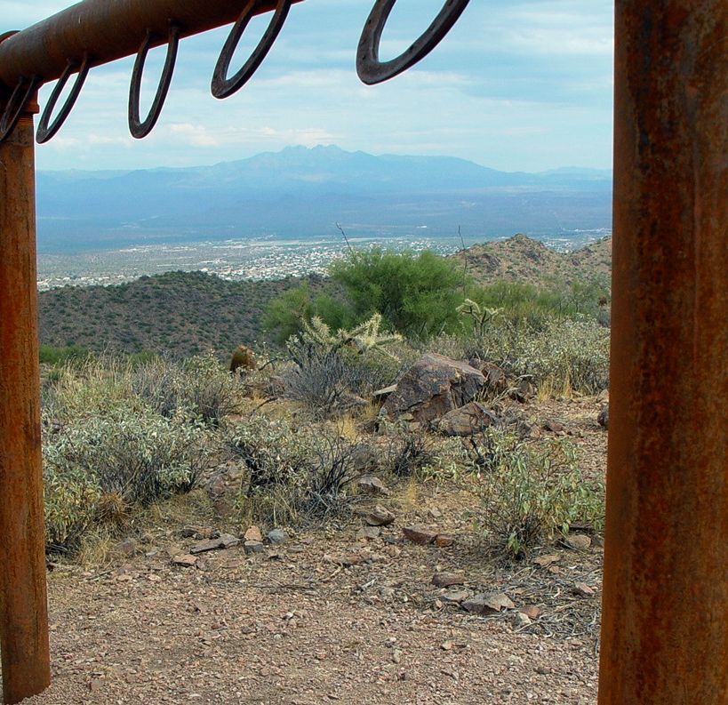
Desert hike with views! by Pua   Overview OverviewFrom the 128th Street Trailhead take Ringtail Trail 0.6 miles up to a right on Sunrise Trail and follow another 2.15 miles to the peak. The summary below is to the popular turnaround at the hitching post. Which saves you 220 feet of steep elevation gain and 0.5 miles off the roundtrip. Summary In the land of red tile roofs, and swimming pools, the McDowell Sonoran Land Trust(MSLT) folks have built a trail that takes you slowly away from civilization and up through Sonoran Desert to an overlook. This North Scottsdale trail can be accessed from 128th Street via the Ringtail Trail or from 124th Street Lost Dog trail. This description is for the 128th Street access. If it has been more than a year since you've ventured into this preserve, you'll know that this trail is relatively new. When I hiked this two years ago, it ended in a dead-end at the ridge in the east. You will appreciate the beefed-up signage, trail maintenance, and the literature and doggie-poo bags available at the trailhead. You'll also notice that these folks have recycled the old 128th street rocky dirt road extension back to nature by tilling it up and planting cacti. You're now steered onto this (really nice) parallel track.
Continuing, and upward, the trail is carved into the side of a small valley that circles back to the north. Rocky ridges hover above and, some days, you're alone with the wind and silence. I once happened to hear a barrel cactus meet its end and go end-over-end down the hillside. A few switchbacks later (about 45 minutes from the start), you're at the top of the ridge. The climb from here is milder. Follow the trail around the amphitheater-like valley, gradually upward, and you will circle your way back east. The land drops away steeply on your right-hand side, so be aware of your footing. About 20 minutes later you will find yourself at the hitching post. Here, a view awaits you, and the land drops away towards Fountain Hills. You can continue to Sunrise Peak if you like, it's just over a quarter-mile beyond this point. Turn around here at about mile 2.5. The MSLT website lists the elevation gain to the hitching post at approximately 1000 feet. It seems like it might be a little lower. This trail is easy to follow and, once away from 128th street, very quiet. The desert is especially beautiful in the spring wildflower season, but even year-round, saguaro, ocotillo, and the usual suspects abound. A fun 2-3 hour hike with some challenges that will make you feel like you earned your lunch. Shuttle It should also be noted that this hike starting or ending from the 128th Street TH combined with any of the other Via Linda Street TH options (from the 124th St-Lost Dog Wash, 136th St., or 145th St.) would make for an excellent car shuttle hike opportunity with minimal driving time-distances to retrieve your other shuttle vehicle. Check out the Official Route and Triplogs. Leave No Trace and +Add a Triplog after your hike to support this local community. | ||||||||||||||||||||||||||||||||||||||||||||||||||||||||||||||||||||||||||||||||||||||||||||||||||||||||||||||||||||||||||||||||||||||||||||||||||||||||||||||||||||||||||||||||||||


