Hike
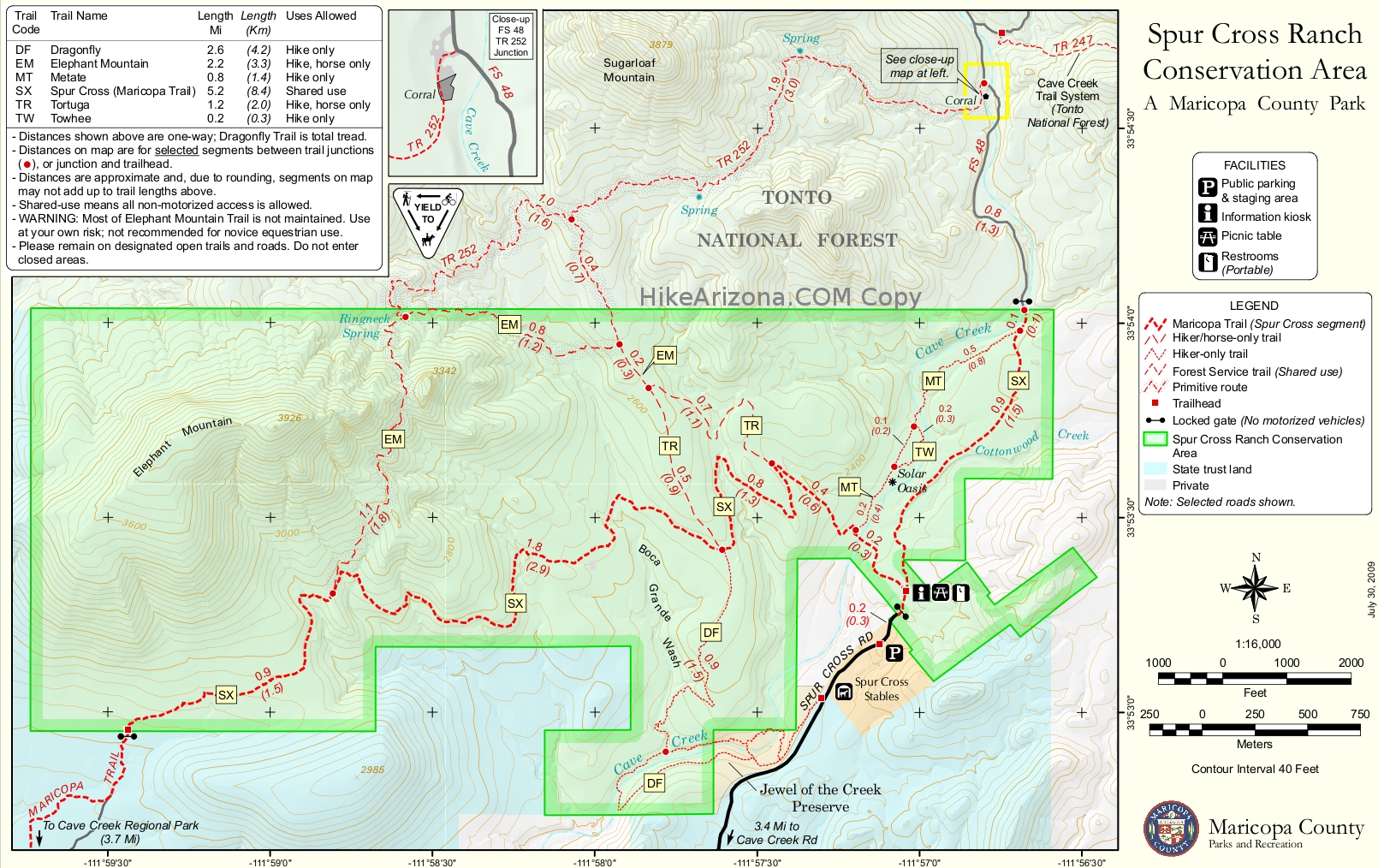
This trail starts as the Tortuga Trail junction 1.5 mi from the trailhead. Head west and cross Cave Creek at 0.25 mi. Climb on a jeep trail. Up and over a ridge then down and across another creekbed. A sign warns that you are entering a primitive unmaintained area. You climb on the jeep trail. At 1.36 miles a spur of the trail heads south. The trail continues north to the junction with the Elephant Mountain trail at 1.54 miles. Tortuga Trail continues north to the Tonto National Forest.
From the Tortuga Trail junction head west and descend some steep switchbacks to a creekbed. The creekbed is well marked with cairns. When the creek branches, follow the left branch. There is a signpost where you leave this creek bed. The trail climbs steeply into the foothills and to the saddle at 3,143 feet. This is a nice place to have a snack and enjoy the views. The effort to reward ratio for this hike is probably optimized at this point and many hikers will want to turn back.
The trail continues along the side of the mountain. It meets up with Spur Cross Trail at a small saddle.
Perks
Porta-Johns at the trailhead. Rangers on duty during the week. Interpretive hikes offered.
When hiking several trails on a single "hike", log it with a generic name that describes the hike. Then link the trails traveled, check out the example.
WARNING! Hiking and outdoor related sports can be dangerous. Be responsible and prepare for the trip. Study the area you are entering and plan accordingly. Dress for the current and unexpected weather changes. Take plenty of water. Never go alone. Make an itinerary with your plan(s), route(s), destination(s) and expected return time. Give your itinerary to trusted family and/or friends.
Permit $$
Spur Cross Conservation Area $5 per person
Directions
Road
FR / Dirt Road / Gravel - Car Okay
To Spur Cross Trailhead I-17 North & Exit 233, which is SR-74 the Carefree Highway. Head east on Carefree Highway 9.9 miles to Cave Creek Road. Head North on Cave Creek Road 2.6 miles to Spur Cross Ranch Road. The road jogs a bit here but you go 4.0 miles to the parking lot.
It is a well-graded dirt road. As it nears the parking area, the road leads past a large green house, through a tall gatepost and past a corral. There is a large signed parking area. Along the road about 75 yards northeast of the parking area, there is a self-pay station and a small informational kiosk with rudimentary maps. Pay the fee and carry the stub with you.
From PHX (I-10 & AZ-51) 35.8 mi - about 57 mins From TUC (Jct 1-10 & Grant) 144 mi - about 2 hours 26 mins From FLG (Jct I-17 & I-40) 133 mi - about 2 hours 10 mins
 Route Editor


 Hike
Hike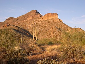


