 Route Editor

| Guide | ♦ | 396 Triplogs | 7 Topics |
details | drive | no permit | forecast | 🔥 route |
stats |
photos | triplogs | topics | location |
| 2.3k | 396 | 7 |
Tricky Hoot! by joebartels   Warning WarningSpray painting or permanently marking the route is defacing the wilderness. If you witness this illegal activity, report it to the Tonto National Forest (602) 225-5200. 2017 Update The trail is marked with multiple routes and can get confusing at times. It is recommended that you ascend and descend on the same route as not to lose the trail. Pay attention on the way up for landmarks to orient yourself.
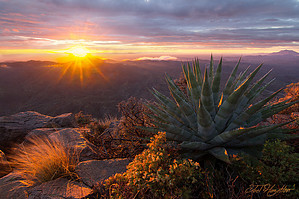
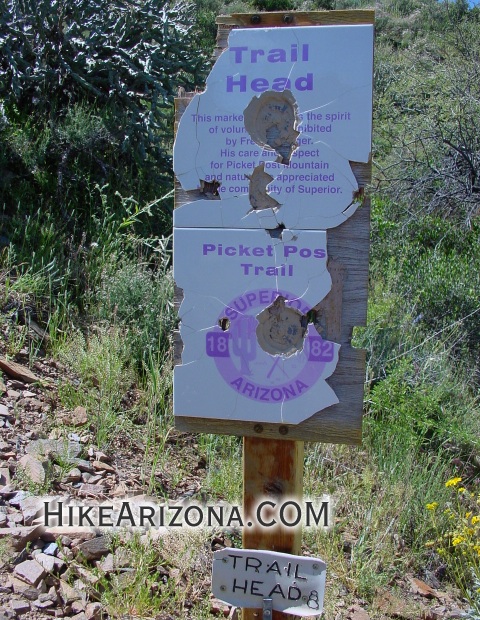
The trail is easier to find from the now maintained trailhead than described below. Hike Head out south on the Arizona Trail from Picketpost Trailhead. Follow the jeep road (formerly known as Alamo Canyon Road) for about ten minutes to the first jeep trail coming in from the left. On this trip there was an AZT marker just before the turn. Take a left onto this jeep road, which takes you closer to Picketpost Mountain. Follow this jeep road about eight minutes to the end. Here you'll encounter the trailhead for the ascent. Notice how ten steps onto this trail, and you've already gained ten feet in elevation. This trail is rarely if ever maintained. Thick low lying vegetation will brush your legs in many sections after the second trailhead. The trail takes advantage of a ridge to crawl up the left side of a ravine that follows up to the top. There is an option to cross the ravine. This alternate trail makes a supposedly easier switchback ascent (lower section only). I recommend taking that on the return trip. Continue going up the ridge. You know the easy stuff is over when you come to a very steep section. Can you say precursor? If this little slope intimidates you, forget it and turn around now. Steep slopes containing loose gravel and cacti will be encountered many times over. The ridge and trail take you away from the ravine to the north. Steep-loose-gravel sections on this part are easy to go up, but the thought of going down might put a damper on the mood. That's why I recommend the alternate trail on the south side of the ravine coming down. When the trail makes it back to the ravine, you feel a little better knowing you can't fall as far now. Like the Flatiron, the route is inconspicuous for a short stretch or two. This trail crosses over and dips in sections as opposed to a beeline ascent. It's too small to be called a mesa and too big for a butte, so I don't know what it's called, but this mountain has a flat top. When you reach the lip, you'll notice the top is slanted up to the east. It's a pleasant stroll across the deck to the peak. Vegetation is abundant. Near the final section, you see a red mailbox in the distance. This is the top. You're strutting your stuff up to the peak, thinking you're the king and all. Then you open the mailbox. Only to find there's a trail log larger than the phone book of Superior Arizona. These books usually offer good remarks about the trail and a little humor too. The mailbox is cool, but don't forget the views! Holly cow, this is the spot. You won't get a better view of the Apache Leap ridge. How 'bout the superstitions! You have Superstition Mountain on the west end, followed by Weavers Needle over to Iron Mountain and yes, the Four Peaks. And without a doubt, the best view of the Catalinas north of Tucson from this far away. They almost look close. Maybe it was an exceptionally clear day or something. I saw more than expected. 360 Panorama (sorry, not to good) Check out the Official Route and Triplogs. Note This is a moderately difficult hike. Leave No Trace and +Add a Triplog after your hike to support this local community. | ||||||||||||||||||||||||||||||||||||||||||||||||||||||||||||||||||||||||||||||||||||||||||||||||


