 Route Editor

| Guide | ♦ | 56 Triplogs | 1 Topic |
details | drive | permit | forecast | route |
stats |
photos | triplogs | topic | location |
| 432 | 56 | 1 |
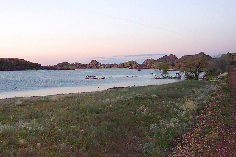
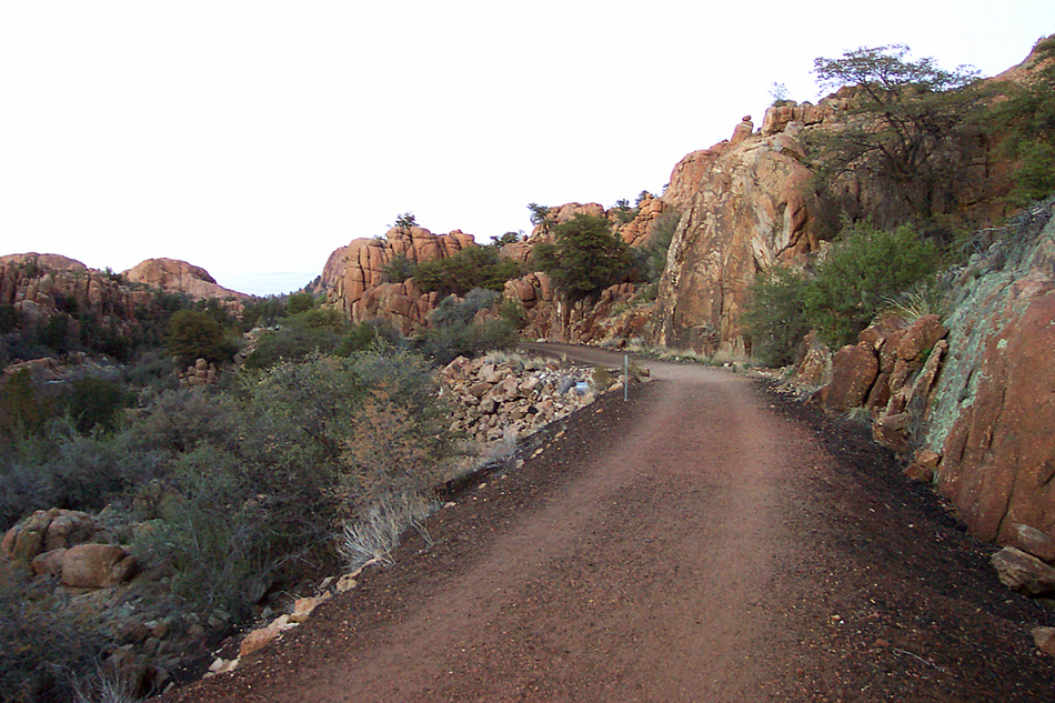
Ghost train to Prescott by PrestonSands   History HistoryThe former railroad was known as the "Peavine" because its twisting curves resembled a pea vine. Overview The Peavine Trail follows the route of the old Santa Fe, Prescott, and Phoenix Railroad through Granite Dells, north of Prescott. The S.F.P.& P. Railroad (nicknamed "The Peavine") was built in the early 1890s from Ash Fork, south through Prescott, and eventually to Phoenix, to provide an alternative to the poorly constructed Prescott and Arizona Central Railroad, and to serve the mining country of the Prescott area. When the tracks were removed from Prescott in the early 1990s, a project began to turn some of the old railroad grades into a recreation trail, hence the Iron King and Peavine Trails.
Beginning at the trailhead just south of Watson Lake, the trail heads northeast and parallels Granite Creek and its forest of cottonwoods. The trail soon passes along the eastern shores of Watson Lake, then gradually enters the natural stone sculptures of Granite Dells. At the halfway point, the trail passes an opening in the rocks, allowing for a great view of Granite Mountain across Watson Lake. The trail curves through the dells, passing through old cuts in the granite bedrock, where the railroad construction crews blasted a path for the iron horse over a century ago. I soon forgot that I was near a major city, as I traveled through the orange and pink-hued granite. While you travel through this maze of rocks, it is easy to see why Granite Dells was used as a hideout by highwaymen and hostile Indians. After a couple of miles of gentle downhill through the pinyon pines, the trail arrives at what was once known as Prescott and Eastern Junction. Here, beneath two large granite buttes, is where the P.& E. Railroad left for the mining towns of Humboldt, Mayer, Crown King, and Poland. During the early days of the railroad, this was a busy spot, complete with a depot and a railroad worker's bunkhouse. From here, you can return the way you came, or turn east onto the Iron King Trail for some more rails-to-trails hiking. As a lifelong railroad fan, it was sad to see these tracks removed, but it is nice that one can hike the old railroad route and relive the history. Check out the Official Route and Triplogs. Leave No Trace and +Add a Triplog after your hike to support this local community. One-Way Notice This hike is listed as One-Way. When hiking several trails on a single "hike", log it with a generic name that describes the hike. Then link the trails traveled, check out the example. | |||||||||||||||||||||||||||||||||||||||||||||||||||||||||||||||||||||||||||||||||||||||||||||||||||||||||||||||||||||||||||||||||||||||||||||||||||||||||||||||||||||||||||||||


