 Route Editor

Flagstaff to Sedona
Moderator: HAZ - Moderators
Linked Guides none
Linked Area, etc none
-
 elimn17Guides: 0 | Official Routes: 0Triplogs Last: none | RS: 0Water Reports 1Y: 0 | Last: never
 - Joined: Apr 27 2008 6:42 pm
- City, State: flagstaff
Flagstaff to Sedona
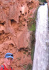
What is a good rout to take to hike from Flagstaff to Sedona? I know of one but I dont want to do any repelling or swiming if I can help it. I really dont want to walk on the road either. I have looked at some maps but it doesnt seem to really help me much.
contribute to this member driven resource
ie: RS > Save/Share after hikes 

-
 JimGuides: 76 | Official Routes: 39Triplogs Last: 5 d | RS: 94Water Reports 1Y: 7 | Last: 5 d
 - Joined: Sep 08 2006 8:14 pm
Re: Flagstaff to Sedona
If you're driving, hiking, biking, strolling, or walking, the only direct route is the 89A way. You could walk down Woody Mountain Road and take FR 231to East Pocket Lookout and then take the AB Young trail to the Creek and follow that to Sedona. I believe its about 40 miles. Bring Water.
You could take I-17 to Schnebly Hill Rd, but thats worse (you can walk on I-17). Think, trucks, 85 mph SUVS driven by barely there college kids, RVs, ect. If you don't want to walk and need transport take greyhound or something.
For 89A, I think anything but an automobile on the switchbacks is suicide.
contribute to this member driven resource
ie: RS > Save/Share after hikes
-
 Davis2001r6Guides: 6 | Official Routes: 14Triplogs Last: 5,912 d | RS: 0Water Reports 1Y: 0 | Last: never
 - Joined: Dec 06 2003 3:27 am
- City, State: Bordeaux, France
- Contact:
Re: Flagstaff to Sedona
You could walk from Sedona up 89A to the Call of the Canyon rec area, then take the west fork of out creek (some swims involved) up 14 miles to some dirt roads south/west of flag, your still probably 20 miles on dirt and 10 miles paved to get to Flag from there.
contribute to this member driven resource
ie: RS > Save/Share after hikes