Hike Arizona urges anyone interested in searching to post or join an event.
If you go out, please track your hike on a GPS and post it for the benefit of future searches. Simply post it upon return. (if you need help ask the webmaster) Hike Arizona will see that it gets linked to a master map. If you have multiple variations in your group, please post all tracks. As more info is posted the map will evolve and the overlaps will be removed.
November 16, 2010
Tonto Rim Search and Rescue volunteers and Gila County Sheriff officers are currently searching for an overdue hiker.
The man, whose name has not been released, was last heard from nine days ago and is believed to be hiking near the Mt. Peeley trail or Sheep Mountain, off Forest Road 201, southwest of Payson.
The Gila County Sheriff’s Office first received a call that the man was overdue Monday, Nov. 15 about 9 p.m.
“The hiker has not been heard from since Nov. 7 and frequents the Mazatzal Mountain Wilderness area,” according to a press release from the sheriff’s office.
The missing hiker’s vehicle was located at the Mt. Peeley trailhead.
Six TRSAR volunteers are currently searching the ground. Earlier Tuesday, a Department of Public Safety Ranger helicopter did an aerial search of the area, but found no signs of the man
Dawn
--On the loose to climb a mountain, on the loose where I am free. On the loose to live my life the way I think my life should be...For we only have a moment and a whole world yet to see...I'll be looking for tomorrow on the loose. ---unknown--
nonot wrote:Thoreau, can you confirm that tomorrow all volunteers can access the Mt Peeley TH?
I'm actually back in Phoenix for the night licking my wounds after that hike, figuratively speaking. Aside from texting that seems a bit sporadic from some folks that are still out there, I'm not totally sure what that status is.
Worth noting is that on the way out, the roadblock that they had set up earlier this morning was completely gone and we were in traffic with more than a few SAR folks heading back to Phoenix, so I would expect it to be clear if they truly have called off the search for good.
Hike Arizona it is full of sharp, pointy, ankle-twisting, HAZmaster crushing ROCKS!!
Hike Arizona it is full of sharp, pointy, shin-stabbing, skin-shredding plants!
Hike Arizona it is full of striking, biting, stabbing, venomous wildlife!
Thoreau wrote:The latest from ArizonaHikers is that SAR has officially ended all operations at this point as well. Permanently.
I think HAZ (and everyone in the hiking community) should (safely) spend any time they possibly can in the area to help bring this to a closure. It simply can't end here...
..and I'm sure we will assure that it doesn't end here! Thanks to all who have contributed to our GPSjoe's search to date.. :thanx: :thanx:
Last edited by Grasshopper on Nov 20 2010 7:00 pm, edited 1 time in total.
Are they really calling it off? Thank them for searching but they cant give up yet. Have there been heli's searching the area. If they have,i don't think it'd be to far off to comb the area at night using thermal.
Here is my search route today, other than a pair of adult sunglasses, I saw nothing important. I doesn't appear either the western 5 miles of the Deer Creek trail, or the Gold Ridge trail, have seen any recent use.
Hike Arizona it is full of sharp, pointy, ankle-twisting, HAZmaster crushing ROCKS!!
Hike Arizona it is full of sharp, pointy, shin-stabbing, skin-shredding plants!
Hike Arizona it is full of striking, biting, stabbing, venomous wildlife!
Ckzona wrote:Are they really calling it off? Thank them for searching but they cant give up yet. Have there been heli's searching the area. If they have,i don't think it'd be to far off to comb the area at night using thermal.
Not to put too negative a spin on this, but I'm not sure the thermal cams will help much at this point.
"The only thing we did was wrong was staying in the wilderness to long...the only thing we did was right was the day we started to fight..."
-Old Spiritual
My book, The Marauders on Lulu and Amazon
So now that SAR is gone, how many are thinking of searching tomorrow? Pumkin 60% chance of rain tomorrow... I really wish I had more than just one day though; anyone else up for spending 2-3 days after Thankgiving wandering around this manzanita jungle?
Yea, canyoneering is an extreme sport... EXTREMELY dramatic!!! =p
I am planning to search tomorrow, however with bad weather, snow, and low visibility predicted, anyone going should be aware of the dangers and possibly the need to abort the search.
Hike Arizona it is full of sharp, pointy, ankle-twisting, HAZmaster crushing ROCKS!!
Hike Arizona it is full of sharp, pointy, shin-stabbing, skin-shredding plants!
Hike Arizona it is full of striking, biting, stabbing, venomous wildlife!
Which area are you planning on focusing on? Hike to Sheep Mt and then return down one of the southern drainages or ridges? Or check out the cliffs below the ridgeline?
Yea, canyoneering is an extreme sport... EXTREMELY dramatic!!! =p
I can count 5 folks heading out tomorrow and probably 4-5 camping there now. I'm sure there are others that I don't know about. We have room in my vehicle. Yes, the weather is looking to have the potential to be eventful....digging out my rain gear........and staying focused on Joe.
(oops, I think I'm breaking forum rules )
nonot wrote:Here is my search route today, other than a pair of adult sunglasses, I saw nothing important. I doesn't appear either the western 5 miles of the Deer Creek trail, or the Gold Ridge trail, have seen any recent use.
I just got back about an hour ago from the Mormon Grove Th. We drove in and was stop by the sheriff and the 201/25 split. He was OK with us going to the Mormon Grove TH. We hiked the Sheep Creek trail to where the Spine of Sheep MTN almost touched the trail. I was thinking if Joe got to the Summit and needed to bail out, the Sheep Creek trail would be the closest trail for a bailout. We did some off trail towards the Sheep mnt on the odd chance we would run across him. Then we hiked to the Peely TH looking in the drainages for any signs. We got to the TH and talked to the SAR teams. One SAR member thinks that the south approach is not too practical and Joe tried the northern side. I'll do a triplog later on.
"Everywhere is walking distance...If you have the time"
-Stephen Wright
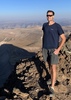
I was asked to upload this video and decided I'd put it here and in my triplog. The video is thru a lens that is scratched. Its less then a minute... 360 view from the Summit of Sheep Mountain. https://www.youtube.com/watch?v=C3mbtFP7T08
nonot wrote:Here is my search route today, other than a pair of adult sunglasses, I saw nothing important. I doesn't appear either the western 5 miles of the Deer Creek trail, or the Gold Ridge trail, have seen any recent use.
Hike Arizona it is full of sharp, pointy, ankle-twisting, HAZmaster crushing ROCKS!!
Hike Arizona it is full of sharp, pointy, shin-stabbing, skin-shredding plants!
Hike Arizona it is full of striking, biting, stabbing, venomous wildlife!
Thanks for everyone that came out today. Sorry to say that I will not be out tomorrow as my wife has put me on house arrest with my mother being here from out of town. I will be back in the area the week of Thanksgiving. Here is what I learned from today:
The Arizona hiking community is full of great people.
SAR has a tough job.
It is dense as heck out there.
Tough Boots and RachelT attach rockets to their boots when they hike.
National Weather Service forecast (elevation 6400' in the Mazatzal Mountains):
Sunday: Rain showers likely. Snow level 6500 feet. Mostly cloudy, with a high near 43. Southwest wind between 18 and 20 mph, with gusts as high as 30 mph. Chance of precipitation is 70%.
Sunday Night: A 50 percent chance of snow showers. Mostly cloudy, with a low around 31. Southwest wind between 8 and 17 mph, with gusts as high as 29 mph. New snow accumulation of 1 to 3 inches possible.
"…you never know when a hike might break out" -Jim Gaffigan
nonot wrote:Here is my search route today, other than a pair of adult sunglasses, I saw nothing important. I doesn't appear either the western 5 miles of the Deer Creek trail, or the Gold Ridge trail, have seen any recent use.
I left them on the trail, I think I have the coordinates.
Thank you but they don't sound like Joe's. I also believe everyone has soon photo's of him with the type of sunglasses he'd be wearing. One other thing I would like to mention to all. Yesterday the Sheriff told us to spread the word that if someone finds anything that looks like it could belong to Joe to please call them. They will try to have us who know him so well identify the article and if it looks it could belong to Joe then they will send out SAR again and do a 'grid' search. Therefore it is also vital that whoever does the find take a coordinate with GPS if at all possible!
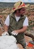
Joe's son, Hank and I are so grateful and appreciate to know that we are part of such a wonderful and caring hiking community. I know we will find him someday so we all can have closure. Thanks again!
Camped down on 25 last night sporatic showers starting early this AM Headed to the TH now. As we drove down here yesterday aftrenoon the blockade going to TH was still up as we tried to go that way and they turned us around. But I am sure the road is open by now if they have called off the search. We will post as soon as we know any differently
 Route Editor