 Route Editor

https://inciweb.nwcg.gov/incident/7438/
Commence your freakout. Might burn the mountain, might not.
I saw the large smoke plume yesterday around 5 PM in a Satellite image but figured it was so large that it must have been a cloud shield. Nope.
2021 Fire Season
Moderator: HAZ - Moderators
Linked Guides none
Linked Area, etc none
-
 JimGuides: 76 | Official Routes: 39Triplogs Last: 34 d | RS: 93Water Reports 1Y: 6 | Last: 45 d
 - Joined: Sep 08 2006 8:14 pm
contribute to this member driven resource
ie: RS > Save/Share after hikes 

-
 chumleyGuides: 94 | Official Routes: 239Triplogs Last: 6 d | RS: 73Water Reports 1Y: 95 | Last: 4 d
 - Joined: Sep 18 2002 8:59 am
- City, State: Tempe, AZ
Re: 2021 Fire Season
The Backbone BAER team posted some photos of Fossil Creek.
https://inciweb.nwcg.gov/incident/photograph/7602/0/
https://inciweb.nwcg.gov/incident/photograph/7602/0/
I'm not sure what my spirit animal is, but I'm confident it has rabies.
contribute to this member driven resource
ie: RS > Save/Share after hikes
-
 toddakGuides: 13 | Official Routes: 7Triplogs Last: 4 d | RS: 0Water Reports 1Y: 0 | Last: 1,720 d
 - Joined: Nov 15 2005 8:46 pm
- City, State: Jackson, CA
contribute to this member driven resource
ie: RS > Save/Share after hikes
-
chumleyGuides: 94 | Official Routes: 239Triplogs Last: 6 d | RS: 73Water Reports 1Y: 95 | Last: 4 d
- Joined: Sep 18 2002 8:59 am
- City, State: Tempe, AZ
Re: 2021 Fire Season
Three lightning starts in the past few days continue to burn in the southern Mazzies. The largest, the Bear Fire is 1700 acres and burning between Davenport Peak and Sheep Mtn (having burned parts of Sheep Creek Tr #88 and Sears Tr #90). Another (Ocotillo) is burning about two miles southwest of the Mormon Grove TH. Crews are watching them. Rain and storms forecast this week may help douse the fires or spread them with erratic winds.
I'm not sure what my spirit animal is, but I'm confident it has rabies.
contribute to this member driven resource
ie: RS > Save/Share after hikes
-
chumleyGuides: 94 | Official Routes: 239Triplogs Last: 6 d | RS: 73Water Reports 1Y: 95 | Last: 4 d
- Joined: Sep 18 2002 8:59 am
- City, State: Tempe, AZ
Re: 2021 Fire Season
There is now an area closure for the fires in the Mazzies.
- Attachments
-
I'm not sure what my spirit animal is, but I'm confident it has rabies.
contribute to this member driven resource
ie: RS > Save/Share after hikes
-
chumleyGuides: 94 | Official Routes: 239Triplogs Last: 6 d | RS: 73Water Reports 1Y: 95 | Last: 4 d
- Joined: Sep 18 2002 8:59 am
- City, State: Tempe, AZ
Re: 2021 Fire Season
KNAU reports on Rafael Fire and resulting damage and destruction of cabins and cliff dwellings within its perimeter.
https://www.knau.org/post/rafael-fire-b ... ural-sites
https://www.knau.org/post/rafael-fire-b ... ural-sites
I'm not sure what my spirit animal is, but I'm confident it has rabies.
contribute to this member driven resource
ie: RS > Save/Share after hikes
-
 Alston_NealGuides: 1 | Official Routes: 0Triplogs Last: 158 d | RS: 0Water Reports 1Y: 0 | Last: never
 - Joined: Apr 19 2008 5:53 pm
- City, State: Phoenix, AZ
Re: 2021 Fire Season
@chumley
Ah my friend The Rez Nez!
Ah my friend The Rez Nez!
contribute to this member driven resource
ie: RS > Save/Share after hikes
-
Alston_NealGuides: 1 | Official Routes: 0Triplogs Last: 158 d | RS: 0Water Reports 1Y: 0 | Last: never
- Joined: Apr 19 2008 5:53 pm
- City, State: Phoenix, AZ
Re: 2021 Fire Season
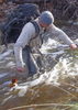
My son sent me photos of what he said was a really cool area and included these photos of a cabin. A couple of days later he sent me another photo and said he thinks it's all gone..  What cabin is/was this? Photos were taken the Sat. before Father's Day June 19
- Attachments
-
-
-
contribute to this member driven resource
ie: RS > Save/Share after hikes
-
chumleyGuides: 94 | Official Routes: 239Triplogs Last: 6 d | RS: 73Water Reports 1Y: 95 | Last: 4 d
- Joined: Sep 18 2002 8:59 am
- City, State: Tempe, AZ
Re: 2021 Fire Season
@Alston_Neal
Buck Ridge 1 [ photo ]
Buck Ridge 2 [ photo ]
Taylor [ photo ]
Winter [ photo ]
Hidden [ photo ]
Secret [ photo ]
Buck Ridge 1 [ photo ]
Buck Ridge 2 [ photo ]
Taylor [ photo ]
Winter [ photo ]
Hidden [ photo ]
Secret [ photo ]
I'm not sure what my spirit animal is, but I'm confident it has rabies.
contribute to this member driven resource
ie: RS > Save/Share after hikes
-
 RedRoxx44Guides: 5 | Official Routes: 0Triplogs Last: 6 d | RS: 0Water Reports 1Y: 0 | Last: 6,521 d
 - Joined: Feb 15 2003 8:07 am
- City, State: outside, anywhere
Re: 2021 Fire Season
Interesting a couple of fires in the Parashant district. Snap Point Fire interesting in that I am puzzled they are putting resources on that. It's pretty remote and while some neat stuff in the area I can't imagine there is anything of a high priority there, other than a communications site. The area rancher must have some political pull.
contribute to this member driven resource
ie: RS > Save/Share after hikes
-
 cactuscatGuides: 0 | Official Routes: 3Triplogs Last: 159 d | RS: 26Water Reports 1Y: 2 | Last: 330 d
 - Joined: Oct 15 2002 12:08 pm
- City, State: Rimrock, Arizona
Re: 2021 Fire Season
@Alston_Neal
You friends with Jason? He's awesome!
You friends with Jason? He's awesome!
contribute to this member driven resource
ie: RS > Save/Share after hikes
-
cactuscatGuides: 0 | Official Routes: 3Triplogs Last: 159 d | RS: 26Water Reports 1Y: 2 | Last: 330 d
- Joined: Oct 15 2002 12:08 pm
- City, State: Rimrock, Arizona
Re: 2021 Fire Season
A fire just started on Mt Graham ... looks like maybe around Turkey Flat. Hopefully enough rain to put it right back out.
EDIT: appears to be out this morning! 

contribute to this member driven resource
ie: RS > Save/Share after hikes
-
 FOTGGuides: 37 | Official Routes: 103Triplogs Last: 6 d | RS: 204Water Reports 1Y: 71 | Last: 11 d
 - Joined: Jan 21 2013 10:47 am
- City, State: AZ
- Contact:
Re: 2021 Fire Season
Bear fires and Willow fires in Blue Range appeared to burn almost textbook like FYI, I have some pics I will share in triplogs when I get home, but I hiked into the burn area a bit on the Eagle Creek Trail and hiked through either a back burn or the actual burn and the forest was immaculate, looks like a healthy burn. A few scorched areas here and there, but so goes fire season. Also looks like a couple backburning areas along 191 may have gotten away from them, but I am not casting judgement..I don’t want to jinx the blue, but it looks like they may have got away with a a couple good healthy burns this year, which is all you can ask for during these times...
contribute to this member driven resource
ie: RS > Save/Share after hikes
-
FOTGGuides: 37 | Official Routes: 103Triplogs Last: 6 d | RS: 204Water Reports 1Y: 71 | Last: 11 d
- Joined: Jan 21 2013 10:47 am
- City, State: AZ
- Contact:
Re: 2021 Fire Season
Between the Bingham Fire last year and the Bear it appears Rose Peak has been entirely scorched. I do not know if the tower survived though. The 191 was also closed at Rose Peak due to a washout or slide caused from the burn scar.
contribute to this member driven resource
ie: RS > Save/Share after hikes
-
chumleyGuides: 94 | Official Routes: 239Triplogs Last: 6 d | RS: 73Water Reports 1Y: 95 | Last: 4 d
- Joined: Sep 18 2002 8:59 am
- City, State: Tempe, AZ
Re: 2021 Fire Season
@friendofThundergod
They better have saved the tower. Their published objectives were basically "we're going to protect the tower and otherwise let it burn freely"
They better have saved the tower. Their published objectives were basically "we're going to protect the tower and otherwise let it burn freely"
I'm not sure what my spirit animal is, but I'm confident it has rabies.
contribute to this member driven resource
ie: RS > Save/Share after hikes
-
FOTGGuides: 37 | Official Routes: 103Triplogs Last: 6 d | RS: 204Water Reports 1Y: 71 | Last: 11 d
- Joined: Jan 21 2013 10:47 am
- City, State: AZ
- Contact:
Re: 2021 Fire Season
@chumley I’m still curious why the fire tower was a threat to burn anyways, it’s ten feet off of the 191 and there is a dirt road to the summit. How has clearing or managing that forest around the tower never come up on anyone’s to do list? I guess getting a chain saw out there or burning a few piles during the winter never crossed anyone’s mind after it nearly burned the summer before....
contribute to this member driven resource
ie: RS > Save/Share after hikes
-
 DixieFlyerGuides: 100 | Official Routes: 98Triplogs Last: 8 d | RS: 899Water Reports 1Y: 19 | Last: 15 d
 - Joined: Jan 07 2017 7:03 am
- City, State: Fountain Hills, AZ
Re: 2021 Fire Season
The Telegraph Fire Closure Order ended yesterday, so the area is no longer restricted.
https://www.fs.usda.gov/Internet/FSE_DO ... 923424.pdf
https://www.fs.usda.gov/Internet/FSE_DO ... 923424.pdf
Civilization is a nice place to visit but I wouldn't want to live there
contribute to this member driven resource
ie: RS > Save/Share after hikes
-
DixieFlyerGuides: 100 | Official Routes: 98Triplogs Last: 8 d | RS: 899Water Reports 1Y: 19 | Last: 15 d
- Joined: Jan 07 2017 7:03 am
- City, State: Fountain Hills, AZ
Re: 2021 Fire Season
The Tonto Forest has now extended the Telegraph Fire Closure Order until December 31, 2021, unless rescinded before then. So there was only a one day window to be in this area.
I can't really tell by looking at the updated closure order, but it looks like Picketpost might be open.
I can't really tell by looking at the updated closure order, but it looks like Picketpost might be open.
Civilization is a nice place to visit but I wouldn't want to live there
contribute to this member driven resource
ie: RS > Save/Share after hikes
-
RedRoxx44Guides: 5 | Official Routes: 0Triplogs Last: 6 d | RS: 0Water Reports 1Y: 0 | Last: 6,521 d
- Joined: Feb 15 2003 8:07 am
- City, State: outside, anywhere
Re: 2021 Fire Season
Took the backway home from the Winds. Driving into Globe from Roosevelt it didn't look too bad on the Pinals from a distance. Probably due to rains stimulating lots of grass. However going over El Cap on Hwy 77 different story. From the highway pretty much moonscape and most of the guardrails slumped over from the supports burning and I guess heat deforming the metal. The small community near El Cap had burn all around it and a couple of structures I could see looked damaged but most of the homes looked intact. I think a few of them had cleared around their homes as I remember. A short section of the Mescal appeared burnt along the cliffs but the rest along Hwy 77 looked fine. Mescal mountain where it originated looked pretty burned over near the top but I think most of the action on that one is out of sight from the highway. When cools off will drive and hike up and take a peak to the other side and see what it looks like.
contribute to this member driven resource
ie: RS > Save/Share after hikes
-
chumleyGuides: 94 | Official Routes: 239Triplogs Last: 6 d | RS: 73Water Reports 1Y: 95 | Last: 4 d
- Joined: Sep 18 2002 8:59 am
- City, State: Tempe, AZ
Re: 2021 Fire Season
Picketpost was not restricted even under the former closure order (https://www.fs.usda.gov/Internet/FSE_DO ... 923425.pdf) which only covered area east of the 177. The updated closure moves the boundary east to FR 2466 which parallels Devils Canyon to the east.DixieFlyer wrote:I can't really tell by looking at the updated closure order, but it looks like Picketpost might be open.
- Attachments
-
I'm not sure what my spirit animal is, but I'm confident it has rabies.
contribute to this member driven resource
ie: RS > Save/Share after hikes
-
ShatteredArmGuides: 12 | Official Routes: 8Triplogs Last: 5 d | RS: 0Water Reports 1Y: 18 | Last: 11 d
- Joined: Nov 30 2015 2:07 pm
- City, State: Phoenix, AZ
Re: 2021 Fire Season
@RedRoxx44
Took 60 between Superior and Miami the other day and the Madera Peak part of the mountain looked pretty well torched. Middle part of the mountain near the summit didn't look as bad, but it was far away.
Took 60 between Superior and Miami the other day and the Madera Peak part of the mountain looked pretty well torched. Middle part of the mountain near the summit didn't look as bad, but it was far away.
contribute to this member driven resource
ie: RS > Save/Share after hikes