Nice West Superstition Wilderness Loop by Grasshopper
Overview
Starting at the Peralta TH, this is a popular loop first in on the Dutchman Trail #104 through Barkley Basin, rounding Miner's Needle on the east side, continuing on TR#104 and back through Barks Canyon on the Bluff Spring Trail 235.
Hike
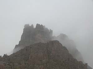
From the Peralta TH, head out east following the Dutchman Trail#104. After passing the beginning hills, the trail drops down into Barkley Basin. It's a scenic hike across. Passing the junction with Coffee Flat Trail#108, Dutchman Trail#104 starts to switchback. Once you make it through the five or six switchbacks, you start heading northwest. Soon you will pass the right(east) side of Miners Needle. Passing the north end (keep looking up), you have a great view through the "eye of the needle". The eye is small, so don't get too excited. Trail#104 makes a quarter circle around Miners Needle then heads north again. Shortly you come to the junction with Whiskey Spring Trail at about four and a quarter miles. Continue on the Dutchman #104 down to its intersection with Bluff Springs Trail#235 at seasonal Crystal Spring. Take Bluff Springs #235 west to the junction with Terrapin Trail#234. To complete this hike description loop, head back by continuing on the Bluff Spring Trail#235 to your TH Start and parking lot, which is 2.3 miles away from this trail intersection.
Some hikers can't imagine heading home at this point. A nice 1.5 mile total hike addition to this loop would be a hike further up the Terrapin Trail#234 to an "off trail" section for some awesome views of Weavers Needle which is fairly close (see HAZ hike description "Bluff Spring Loop & Weaver's View" for additional details) .. plus there is an option to make this an even bigger loop over to the Peralta Trail#102or to the unofficial Cave Trail.
Water Sources
Seasonal creeks and drainage's along this loop hike.
Camping
A few open area backpack camps with little privacy, mainly along the back trail section of this loop just off the Dutchman Trail 104 at seasonal Crystal Spring (just ~75 yards up #104 from the intersection of Dutchman Trail 104 / Bluff Spring Trail 235).
WARNING! Hiking and outdoor related sports can be dangerous. Be responsible and prepare for the trip. Study the area you are entering and plan accordingly. Dress for the current and unexpected weather changes. Take plenty of water. Never go alone. Make an itinerary with your plan(s), route(s), destination(s) and expected return time. Give your itinerary to trusted family and/or friends.
Permit $$
None
Directions
Road
FR / Dirt Road / Gravel - Car Okay
To Peralta Trailhead 7.6 miles east of the junction Idaho Rd / US-60. Turn Left on to FS77 which is Peralta Road. Follow FS77 5.6 miles to a left and up turnoff. Continue 1.9 miles to Peralta Trailhead.
The trailhead has restrooms minus running water. The parking lot is enormous. It does fill up in season on weekends. Since there are no lines, the rangers ask that you park straight between the posts in the main lot. Please do your part with this simple request and make room for the next guy. 0.5 miles before reaching the trailhead is an overflow lot, which is also suited for horse trailer parking.
From PHX (Jct I-10 & AZ-51) 45.2 mi - about 1 hour 8 mins From TUC (Jct 1-10 & Grant) 97.0 mi - about 2 hours 16 mins From FLG (Jct I-17 & I-40) 192 mi - about 3 hours 15 mins
page created by Grasshopper on Dec 05 2010 1:59 pm
 Route Editor

 Overview