Antelope Canyon Odyssey

Moderator: HAZ - Moderators

 Linked Guides none
 Linked Area, etc none
Post Reply
User avatar
BoyNhisDog
Triplogs Last: none | RS: 0
Water Reports 1Y: 0 | Last: never
Joined: Feb 03 2002 2:09 pm
City, State: Tucson, AZ

Antelope Canyon Odyssey

Post by BoyNhisDog »

Antelope canyon is a beautiful, dramatic and remarkable slot canyon. The road from Page loops south before it turns to Antelope so I chose a more direct and quiet route through three miles of orange sand and desert scrub wasteland. Everyone who has walked through sand can guess at the difficulty of zigzagging around knee high scrub and rolling sand hills. It took me one grueling hour to reach the canyon.

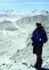
I took my standard survival pack with extra water.

You cannot see a slot canyon until you are right on top of it. I began to doubt if it was even out there. I thought to myself, I saw it from the air so it must be out here somewhere. Finally all doubts were erased as I found myself on the rim of a magnificent site. Now to find a way down into the magical place.

Two tries dead ended in drop-offs. Finally I came to an orange sand fall, going down at a seemingly impossible angle, but when I followed it down the deep sand held me secure. The decent was incredibly fun.

The walls soared up around me and narrowed down to shoulder width in places. In one area the walls were only one inch apart at the canyon floor but as the wall came apart in a V shape, I was able to walk on the V without touching the canyon floor. In some places I had to remove my pack to squeeze through.

I came to dead ends, drop-offs, and spooky boulder chokes and had to climb out at one point and enter through another feeder canyon. Time did not exist. After two or three miles of navigating, climbing and descending the canyon, it was time to climb back out and make the three miles of sandy desert wasteland back to Page.

Birds, lizards, snakes, rabbits and coyote’s tracks were everywhere. I felt as if I was floating.

Image
Glen
contribute to this member driven resource
ie: RS > Save/Share after hikes Route Scout GPS Topo Mapper on the App Store Route Scout GPS Topo Mapper on Google Play
User avatar
montezumawell
Guides: 6 | Official Routes: 0
Triplogs Last: 7,479 d | RS: 0
Water Reports 1Y: 0 | Last: never
Joined: Feb 03 2002 6:32 pm
City, State: Montezumawell, AZ

Great picture, Glen!

Post by montezumawell »

That little Canon of yours really takes nice pictures, Glen! Awesome shot of Antelope. That's probably going to be on the upcoming HAZ 2003 calendar. Right, Joe?

Glen's Antelope Canyon post got us to remembering one of Arizona's worst flash flood tragedies there. It dawned on us today that the 5th anniversary of the tragedy would be coming up this August. It also dawned on us this evening that the August 12, 1997, Antelope Canyon tragedy could certainly be considered Arizona's worst Day Hiker Tragedy and possibly the Southwest's and possibly America's worst Day Hiker Tragedy. We don't know about other states but we're virtually sure it would be Arizona's worst. We recently learned about the flash flood death of photographer George Mancuso in Big Canyon and that also got us to thinking about Antelope Canyon. The Antelope Canyon saga is an incredibly sad story but one that should certainly get annual 'play' because such dangers will always lurk everywhere water flows deep in those haunting narrow places.
The Flagstaff NWS has a short synposis of the Antelope Canyon thing, as well as that incredible Tonto Creek flood that killed a lot of people in 1970. Here's its link. Interested readers can find abundant other source material on the Antelope Canyon tragedy.

http://www.wrh.noaa.gov/Flagstaff/science/flashfld.htm

J&S in RR
contribute to this member driven resource
ie: RS > Save/Share after hikes Route Scout GPS Topo Mapper on the App Store Route Scout GPS Topo Mapper on Google Play
User avatar
ck_1
Guides: 9 | Official Routes: 0
Triplogs Last: 8,315 d | RS: 0
Water Reports 1Y: 0 | Last: never
Joined: Feb 04 2002 9:30 am
City, State: Mesa, AZ

Post by ck_1 »

Excellent photo! I just read in I think Sunday's paper that the NPS wants to build a new marina just to the northeast of Antelope, a few miles from where the canyon enters the lake...I wonder about the possible effects on the canyon...I wonder about the logic of that decision...
Image
'The Journey is the Destination!'
contribute to this member driven resource
ie: RS > Save/Share after hikes Route Scout GPS Topo Mapper on the App Store Route Scout GPS Topo Mapper on Google Play
User avatar
chihiggs
Triplogs Last: 7,458 d | RS: 0
Water Reports 1Y: 0 | Last: never
Joined: Apr 11 2002 9:33 am
City, State: Gilbert, AZ

Map

Post by chihiggs »

Anyone know which topo map shows this canyon?
Higgs
contribute to this member driven resource
ie: RS > Save/Share after hikes Route Scout GPS Topo Mapper on the App Store Route Scout GPS Topo Mapper on Google Play
User avatar
pixelfrog
Triplogs Last: 1,968 d | RS: 0
Water Reports 1Y: 0 | Last: never
Joined: Apr 11 2002 10:00 am
City, State: Chandler, AZ
Contact:

Post by pixelfrog »

Hey Glen, did you not have to have a guide to go down into antelope, or is there sections that are not on the resi?

Pix
contribute to this member driven resource
ie: RS > Save/Share after hikes Route Scout GPS Topo Mapper on the App Store Route Scout GPS Topo Mapper on Google Play
User avatar
montezumawell
Guides: 6 | Official Routes: 0
Triplogs Last: 7,479 d | RS: 0
Water Reports 1Y: 0 | Last: never
Joined: Feb 03 2002 6:32 pm
City, State: Montezumawell, AZ

Post by montezumawell »

[quote='ck1']...I wonder about the possible effects on the canyon...[/quote]

It sure seems to us that Antelope Canyon is HEAVILY commercialized already. It's kinda hard to imagine that it could get even MORE commercialized after construction of the nearby proposed marina.
Last time we drove through Page last fall, it seemed there were 'Antelope Canyon Tour' signs just about everywhere. We pretty sure that you need a Navajo permit to go in there unless you happen to be an ace map reader. We've heard it's incredibly crowded during peak use periods. The canyon does get a pretty good cleaning and scouring during most monsoon seasons. Let's just hope that day hikers and flash floods there never meet again there.

J&S in RR
contribute to this member driven resource
ie: RS > Save/Share after hikes Route Scout GPS Topo Mapper on the App Store Route Scout GPS Topo Mapper on Google Play
User avatar
BoyNhisDog
Triplogs Last: none | RS: 0
Water Reports 1Y: 0 | Last: never
Joined: Feb 03 2002 2:09 pm
City, State: Tucson, AZ

Post by BoyNhisDog »

Yes one must be aware of flash floods in a slot canyon. Don't do it if it is raining anywhere in miles of where you are. If you are caught in an area with shear walls, you are done.

ck1, the area for the new marina has been mapped. Over the years I have seen everything change up there. Bounderies become more defined and fees are collected. I inquired at the airport of the legality of going there by myself and was told that it was no problem so I just walked there through the desert. I saw a couple of Navajos on top of a cliff and one asked me how I got there. I jokingly told him that I came out of nowhere. He was just curious and did not indicate that anything was wrong. I treat the land with reverance. The guy at the airport may have been wrong though so proceed with caution.


chihiggs, try the Page quad. It may have Antelope canyon on the eastern portion.
Glen
contribute to this member driven resource
ie: RS > Save/Share after hikes Route Scout GPS Topo Mapper on the App Store Route Scout GPS Topo Mapper on Google Play
User avatar
Lizard
Guides: 15 | Official Routes: 0
Triplogs Last: 5,272 d | RS: 0
Water Reports 1Y: 0 | Last: never
Joined: Feb 05 2002 6:40 pm
City, State: Phoenix, AZ

Post by Lizard »

[quote='BoyNhisDog']ck1, the area for the new marina has been mapped. Over the years I have seen everything change up there. Bounderies become more defined and fees are collected. I inquired at the airport of the legality of going there by myself and was told that it was no problem so I just walked there through the desert. I saw a couple of Navajos on top of a cliff and one asked me how I got there. I jokingly told him that I came out of nowhere. He was just curious and did not indicate that anything was wrong. I treat the land with reverance. The guy at the airport may have been wrong though so proceed with caution. [/quote]

My experience when I went in 1999 was slightly different. Your options back then were either to hire one of the licensed guides in Page, who charged from $40-70 depending on the length of the tour, or you could pay the guy at the gate off Highway 98. The charge at the gate was something like $10 for the drive up and $10 for each hour you wanted to spend in the canyon. You have your own freedom to explore by using that option. Again, this was a couple years ago so the situation could be totally different now. Giving the increasing use of the canyon by tourists I would not be surprised if you were now required to use a guide.

Lizard
contribute to this member driven resource
ie: RS > Save/Share after hikes Route Scout GPS Topo Mapper on the App Store Route Scout GPS Topo Mapper on Google Play
User avatar
BoyNhisDog
Triplogs Last: none | RS: 0
Water Reports 1Y: 0 | Last: never
Joined: Feb 03 2002 2:09 pm
City, State: Tucson, AZ

Post by BoyNhisDog »

I had a feeling that there were some kinds of restrictions Lizard. That is why I asked about it. I knew there was a possibility that there were fees but decided that I would figure it out when I got there. If you try to anylize everything to the point of an ultimate answer, you never get anywhere. I only saw those two people on the whole journey and I could have remained hidden if I chose as I heard them long before I let them see me. I wanted to ask a couple of questions. I never saw a sign of any kind. I'm sure it was because of the direction that I came in. Most likely nobody comes in from the desert. All come by road. Approaching the 'Sand Fall' was a little un-nerving so I'm fairly sure that many folks don't do it. One thing is for sure though. I am going back again as soon as I get the chance.

Believe me, $10 would be well worth it. This is a very unique place. As a general rule I try to avoid Page in from Memorial Day to Labor Day. If you go during the winter you will most likely never see a soul out and about in the desert and many places by the lake.

Here is a view in a feeder canyon that I went through in quest of going further down Antelope. The visual is quite overwhelming. I found an area with almost red sand that was super fine.

The Beauty of Varnished Rock in Antelope

Here is an aerial photo I took on the way out the next morning, which was yesterday. In the upper right you can see where the 'Sand Falls' shoot down into the canyon. This is a very small portion of Antelope canyon.

Aerial View of Antelope Canyon
Glen
contribute to this member driven resource
ie: RS > Save/Share after hikes Route Scout GPS Topo Mapper on the App Store Route Scout GPS Topo Mapper on Google Play
User avatar
Nighthiker
Triplogs Last: 1,416 d | RS: 0
Water Reports 1Y: 0 | Last: never
Joined: Feb 03 2002 6:59 am
City, State: Payson

Flash Flood

Post by Nighthiker »

I went fishing to Roosevelt Lake during the storm in 1970. We just cleared the wash, parked and checked our truck (bounced it pretty hard in the wash) when a flash flood came down the wash. I believe it continued down the wash and killed several people camped at Burnt Corral (we did not know it at the time) and continued to Roosevelt Lake. We camped at School House Point and it poured. When we left a couple of days later we went across the dam to Punkin Center and down AZ 87. A bridge was washed out and a DPS Officer was killed so we turned around and went to Globe to access US 60 and head home to the valley.
contribute to this member driven resource
ie: RS > Save/Share after hikes Route Scout GPS Topo Mapper on the App Store Route Scout GPS Topo Mapper on Google Play
User avatar
Pellegrino
Triplogs Last: 8,346 d | RS: 0
Water Reports 1Y: 0 | Last: never
Joined: Feb 04 2002 3:58 am
City, State: Gilbert, AZ

Post by Pellegrino »

Super awesome shots. I can understand why you felt like time didn't exist and that you were floating. Thanks for sharing.
Kelly :)

Climb every mountain, ford every stream
Follow every rainbow, till you find your dream
contribute to this member driven resource
ie: RS > Save/Share after hikes Route Scout GPS Topo Mapper on the App Store Route Scout GPS Topo Mapper on Google Play
User avatar
olesma
Triplogs Last: 8,458 d | RS: 0
Water Reports 1Y: 0 | Last: never
Joined: Feb 09 2002 1:02 pm
City, State: Mesa, AZ

Salivation and drool

Post by olesma »

If anyone - and I mean ANYONE is planning on a trip up there this summer - count me in. I am absolutely dying to do this canyon.

Here is a good website about Antelope canyon:

http://www.blackrabbit.com/antelope.htm

There are also links to other slot canyons in the area - Buckskin gorge looks interesting as well.

By the way - Glen - nice shots.
'Weird is a relative, not an absolute.' - A. Einstein
contribute to this member driven resource
ie: RS > Save/Share after hikes Route Scout GPS Topo Mapper on the App Store Route Scout GPS Topo Mapper on Google Play
User avatar
snow22_5150
Triplogs Last: 7,617 d | RS: 0
Water Reports 1Y: 0 | Last: never
Joined: Apr 22 2002 2:13 pm
City, State: Mesa, AZ

Post by snow22_5150 »

Absolutely incredible!
Kristyn

"The best education is to be perpetually thrilled by life."
contribute to this member driven resource
ie: RS > Save/Share after hikes Route Scout GPS Topo Mapper on the App Store Route Scout GPS Topo Mapper on Google Play
User avatar
BoyNhisDog
Triplogs Last: none | RS: 0
Water Reports 1Y: 0 | Last: never
Joined: Feb 03 2002 2:09 pm
City, State: Tucson, AZ

Post by BoyNhisDog »

olesma, my recent trip there was opportunistic and implusive. I did not even know that I would be spending the night in Page that morning. The weather prevented me from finishing some mapping work so I headed to Page. On the way in I looked down and said to myself, 'I am going into that canyon today.'

Now that I am back home and have the computer, my research finds that there is a fee but there are many different postings on just what it is. Next time I will find the building where you pay that fee. There was no fence or signs at all when coming from the west through the desert. The sand falls was the first access that I came to so I just followed it and knew I better find another way out which I did. Wheew!

In my internet search I found that there are many good slot canyons in the Escalante area that are fantastic and uncrowded. Summer is really not the time to be in Page unless you really want to be around a whole lot of touristy type folks with whinning kids etc. The crowds are enormous. I find it unappealing at the best. I saw two people all day long after I left Page for Antelope. I could have avoided them if I had wanted to. Memorial day and after will be a far different story. I like my wilderness solitude.
Glen
contribute to this member driven resource
ie: RS > Save/Share after hikes Route Scout GPS Topo Mapper on the App Store Route Scout GPS Topo Mapper on Google Play
no avatar
spodumene
Triplogs Last: none | RS: 0
Water Reports 1Y: 0 | Last: never
Joined: Mar 31 2002 2:47 pm
City, State: Phoenix, AZ

Post by spodumene »

There have obviously been an incredible amount of changes since I was in the Page area eight years ago. At that time we took our boat to the mouth of the canyon and started hiking upstream. However, as soon as the canyon walls started closing in on me I turned around. It was beautiful, but not the kind of place for someone with clostrophobia!
Happy Trails
contribute to this member driven resource
ie: RS > Save/Share after hikes Route Scout GPS Topo Mapper on the App Store Route Scout GPS Topo Mapper on Google Play
Post Reply

Return to “Poems & Literature”