 Route Editor

https://inciweb.nwcg.gov/incident/7438/
Commence your freakout. Might burn the mountain, might not.
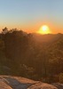
I saw the large smoke plume yesterday around 5 PM in a Satellite image but figured it was so large that it must have been a cloud shield. Nope.
2021 Fire Season
Moderator: HAZ - Moderators
Linked Guides none
Linked Area, etc none
-
 JimGuides: 76 | Official Routes: 39Triplogs Last: 34 d | RS: 93Water Reports 1Y: 6 | Last: 45 d
 - Joined: Sep 08 2006 8:14 pm
contribute to this member driven resource
ie: RS > Save/Share after hikes 

-
 andrewpGuides: 3 | Official Routes: 3Triplogs Last: 1,722 d | RS: 2Water Reports 1Y: 0 | Last: 1,721 d
 - Joined: Sep 27 2020 6:18 pm
- City, State: Tucson, AZ
Re: 2021 Fire Season
Horton Complex recently popped up just north of Hannagan Meadow:
https://inciweb.nwcg.gov/incident/7547/
Last report was about 70 acres, but latest VIIRS shows a lot of activity in the last 12 hours so that number is likely quite a bit more.
https://inciweb.nwcg.gov/incident/7547/
Last report was about 70 acres, but latest VIIRS shows a lot of activity in the last 12 hours so that number is likely quite a bit more.
contribute to this member driven resource
ie: RS > Save/Share after hikes
-
 NighthikerGuides: 0 | Official Routes: 0Triplogs Last: 1,645 d | RS: 0Water Reports 1Y: 0 | Last: never
 - Joined: Feb 03 2002 6:59 am
- City, State: Payson
contribute to this member driven resource
ie: RS > Save/Share after hikes
-
JimGuides: 76 | Official Routes: 39Triplogs Last: 34 d | RS: 93Water Reports 1Y: 6 | Last: 45 d
- Joined: Sep 08 2006 8:14 pm
Re: 2021 Fire Season
Horton would be another good one to allow to burn, or only confine to a large areas. It's in the Wallow scar, it's far from those pesky, "resources", we are getting closer to rain, it started from dry lightning, and it's in an area that is more able to have a natural fire regime policy due to being far from the city people.
The Johnson in the Gila is going nicely. It stopped NW progress as it came into the Cub Fire Scar, and to the east/southeast as it came into another fire scar. Both from last summer, and I think both from lightning. The 65,000 acre big Johnson fire is from lightning, too. Seems that if the Cub fire and the other had burned more last summer, some money could potentially been saved, there may have been more moisture in fuels, there might have been some lower intensity in areas of mixed conifer that may have burned a bit hotter this spring due to the very dry last 12 months, and well, it would have been natural and what wilderness is supposed to be about. Wilderness isn't supposed to be cute signs and cuddles and good feels all around.
The Johnson in the Gila is going nicely. It stopped NW progress as it came into the Cub Fire Scar, and to the east/southeast as it came into another fire scar. Both from last summer, and I think both from lightning. The 65,000 acre big Johnson fire is from lightning, too. Seems that if the Cub fire and the other had burned more last summer, some money could potentially been saved, there may have been more moisture in fuels, there might have been some lower intensity in areas of mixed conifer that may have burned a bit hotter this spring due to the very dry last 12 months, and well, it would have been natural and what wilderness is supposed to be about. Wilderness isn't supposed to be cute signs and cuddles and good feels all around.
contribute to this member driven resource
ie: RS > Save/Share after hikes
-
 The_EagleGuides: 42 | Official Routes: 365Triplogs Last: 9 d | RS: 765Water Reports 1Y: 76 | Last: 16 d
 - Joined: Jan 20 2009 2:46 pm
- City, State: Far NE Phoenix, Az
- Contact:
Re: 2021 Fire Season
@chumley
Residents of the Hunts Ranch area have been moved to SET status.
I'm not exactly sure where that is though.
Residents of the Hunts Ranch area have been moved to SET status.
I'm not exactly sure where that is though.
There is a very fine line between "hobby" and "mental illness."
Dave Barry
Dave Barry

contribute to this member driven resource
ie: RS > Save/Share after hikes
-
 chumleyGuides: 94 | Official Routes: 239Triplogs Last: 6 d | RS: 73Water Reports 1Y: 95 | Last: 4 d
 - Joined: Sep 18 2002 8:59 am
- City, State: Tempe, AZ
Re: 2021 Fire Season
I'm not sure what my spirit animal is, but I'm confident it has rabies.
contribute to this member driven resource
ie: RS > Save/Share after hikes
-
The_EagleGuides: 42 | Official Routes: 365Triplogs Last: 9 d | RS: 765Water Reports 1Y: 76 | Last: 16 d
- Joined: Jan 20 2009 2:46 pm
- City, State: Far NE Phoenix, Az
- Contact:
Re: 2021 Fire Season
Residents of Pine-Strawberry now moved to SET Status
Also, Hunts Ranch Moved to GO Status
Also, Hunts Ranch Moved to GO Status
There is a very fine line between "hobby" and "mental illness."
Dave Barry
Dave Barry
contribute to this member driven resource
ie: RS > Save/Share after hikes
-
The_EagleGuides: 42 | Official Routes: 365Triplogs Last: 9 d | RS: 765Water Reports 1Y: 76 | Last: 16 d
- Joined: Jan 20 2009 2:46 pm
- City, State: Far NE Phoenix, Az
- Contact:
Re: 2021 Fire Season
This one must be moving fast, They just moved Strawberry to GO status.
There is a very fine line between "hobby" and "mental illness."
Dave Barry
Dave Barry
contribute to this member driven resource
ie: RS > Save/Share after hikes
-
The_EagleGuides: 42 | Official Routes: 365Triplogs Last: 9 d | RS: 765Water Reports 1Y: 76 | Last: 16 d
- Joined: Jan 20 2009 2:46 pm
- City, State: Far NE Phoenix, Az
- Contact:
Re: 2021 Fire Season
Pine just moved to Go Status. 
There is a very fine line between "hobby" and "mental illness."
Dave Barry
Dave Barry
contribute to this member driven resource
ie: RS > Save/Share after hikes
-
NighthikerGuides: 0 | Official Routes: 0Triplogs Last: 1,645 d | RS: 0Water Reports 1Y: 0 | Last: never
- Joined: Feb 03 2002 6:59 am
- City, State: Payson
Re: 2021 Fire Season
Backbone Fire 6,000 acres.
Last edited by Nighthiker on Jun 18 2021 6:24 pm, edited 1 time in total.
jk
contribute to this member driven resource
ie: RS > Save/Share after hikes
-
JimGuides: 76 | Official Routes: 39Triplogs Last: 34 d | RS: 93Water Reports 1Y: 6 | Last: 45 d
- Joined: Sep 08 2006 8:14 pm
Re: 2021 Fire Season
@Nighthiker
What is?
What is?
contribute to this member driven resource
ie: RS > Save/Share after hikes
-
 RedRoxx44Guides: 5 | Official Routes: 0Triplogs Last: 6 d | RS: 0Water Reports 1Y: 0 | Last: 6,521 d
 - Joined: Feb 15 2003 8:07 am
- City, State: outside, anywhere
Re: 2021 Fire Season
Telegraph at 176K acres and 51 structures burned--- reported before the other issue about 22 structures burned. Amused when they said one border of the fire checked at the Ray Mine--ya think with that huge pit! What a fire break. I bet the mine didn't even blink at stopping production.
contribute to this member driven resource
ie: RS > Save/Share after hikes
-
 JimmyLydingGuides: 111 | Official Routes: 94Triplogs Last: 769 d | RS: 0Water Reports 1Y: 0 | Last: 2,340 d
 - Joined: Feb 16 2007 3:17 pm
- City, State: Walnut Creek, CA
Re: 2021 Fire Season
whereveriroam wrote:I really don't think that I'd welcome them showing up in my town. I have insurance and can rebuild or move on. I don't think the wildlife has that option...
You really wouldn't like them showing up on your property like my aunt and uncle experienced in Southern California. Part of that is the loss of control one has over their own property, and part of it is the realization that feces is really really bad in your neck of the woods.
contribute to this member driven resource
ie: RS > Save/Share after hikes
-
chumleyGuides: 94 | Official Routes: 239Triplogs Last: 6 d | RS: 73Water Reports 1Y: 95 | Last: 4 d
- Joined: Sep 18 2002 8:59 am
- City, State: Tempe, AZ
Re: 2021 Fire Season
Bear fire south of Hannagan Meadow. Rose Peak is in the path.
I'm not sure what my spirit animal is, but I'm confident it has rabies.
contribute to this member driven resource
ie: RS > Save/Share after hikes
-
RedRoxx44Guides: 5 | Official Routes: 0Triplogs Last: 6 d | RS: 0Water Reports 1Y: 0 | Last: 6,521 d
- Joined: Feb 15 2003 8:07 am
- City, State: outside, anywhere
Re: 2021 Fire Season
San Carlos Tribe has gone to Stage 3 restrictions. Roads north of Hwy 70 closed except to residents; Point of Pines etc all forest is closed until further notice, including Seneca Lake.
contribute to this member driven resource
ie: RS > Save/Share after hikes
-
 DixieFlyerGuides: 100 | Official Routes: 98Triplogs Last: 8 d | RS: 899Water Reports 1Y: 19 | Last: 15 d
 - Joined: Jan 07 2017 7:03 am
- City, State: Fountain Hills, AZ
Re: 2021 Fire Season
that sucks. Hopefully they can save the fire lookout tower on the summit of Rose Peak
Civilization is a nice place to visit but I wouldn't want to live there
contribute to this member driven resource
ie: RS > Save/Share after hikes
-
JimGuides: 76 | Official Routes: 39Triplogs Last: 34 d | RS: 93Water Reports 1Y: 6 | Last: 45 d
- Joined: Sep 08 2006 8:14 pm
Re: 2021 Fire Season
The other fire in 2020 which is confining the current Johnson Fire in the Gila, was the, "Good Fire". Aptly named, I suspect.
contribute to this member driven resource
ie: RS > Save/Share after hikes
-
 jacobemerickGuides: 38 | Official Routes: 37Triplogs Last: 98 d | RS: 107Water Reports 1Y: 23 | Last: 138 d
 - Joined: Dec 09 2014 6:50 am
- City, State: Gilbert, AZ
- Contact:
Re: 2021 Fire Season
First map of Backbone (now 17k acres) posted. Looks like its ripping through Fossil Creek and, so far, seems to be staying west of Deadman Mesa / Hardscrabble. Map includes some neat info about their plan of attack and focus points.
contribute to this member driven resource
ie: RS > Save/Share after hikes
-
 mudlugsGuides: 0 | Official Routes: 0Triplogs Last: 1,154 d | RS: 0Water Reports 1Y: 0 | Last: never
 - Joined: Jan 30 2011 5:21 pm
- City, State: Phoenix, AZ
Re: 2021 Fire Season
@jacobemerick Posted on the facebook page for the Backbone fire (facebook/backbonefireinfo ) probably around 2pm Saturday. I think it's looking east toward Strawberry because the DC10 tankers on Flightaware have been following a track over the town all afternoon.

contribute to this member driven resource
ie: RS > Save/Share after hikes
-
NighthikerGuides: 0 | Official Routes: 0Triplogs Last: 1,645 d | RS: 0Water Reports 1Y: 0 | Last: never
- Joined: Feb 03 2002 6:59 am
- City, State: Payson
contribute to this member driven resource
ie: RS > Save/Share after hikes
-
 toddakGuides: 13 | Official Routes: 7Triplogs Last: 4 d | RS: 0Water Reports 1Y: 0 | Last: 1,720 d
 - Joined: Nov 15 2005 8:46 pm
- City, State: Jackson, CA
contribute to this member driven resource
ie: RS > Save/Share after hikes