 Route Editor

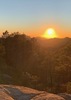
Atmosphere Comparison
Moderator: HAZ - Moderators
Linked Guides none
Linked Area, etc none
-
 JimGuides: 76 | Official Routes: 39Triplogs Last: 32 d | RS: 93Water Reports 1Y: 6 | Last: 43 d
 - Joined: Sep 08 2006 8:14 pm
Atmosphere Comparison
The endless chatter of weather.
Last edited by big_load on Aug 01 2017 9:52 pm, edited 25 times in total.
contribute to this member driven resource
ie: RS > Save/Share after hikes 

-
 LindaAnnGuides: 119 | Official Routes: 121Triplogs Last: 2 d | RS: 2033Water Reports 1Y: 36 | Last: 2 d
 - Joined: Dec 24 2007 6:49 am
- City, State: Ahwatukee, AZ
- Contact:
Re: Atmosphere Comparison
Can we steal 2 square miles from a neighboring state or country???There are 113,998 square miles in AZ
Stop crying and just go do the hike.
contribute to this member driven resource
ie: RS > Save/Share after hikes
-
 WataugaGuides: 0 | Official Routes: 0Triplogs Last: 1,496 d | RS: 0Water Reports 1Y: 0 | Last: 1,270 d
 - Joined: May 14 2020 2:07 pm
- City, State: Tempe
Re: Atmosphere Comparison
Now that we're actually getting somewhat regular precipitation, where does everyone find reliable forecast info for planning trips during Monsoon season?
Also, I'm I correct in assuming that I should stay out of West Clear Creek if there's even a slight chance of rain in the area or upstream? Or am I being too cautious?
Also, I'm I correct in assuming that I should stay out of West Clear Creek if there's even a slight chance of rain in the area or upstream? Or am I being too cautious?
contribute to this member driven resource
ie: RS > Save/Share after hikes
-
 toddakGuides: 13 | Official Routes: 7Triplogs Last: 8 d | RS: 0Water Reports 1Y: 0 | Last: 1,718 d
 - Joined: Nov 15 2005 8:46 pm
- City, State: Jackson, CA
Re: Atmosphere Comparison
@Watauga
Most of WCC isn't tight narrows, it's usually broad enough you could get to higher ground. If you avoid it any time "there's even a slight chance of rain in the area or upstream" then you've pretty much taken June - August off the calendar. But there are relatively few places to get in/out of the canyon in some sections. so it can be committing. I'd probably avoid it if the thunderstorm forecast is above 50% for consecutive days. NWS site weather.gov is good enough for me and it has a map you can click around on for local area forecast.
Most of WCC isn't tight narrows, it's usually broad enough you could get to higher ground. If you avoid it any time "there's even a slight chance of rain in the area or upstream" then you've pretty much taken June - August off the calendar. But there are relatively few places to get in/out of the canyon in some sections. so it can be committing. I'd probably avoid it if the thunderstorm forecast is above 50% for consecutive days. NWS site weather.gov is good enough for me and it has a map you can click around on for local area forecast.
contribute to this member driven resource
ie: RS > Save/Share after hikes
-
 DixieFlyerGuides: 100 | Official Routes: 98Triplogs Last: 6 d | RS: 897Water Reports 1Y: 19 | Last: 13 d
 - Joined: Jan 07 2017 7:03 am
- City, State: Fountain Hills, AZ
Re: Atmosphere Comparison
Below is an interesting graphic from the NWS in Flag that compares monsoon rainfall in 2020 with YTD 2021 monsoon rainfall
https://scontent.fphx1-1.fna.fbcdn.net/ ... e=6125C285
https://scontent.fphx1-1.fna.fbcdn.net/ ... e=6125C285
Civilization is a nice place to visit but I wouldn't want to live there
contribute to this member driven resource
ie: RS > Save/Share after hikes
-
 big_loadGuides: 0 | Official Routes: 1Triplogs Last: 508 d | RS: 3Water Reports 1Y: 0 | Last: 2,710 d
 - Joined: Oct 28 2003 11:20 am
- City, State: Andover, NJ
Re: Atmosphere Comparison
@DixieFlyer
That's a stunning contrast across the board.
That's a stunning contrast across the board.
contribute to this member driven resource
ie: RS > Save/Share after hikes
-
 chumleyGuides: 94 | Official Routes: 239Triplogs Last: 4 d | RS: 73Water Reports 1Y: 95 | Last: 2 d
 - Joined: Sep 18 2002 8:59 am
- City, State: Tempe, AZ
Re: Atmosphere Comparison
NWS Phx published a review of last month's anomalous rain event across the state. It's 100% nerdy stuff that probably only Jim will be interested in. But just in case there's a silent lurker out there who also appreciates such things, here's the link: https://www.weather.gov/psr/StormReportfor2126July2021
It's got lots of cool graphics and maps and whatnot.
It's got lots of cool graphics and maps and whatnot.
I'm not sure what my spirit animal is, but I'm confident it has rabies.
contribute to this member driven resource
ie: RS > Save/Share after hikes
-
 LosDosSloFolksGuides: 0 | Official Routes: 0Triplogs Last: 6 d | RS: 77Water Reports 1Y: 12 | Last: 5 d
 - Joined: Feb 10 2019 3:42 pm
- City, State: Cave Creek, AZ
Re: Atmosphere Comparison
There seems to be an ever increasing demand for whatnot.chumley wrote: lots of cool graphics and maps and whatnot
Surely not everyone was Kung Fu fighting?
contribute to this member driven resource
ie: RS > Save/Share after hikes
-
big_loadGuides: 0 | Official Routes: 1Triplogs Last: 508 d | RS: 3Water Reports 1Y: 0 | Last: 2,710 d
- Joined: Oct 28 2003 11:20 am
- City, State: Andover, NJ
Re: Atmosphere Comparison
It's like cole slaw. It comes whether you want it or not.LosDosSloFolks wrote: ↑Aug 03 2021 3:35 pmThere seems to be an ever increasing demand for whatnot.chumley wrote: lots of cool graphics and maps and whatnot
contribute to this member driven resource
ie: RS > Save/Share after hikes
-
 The_DudeGuides: 1 | Official Routes: 10Triplogs Last: 788 d | RS: 22Water Reports 1Y: 0 | Last: 1,920 d
 - Joined: Jun 10 2011 11:19 am
- City, State: Phoenix, AZ
Re: Atmosphere Comparison
@chumley
Well I guess this makes me a silent lurker. I do find myself on NWS probably more than is necessary, but hey I work and play outside. Nice set of data, especially all the gage info. Some of those usually always dry areas get tempting for a well timed kayak.
Well I guess this makes me a silent lurker.
contribute to this member driven resource
ie: RS > Save/Share after hikes
-
 Alston_NealGuides: 1 | Official Routes: 0Triplogs Last: 156 d | RS: 0Water Reports 1Y: 0 | Last: never
 - Joined: Apr 19 2008 5:53 pm
- City, State: Phoenix, AZ
Re: Atmosphere Comparison
Jim is on the Subaru Forum now, he'll be back in a sec.chumley wrote:It's 100% nerdy stuff that probably only Jim will be interested in.
contribute to this member driven resource
ie: RS > Save/Share after hikes
-
JimGuides: 76 | Official Routes: 39Triplogs Last: 32 d | RS: 93Water Reports 1Y: 6 | Last: 43 d
- Joined: Sep 08 2006 8:14 pm
Re: Atmosphere Comparison
Yeah, it was really wet for a while and now it is drier. It's getting extremely hot again, too. NWS claims 111 today for my point forecast off the Cortaro Rd exit, and 113 for Phoenix.
I miss Piestewa on days like this, as you can safely hike it near sunset on a trail. For as much as some rave about the local hikes being better than Phoenix ones, Sombrero, Pusch/Pusch's Flatiron, and Golden Gate Mountain are not on real trails and are in really bad shape. There is something to be said for a real trail. Air quality is usually very similar this time of year, too, I think. Ozone? Maybe not? Then again, Piestewa is only hikable these days provided it is "open", but if it's over 100 I would wait until about 1 hour before sunset, anyway. Mormon Trail or Holbert would be nice options for roasting on a pretty good trail, at least.
On the plus side, if one was inclined to drive to Flagstaff, the next few days will probably be awesome days for hiking Humphrey's Peak, Baldy or Escudilla, or Mount Graham. I'd love a return trip to the Spring Mountains to either hike the Mt Chuck North Loop to some point along the cliffs, or Mummy Mt, but I hate Las Vegas so very, very much. Why did one of the most beautiful mountain ranges in the region have to be right next to such a god awful place?
contribute to this member driven resource
ie: RS > Save/Share after hikes
-
 andrewpGuides: 3 | Official Routes: 3Triplogs Last: 1,720 d | RS: 2Water Reports 1Y: 0 | Last: 1,719 d
 - Joined: Sep 27 2020 6:18 pm
- City, State: Tucson, AZ
Re: Atmosphere Comparison
Heading up for a 3-day stint in the White Mountains this weekend with a plan to do Baldy on Sunday. As far as I can tell the weather is predicted to hold through the weekend, but the NWS is obviously hedging in their forecasts:Jim_H wrote:the next few days will probably be awesome days for hiking ... Baldy or ...
...or, "we know that moisture will return at some point, but since we've issued 5 vastly different forecasts in the last 5 days we're giving up and going with a statement that is so non-committal that we can't be wrong!"NWS wrote:Uncertainty does exist with the exact timing and extent of the moisture return, however ensemble guidance does signal that coverage will increase some during the upcoming week.
Don't get me wrong, I really appreciate what the NWS guys do and having spent time in a past life trying to wrestle valid conclusions from a similarly chaotic model I can absolutely sympathize with the forecast roulette rut that they get into.... but... there has to be a happy medium between "x.xx inches of ran on Sunday" and "moisture will return at some point."
contribute to this member driven resource
ie: RS > Save/Share after hikes
-
 SpiderLegsGuides: 2 | Official Routes: 2Triplogs Last: 10 d | RS: 1Water Reports 1Y: 5 | Last: 24 d
 - Joined: Jul 12 2012 7:35 pm
- City, State: Oro Valley, AZ
Re: Atmosphere Comparison
Ozone levels have been high the past week in Tucson, does a nasty number on your lungs if you try to exercise according to my allergist. I'm getting older and crankier about all this. Between what is now a regular occurrence of wildfire season, then ozone issues off and on all summer I'm seriously tempted to go buy a place near water up in the Midwest to ride things out for 3-4 months a year. Can't go outside safely without asthma issues for 5-6 weeks now between Memorial Day and Labor Day.Jim_H wrote:I miss Piestewa on days like this, as you can safely hike it near sunset on a trail. For as much as some rave about the local hikes being better than Phoenix ones, Sombrero, Pusch/Pusch's Flatiron, and Golden Gate Mountain are not on real trails and are in really bad shape. There is something to be said for a real trail. Air quality is usually very similar this time of year, too, I think. Ozone? Maybe not?
Would agree about the lack of a decent well maintained trail for training that you can simply do on autopilot. One slight thing I miss about central Phoenix.
See my pics on Instagram @tucsonexplorer
contribute to this member driven resource
ie: RS > Save/Share after hikes
-
JimGuides: 76 | Official Routes: 39Triplogs Last: 32 d | RS: 93Water Reports 1Y: 6 | Last: 43 d
- Joined: Sep 08 2006 8:14 pm
Re: Atmosphere Comparison
@SpiderLegs
I believe Phoenix has the better hiking within the urban areas. Tucson, does not. Tucson has better large hikes like Finger Rock, Ventana ( where it isn't eroded), and Romero Trail ( to access Mount Lemmon), but Phoenix has the better after work or whenever 1 hour hikes like Piestewa, Camelback, and stuff like North Mountain, Lookout Mountain, and so on. South Mountain and the Tucson Mts are very similar, too, but I find the trails at SoMo a little nicer due to a preference for that vegetation. This is the difference between a city park and maintained trails, and a NF or NP, or just being in the county. I was able to keep enthusiasm up to hike Piestewa at least twice a week at certain times, and could now, too. Sombrero or any of Pusch, that is hard to do.
However, Tucson air quality is much better, so there is that. Maybe I should say Marana/Oro Valley has better air quality? I wouldn't want to actually live in Tucson, and judging by where most do live, few actually want to live in Tucson proper. This is part of why I wish I could have lived in the valley for several decades back before the 1990s and before the population and air pollution became completely overwhelming. I turned 11 in 1990, so clearly this was never possible.
contribute to this member driven resource
ie: RS > Save/Share after hikes
-
chumleyGuides: 94 | Official Routes: 239Triplogs Last: 4 d | RS: 73Water Reports 1Y: 95 | Last: 2 d
- Joined: Sep 18 2002 8:59 am
- City, State: Tempe, AZ
Re: Atmosphere Comparison
The drought is often said to have persisted for decades now, and we may in fact be in a "megadrought". But regardless, after a couple of inches of rain it only took two weeks to change everything. Praise be to Cthulhu!
- Attachments
-
I'm not sure what my spirit animal is, but I'm confident it has rabies.
contribute to this member driven resource
ie: RS > Save/Share after hikes
-
toddakGuides: 13 | Official Routes: 7Triplogs Last: 8 d | RS: 0Water Reports 1Y: 0 | Last: 1,718 d
- Joined: Nov 15 2005 8:46 pm
- City, State: Jackson, CA
Re: Atmosphere Comparison
A few trillion gallons does the state good!
contribute to this member driven resource
ie: RS > Save/Share after hikes
-
 rwstormGuides: 1 | Official Routes: 12Triplogs Last: 603 d | RS: 1Water Reports 1Y: 0 | Last: 2,816 d
 - Joined: Feb 28 2003 5:45 pm
- City, State: Tucson, AZ
- Contact:
Re: Atmosphere Comparison
I ended up with a total 7.44 inches of rain at my place for July. Just missed being my wettest month on record, which is 7.47 inches in July 2017.
contribute to this member driven resource
ie: RS > Save/Share after hikes
-
DixieFlyerGuides: 100 | Official Routes: 98Triplogs Last: 6 d | RS: 897Water Reports 1Y: 19 | Last: 13 d
- Joined: Jan 07 2017 7:03 am
- City, State: Fountain Hills, AZ
Re: Atmosphere Comparison
@rwstorm
your rain gauge is a lot more accurate than mine!
your rain gauge is a lot more accurate than mine!
Civilization is a nice place to visit but I wouldn't want to live there
contribute to this member driven resource
ie: RS > Save/Share after hikes
-
rwstormGuides: 1 | Official Routes: 12Triplogs Last: 603 d | RS: 1Water Reports 1Y: 0 | Last: 2,816 d
- Joined: Feb 28 2003 5:45 pm
- City, State: Tucson, AZ
- Contact:
Re: Atmosphere Comparison
@DixieFlyer
I don't know about that, but getting accurate readings can be tricky. Especially using tipping bucket gauges that I use to record data remotely and then send it out to Davis Weatherlink and Weather Underground networks. One thing I learned long ago is that it is important to have backups when dealing with electronics. That is why I still have old fashioned 4 inch and 8 inch gauges to check on the readouts.
I don't know about that, but getting accurate readings can be tricky. Especially using tipping bucket gauges that I use to record data remotely and then send it out to Davis Weatherlink and Weather Underground networks. One thing I learned long ago is that it is important to have backups when dealing with electronics. That is why I still have old fashioned 4 inch and 8 inch gauges to check on the readouts.
contribute to this member driven resource
ie: RS > Save/Share after hikes
-
 SuperstitionGuyGuides: 0 | Official Routes: 0Triplogs Last: 1,824 d | RS: 0Water Reports 1Y: 0 | Last: never
 - Joined: Dec 25 2005 8:24 pm
- City, State: Queen Creek, Arizona
Re: Atmosphere Comparison
@rwstorm
I have often wondered when during a monsoon storm, "How do you measure the wind blown rain when it is flying horizontally?".
](./images/smilies/eusa_wall.gif "Brick wall")
I have often wondered when during a monsoon storm, "How do you measure the wind blown rain when it is flying horizontally?".
A man's body may grow old, but inside his spirit can still be as young and restless as ever.
- Garth McCann from the movie Second Hand Lions
Another victim of Pixel Trivia.
Current avatar courtesy of Snakemarks
- Garth McCann from the movie Second Hand Lions
Another victim of Pixel Trivia.
Current avatar courtesy of Snakemarks
contribute to this member driven resource
ie: RS > Save/Share after hikes