 Route Editor

Historical maps of South Mountain?
Moderator: HAZ - Moderators
Linked Guides none
Linked Area, etc none
-
 overthehillsfarawayGuides: 0 | Official Routes: 0Triplogs Last: 30 d | RS: 0Water Reports 1Y: 0 | Last: never
 - Joined: Nov 24 2023 4:57 pm
- City, State: Tempe, AZ
Historical maps of South Mountain?
Trail systems change over time. I was curious about how I might find older trail maps of South Mountain that might show where some previous trails are that may not be used any longer. Any ideas where to start looking? City hall? Local librarian?
contribute to this member driven resource
ie: RS > Save/Share after hikes 

-
 mudlugsGuides: 0 | Official Routes: 0Triplogs Last: 1,156 d | RS: 0Water Reports 1Y: 0 | Last: never
 - Joined: Jan 30 2011 5:21 pm
- City, State: Phoenix, AZ
Re: Historical maps of South Mountain?
The mountain bikers have some:
http://mtbikeaz.com/2010/02/20/south-mo ... ough-time/
You might also try the historical aerial photos here: https://www.maricopa.gov/3942/GIS-Mapping-Applications
Scroll down a bit to see the historical aerial tile.
Select which set of pics by year on the right.
Not all years have good (or any) photos and some are incomplete so you'll only get part of SM.
1949 seems decent.
contribute to this member driven resource
ie: RS > Save/Share after hikes
-
overthehillsfarawayGuides: 0 | Official Routes: 0Triplogs Last: 30 d | RS: 0Water Reports 1Y: 0 | Last: never
- Joined: Nov 24 2023 4:57 pm
- City, State: Tempe, AZ
Re: Historical maps of South Mountain?
@mudlugs
This is exactly the kind of stuff I was looking for thanks!!
This is exactly the kind of stuff I was looking for thanks!!
contribute to this member driven resource
ie: RS > Save/Share after hikes
-
 GrimeyGuides: 0 | Official Routes: 0Triplogs Last: 364 d | RS: 2Water Reports 1Y: 0 | Last: 2,172 d
 - Joined: Oct 17 2005 2:22 pm
- City, State: Phoenix, AZ
Re: Historical maps of South Mountain?
Pretty interesting stuff. I like the 1936 map, "roads to be constructed" seems to suggest that Pima Canyon Road was planned to go all the way up to Buena Vista. Seems pretty optimistic, but then again, those folks in the 30s were into building things.
contribute to this member driven resource
ie: RS > Save/Share after hikes
-
 SredfieldGuides: 4 | Official Routes: 4Triplogs Last: 3 d | RS: 0Water Reports 1Y: 0 | Last: 735 d
 - Joined: Sep 08 2002 1:07 pm
- City, State: Ahwatukee, AZ
Re: Historical maps of South Mountain?
@overthehillsfaraway
In the spring when the first grass is coming, the old paths are quite evident.
In the spring when the first grass is coming, the old paths are quite evident.
Shawn
The bear went over the mountain to see what he could see.
The bear went over the mountain to see what he could see.
contribute to this member driven resource
ie: RS > Save/Share after hikes
-
overthehillsfarawayGuides: 0 | Official Routes: 0Triplogs Last: 30 d | RS: 0Water Reports 1Y: 0 | Last: never
- Joined: Nov 24 2023 4:57 pm
- City, State: Tempe, AZ
Re: Historical maps of South Mountain?
@Sredfield
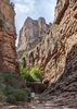
For better or worse, I've also realized Strava heat maps give away a lot of them/+social trails. Also spotting them now better on satellite, but I've been mistaken before and wound up in a crazy canyon...
For better or worse, I've also realized Strava heat maps give away a lot of them/+social trails. Also spotting them now better on satellite, but I've been mistaken before and wound up in a crazy canyon...
contribute to this member driven resource
ie: RS > Save/Share after hikes