 Route Editor

Bagging all Four Peaks - Sat Dec 20th
Moderators: HAZ Group Coordinators, HAZ - Moderators
-
 AKGuides: 0 | Official Routes: 0Triplogs Last: 7,580 d | RS: 0Water Reports 1Y: 0 | Last: never
 - Joined: Mar 06 2003 2:49 am
- City, State: Mesa, AZ
Bagging all 4 "Four Peaks"
Just curious if anyone here or anyone you know has ever bagged all 4 of the Four Peaks. Its something I'm thinking of attempting possibly next spring.
Aaron
"Can't think of a good signature quote" - Me
"Can't think of a good signature quote" - Me
contribute to this member driven resource
ie: RS > Save/Share after hikes 

-
AKGuides: 0 | Official Routes: 0Triplogs Last: 7,580 d | RS: 0Water Reports 1Y: 0 | Last: never
- Joined: Mar 06 2003 2:49 am
- City, State: Mesa, AZ
contribute to this member driven resource
ie: RS > Save/Share after hikes
-
 olesmaGuides: 0 | Official Routes: 0Triplogs Last: 8,645 d | RS: 0Water Reports 1Y: 0 | Last: never
 - Joined: Feb 09 2002 1:02 pm
- City, State: Mesa, AZ
For all you non-married men out there, the answer is YES!AK wrote:Oh god the pressure. College girls to hike with. Hmmmmmm...........
For us married folks the answer is - sure, we love the company.
I personally am not opposed to larger groups. It can slow things down a bit - but that is about the worst it gets. We did the ridgeline a couple months back with 10 or so and it was just fine. I've also done Flatiron with a group of 20 - that was a little overboard, and we rarely stuck together - but the larger group meant that more people of similar skill were able to hike together - thereby not leaving peope to hike alone.
I say, the more the merrier.
FRS and unknown (but probably FRS)matt gilbert wrote:GMRS or FMS?
'Weird is a relative, not an absolute.' - A. Einstein
contribute to this member driven resource
ie: RS > Save/Share after hikes
-
 mttgilbertGuides: 5 | Official Routes: 0Triplogs Last: 6,180 d | RS: 0Water Reports 1Y: 0 | Last: 6,375 d
 - Joined: Oct 14 2002 3:40 pm
- City, State: Denver, CO
contribute to this member driven resource
ie: RS > Save/Share after hikes
-
 azhiker96Guides: 0 | Official Routes: 0Triplogs Last: 1,134 d | RS: 2Water Reports 1Y: 0 | Last: never
 - Joined: Feb 03 2002 10:17 am
- City, State: Gilbert, AZ
Daryl, I kinda agree on staying in a group. However, two or three small groups should be fine also. We just need to make sure nobody drops out by themself. The radios are a good idea. We should make sure there's one per group. One caution, there is no trail between these peaks. We'll have to find a path that does not require ropes or wings. I do think 6 hours is a reasonable estimate for the hike, a good target anyway. I saw that Flag was getting snow. I hope we don't have any for this hike.
"Sometimes I wonder whether the world is being run by smart people who are putting us on or by imbeciles who really mean it."
~ Mark Twain
~ Mark Twain
contribute to this member driven resource
ie: RS > Save/Share after hikes
-
AKGuides: 0 | Official Routes: 0Triplogs Last: 7,580 d | RS: 0Water Reports 1Y: 0 | Last: never
- Joined: Mar 06 2003 2:49 am
- City, State: Mesa, AZ
contribute to this member driven resource
ie: RS > Save/Share after hikes
-
olesmaGuides: 0 | Official Routes: 0Triplogs Last: 8,645 d | RS: 0Water Reports 1Y: 0 | Last: never
- Joined: Feb 09 2002 1:02 pm
- City, State: Mesa, AZ
contribute to this member driven resource
ie: RS > Save/Share after hikes
-
 MtnGeekGuides: 9 | Official Routes: 0Triplogs Last: 2,084 d | RS: 0Water Reports 1Y: 0 | Last: never
 - Joined: May 01 2002 11:09 am
- City, State: Denver, CO
With this hike being mainly off trail who is going to be out there counting to make sure we are under 15 people? does it really matter? It just seems silly to me.
As far as the snow...I did Browns Peak last year with about 3 feet of snow in the scree chute. It was doable, but was just about the scariest thing I have ever encountered hiking up any peak. I cannot imagine that there would be very much snow up there yet. Flagstaff only got about an inch last week which is compairible elevation wise. Snow Bowl got 4 inches. I really don't think that snow will be an issue even if there is some up there. It'll just make out boots a little bit wet.
As far as the snow...I did Browns Peak last year with about 3 feet of snow in the scree chute. It was doable, but was just about the scariest thing I have ever encountered hiking up any peak. I cannot imagine that there would be very much snow up there yet. Flagstaff only got about an inch last week which is compairible elevation wise. Snow Bowl got 4 inches. I really don't think that snow will be an issue even if there is some up there. It'll just make out boots a little bit wet.
Mountains are there to be hiked!
contribute to this member driven resource
ie: RS > Save/Share after hikes
-
 LizardGuides: 15 | Official Routes: 0Triplogs Last: 5,459 d | RS: 0Water Reports 1Y: 0 | Last: never
 - Joined: Feb 05 2002 6:40 pm
- City, State: Phoenix, AZ
The rule is in place for good reason: to limit impact. Taking 15+ people on an offtrail hike is going to have an effect on the land. Something to consider.Steven wrote:With this hike being mainly off trail who is going to be out there counting to make sure we are under 15 people? does it really matter? It just seems silly to me.
"Of course we weren't lost. We were merely where we shouldn't have been, without knowing exactly where that was."
contribute to this member driven resource
ie: RS > Save/Share after hikes
-
 azrocksGuides: 0 | Official Routes: 0Triplogs Last: none | RS: 0Water Reports 1Y: 0 | Last: never
 - Joined: Mar 21 2002 5:38 pm
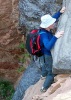
As we sat on Brown's peak, several of our group said they would not be willing to repeat this hike with such a large group (10). It slowed us down a lot, and was more dangerous. At each ascent, the group would split, the adrenaline junkies taking a hard line, the wimps searching for easier lines, and then we would wait around to regroup at the next peak. Often we could hear people close by, but buried in manzanita hunting for tunnels and calling out for directions, or just hidden behind rock outcrops wondering which way to go. What could you tell them with a radio ? When you look at the side of the peaks, you see yellow rock, but look closer and you see green lines which are gullies round the boulders, and that is where you will be, because the rock faces are mostly too steep.
Often you have no more than 100 ft visibility, and nowhere can you see the peak, or know if the peak you see is the target peak. This is seat of the pants orienteering. You will be surprised at how much vegetation you deal with, long sleeves and pants is mandatory. I was told this trip only became possible after the fire, and has gotten harder each year since.
Coming off peak 2, where you go down a steep loose gully, large rocks come whizzing past from the folks behind, and this is seriously scary. Picture a brick falling 50ft onto your head. You need to go one at a time, and find shelter. I like to think I'm really careful, but I sent a cannonball down Brown's, and it sounded like it went all the way, and I bet it was doing 100mph at the bottom.
I think we were off route at the time, but between peak 3 and Brown's, we had a downclimb that was at the limit of what prudent people should do without a rope, about as difficult as Browns, but twice the exposure, so potentially a fatal fall. I didn't see any skeletons, though.
As regards environmental impact, when you see the dense vegetation in Amethyst gully, and see the soil being pushed downhill at each step, you might wonder whether Brown's gully was once similarly vegetated. Once loosened, that soil will wash away at the next rain, and be gone forever. All you can do is try to minimize the footprints by all stepping in the same spots. It was quite wet, so if it's frozen there will be less damage.
I hope this is not too melodramatic, I just want you to go safe and not spend the night up there.
contribute to this member driven resource
ie: RS > Save/Share after hikes
-
 pfredricksGuides: 0 | Official Routes: 0Triplogs Last: 4,934 d | RS: 0Water Reports 1Y: 0 | Last: never
 - Joined: Oct 18 2002 10:59 am
- City, State: Glendale, AZ
It sounds like most going are reasonable people with reasonable experience. THe radios will allow us to stay in touch, ask for help if needed, but not really to be used to guide the others up.
THings just work themselves out.
I think there are some medics in the group too.
-Pete
THings just work themselves out.
I think there are some medics in the group too.
-Pete
"I'd feel better if we had some crampons. Oh, what the hell, let's go for it..." — Common climbing last words.
contribute to this member driven resource
ie: RS > Save/Share after hikes
-
 te_waGuides: 3 | Official Routes: 0Triplogs Last: 1,854 d | RS: 2Water Reports 1Y: 0 | Last: 2,054 d
 - Joined: Aug 22 2003 9:16 pm
- City, State: Mesa
overnite
this isnt really related to the upcoming 4 peaks summits, but i heard there are good campsites just west of the saddle. this is where the browns trail forks(3 way) and Ive only been to the left, accessing brown's. I think the trail forks left to brown's, straight to amethyst, and right?? Got any info on these campsites? Pete? Joe? Aaron?
squirrel!
contribute to this member driven resource
ie: RS > Save/Share after hikes
-
 DarylGuides: 0 | Official Routes: 0Triplogs Last: 8,168 d | RS: 0Water Reports 1Y: 0 | Last: never
 - Joined: Mar 07 2002 11:18 am
- City, State: Lake Stevens, WA
I sat down with my mapping software and this is what I got for our trip:
2.5 miles and 1780 ft of climbing to Browns peak (peak 1)
Using straight lines it's then 1 mile horizontal distance to peak 4 with:
110 feet of climbing to peak 2
290 feet of climbing to peak 3
110 feet to peak 4
Using:
Trailhead = 5650'
Browns peak = 7470'
saddle between Browns and peak 2 = 7320'
Peak 2 = 7430'
saddle 2-3 = 7050'
Peak 3 = 7340'
saddle 3-4 = 7220'
peak 4 = 7330'
It's then less then 1/2 a mile down hill to Amethyst Spring where we can follow a trail about 4 miles to the trail head.
So totals I'm getting are about 8 miles round trip with 2,290' of climbing up and 2,290' of going down. If my software is right and there is a trail from Amethyst Springs, it means only about 2 miles of the trip will be off trail and really ugly.
Giving us 4 hours to do the off trail stuff, we should be able to knock the 6 miles of trail hiking out pretty easily in 2-4 hours, I'm guessing we can have it done in 7 hours. Assuming a 7am start moving time, we'll be off the trail by 2pm with time to go home and take a shower before hitting "the other" four peaks.
Sounds too easy (just kidding), am I missing anything?
“Life is tough, but it’s tougher if you’re stupid”
John Wayne as Sergeant John M. Stryker, USMC in “The Sands of Iwo Jima”
John Wayne as Sergeant John M. Stryker, USMC in “The Sands of Iwo Jima”
contribute to this member driven resource
ie: RS > Save/Share after hikes
-
pfredricksGuides: 0 | Official Routes: 0Triplogs Last: 4,934 d | RS: 0Water Reports 1Y: 0 | Last: never
- Joined: Oct 18 2002 10:59 am
- City, State: Glendale, AZ
Great Calculations Daryl.
You forgot group lag time though
Just running the numbers on the group-looks like 10 so far
AK
Daryl
Kenny
AZhiker96
Bullseye
Olsema
Steven
AZBrad123
Pfredricks
MattGilbert
There is almost always a few no shows.
That will be less than the 15
DO we need more 4x4 transportation? I have a camry
You forgot group lag time though
Just running the numbers on the group-looks like 10 so far
AK
Daryl
Kenny
AZhiker96
Bullseye
Olsema
Steven
AZBrad123
Pfredricks
MattGilbert
There is almost always a few no shows.
That will be less than the 15
DO we need more 4x4 transportation? I have a camry
"I'd feel better if we had some crampons. Oh, what the hell, let's go for it..." — Common climbing last words.
contribute to this member driven resource
ie: RS > Save/Share after hikes
-
DarylGuides: 0 | Official Routes: 0Triplogs Last: 8,168 d | RS: 0Water Reports 1Y: 0 | Last: never
- Joined: Mar 07 2002 11:18 am
- City, State: Lake Stevens, WA
contribute to this member driven resource
ie: RS > Save/Share after hikes
-
 FritzskiGuides: 43 | Official Routes: 0Triplogs Last: 3,412 d | RS: 0Water Reports 1Y: 0 | Last: never
 - Joined: Feb 04 2002 8:26 am
- City, State: Gilbert, AZ
Hey guys, this sounds like an epic adventure! Just the kind of thing I would like to be in on.
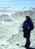
I gotta tell you, I just flew over this morning and the whole peak is covered in snow. Realize that normally nasty free climbed gullies will probably harbor ice for the rest of the winter. In permanently shaded areas the rock may freeze your fingers.
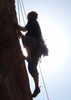
This is a very serious undertaking as an individual, let alone a large party. I just hope everyone realizes how rugged (mostly class 4 - meaning you can die if you fall) and sustained the terrain is to accomplish this hike.
I truly don't want to rain on anyone's parade, but just don't want anyone getting in over their heads.
Good luck, and great hiking! Looking forward to the reports!
I gotta tell you, I just flew over this morning and the whole peak is covered in snow. Realize that normally nasty free climbed gullies will probably harbor ice for the rest of the winter. In permanently shaded areas the rock may freeze your fingers.
This is a very serious undertaking as an individual, let alone a large party. I just hope everyone realizes how rugged (mostly class 4 - meaning you can die if you fall) and sustained the terrain is to accomplish this hike.
I truly don't want to rain on anyone's parade, but just don't want anyone getting in over their heads.
Good luck, and great hiking! Looking forward to the reports!
contribute to this member driven resource
ie: RS > Save/Share after hikes
-
pfredricksGuides: 0 | Official Routes: 0Triplogs Last: 4,934 d | RS: 0Water Reports 1Y: 0 | Last: never
- Joined: Oct 18 2002 10:59 am
- City, State: Glendale, AZ
contribute to this member driven resource
ie: RS > Save/Share after hikes
-
 bzacharGuides: 0 | Official Routes: 0Triplogs Last: none | RS: 0Water Reports 1Y: 0 | Last: never
 - Joined: Dec 10 2002 10:35 pm
- City, State: Mesa, AZ
Same here.I truly don't want to rain on anyone's parade, but just don't want anyone getting in over their heads.
We tried hiking up to Brown's Saddle a year ago and had to turn around. On Brown's Trail at 12S 469269 3728220 is a north-facing slop that was covered in snow. All the other slopes were clear. We hiked up it for a few minutes and realized that going up was relatively easy but trying to walk down it was going to be hard. We turned around and it was extremely slippery. The trail was a mixture of mud and half-frozen snow. If you slipped you'd just keep sliding down the snow-covered slope.
Bill
contribute to this member driven resource
ie: RS > Save/Share after hikes
-
FritzskiGuides: 43 | Official Routes: 0Triplogs Last: 3,412 d | RS: 0Water Reports 1Y: 0 | Last: never
- Joined: Feb 04 2002 8:26 am
- City, State: Gilbert, AZ
I'm just recalling from memory and what I look at when I'm flying over. Fact is you can still die, or wish you did, on a fall from 3rd class terrain.
I can assure you of this though, it will be very slow, careful going at best and could potentially develop into what climbers call an "epic" with a large group, even if no one individual happens to "freeze up" on a particular section.
I'll bet you just the initial climb up the gulley from the trail to the peak will get some folks attention. My wife flat refused to downclimb it and we had to bushwhack off the east side. She's climbed 5.7 on the rocks.
contribute to this member driven resource
ie: RS > Save/Share after hikes
-
AKGuides: 0 | Official Routes: 0Triplogs Last: 7,580 d | RS: 0Water Reports 1Y: 0 | Last: never
- Joined: Mar 06 2003 2:49 am
- City, State: Mesa, AZ
contribute to this member driven resource
ie: RS > Save/Share after hikes
-
olesmaGuides: 0 | Official Routes: 0Triplogs Last: 8,645 d | RS: 0Water Reports 1Y: 0 | Last: never
- Joined: Feb 09 2002 1:02 pm
- City, State: Mesa, AZ
Geeze, Fritzski - you're making this sound pretty hairy to do this time of year.
I know you're not trying to rain on our parade - but you've certainly made me re-think if I want to do this or not.
I consider myself a very skilled and experienced hiker/backpacker - and I have some skill with climbing as well - but I certainly don't want to get caught on icy slopes on an exposed 4. That's just not my idea of fun.
To be honest - ice and snow intimidate me. I have zero - zip - nada - experience hiking in the snow or ice. Never done it (asside from short walks into snowy forrests once in a while).
I guess I'm going to be looking closely at the weather for the next week.
'Weird is a relative, not an absolute.' - A. Einstein
contribute to this member driven resource
ie: RS > Save/Share after hikes