 Route Editor

Bagging all Four Peaks - Sat Dec 20th
Moderators: HAZ Group Coordinators, HAZ - Moderators
-
 AKGuides: 0 | Official Routes: 0Triplogs Last: 7,580 d | RS: 0Water Reports 1Y: 0 | Last: never
 - Joined: Mar 06 2003 2:49 am
- City, State: Mesa, AZ
Bagging all 4 "Four Peaks"
Just curious if anyone here or anyone you know has ever bagged all 4 of the Four Peaks. Its something I'm thinking of attempting possibly next spring.
Aaron
"Can't think of a good signature quote" - Me
"Can't think of a good signature quote" - Me
contribute to this member driven resource
ie: RS > Save/Share after hikes 

-
 pfredricksGuides: 0 | Official Routes: 0Triplogs Last: 4,934 d | RS: 0Water Reports 1Y: 0 | Last: never
 - Joined: Oct 18 2002 10:59 am
- City, State: Glendale, AZ
contribute to this member driven resource
ie: RS > Save/Share after hikes
-
 DarylGuides: 0 | Official Routes: 0Triplogs Last: 8,168 d | RS: 0Water Reports 1Y: 0 | Last: never
 - Joined: Mar 07 2002 11:18 am
- City, State: Lake Stevens, WA
I assumed we'd be starting with the first peak since there is a trail up to it (kind of).
I'll be re-thinking this if the snow sticks around. I've never been up there so i don't know what to expect. I'd rather not go into the unknown with snow/ice. I've done enough hiking in the snow to know it can make the hike a lot more interesting. Plus I do not have waterproof or even insulated boots. Cold, numb, wet feet don't work well on bad terrain.
Those of you that have been up there, how would you compare the terrain to Siphon Draw or Picket Post?
“Life is tough, but it’s tougher if you’re stupid”
John Wayne as Sergeant John M. Stryker, USMC in “The Sands of Iwo Jima”
John Wayne as Sergeant John M. Stryker, USMC in “The Sands of Iwo Jima”
contribute to this member driven resource
ie: RS > Save/Share after hikes
-
 MtnGeekGuides: 9 | Official Routes: 0Triplogs Last: 2,084 d | RS: 0Water Reports 1Y: 0 | Last: never
 - Joined: May 01 2002 11:09 am
- City, State: Denver, CO
contribute to this member driven resource
ie: RS > Save/Share after hikes
-
 FritzskiGuides: 43 | Official Routes: 0Triplogs Last: 3,412 d | RS: 0Water Reports 1Y: 0 | Last: never
 - Joined: Feb 04 2002 8:26 am
- City, State: Gilbert, AZ
Hey guys,
Like I said, I hope you go, but I just want you to be in the right frame of mind when you do. You can always back off, as long as you never get committed beyond that point, so just keep that in mind.
In answer to Daryl's question: Don't expect "snow filled gullies and avalanches", but a little clear ice in the shaded nooks could make things real dicey. The terrain just from the saddle up to Brown's is more intense than what you'd encounter on either Siphon or Picket - from there I haven't been, but my recollection was extremely rugged in most directions.
Awesome idea, and I would love to undertake this adventure myself, but I feel December is probably not the optimum month to pull it off.
contribute to this member driven resource
ie: RS > Save/Share after hikes
-
AKGuides: 0 | Official Routes: 0Triplogs Last: 7,580 d | RS: 0Water Reports 1Y: 0 | Last: never
- Joined: Mar 06 2003 2:49 am
- City, State: Mesa, AZ
contribute to this member driven resource
ie: RS > Save/Share after hikes
-
 HikerInGilbertGuides: 0 | Official Routes: 0Triplogs Last: none | RS: 0Water Reports 1Y: 0 | Last: never
 - Joined: May 07 2003 5:51 pm
- City, State: Gilbert, AZ
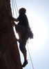
I'm sure a few of you guys meandered a little further into Azrocks' site to check out the pics from their excursion.AK wrote:The scree chute is the best part of Browns Peak. Up or down. Although adding a little ice will boost the pucker factor a little more. We'll keep our eyes on the weather this week. I'm not too concerned at this point.
http://keepthis.info/FourPeaks/ Take a good look at pages 2, 3, and 4.
Looks like a great climb. Adding a little snow, ice, and cold rocks sure would raise that "pucker factor" I'd say. I, for one, am going to wait for warmer temps to do that one.
Have fun guys. Be careful up there.
_______________________________
Tom
Tom
contribute to this member driven resource
ie: RS > Save/Share after hikes
-
AKGuides: 0 | Official Routes: 0Triplogs Last: 7,580 d | RS: 0Water Reports 1Y: 0 | Last: never
- Joined: Mar 06 2003 2:49 am
- City, State: Mesa, AZ
For anyone planning on attending this hike, please sign up here: http://hikearizona.com/dex2/group-VIEW.php?GID=30
Aaron
"Can't think of a good signature quote" - Me
"Can't think of a good signature quote" - Me
contribute to this member driven resource
ie: RS > Save/Share after hikes
-
MtnGeekGuides: 9 | Official Routes: 0Triplogs Last: 2,084 d | RS: 0Water Reports 1Y: 0 | Last: never
- Joined: May 01 2002 11:09 am
- City, State: Denver, CO
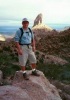
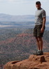
Here are my pics when I went up the Scree Chute in the snow with ArizonaHeat and Cactuscat.
http://www.summitpost.com/mountains/pho ... ssion_date
http://www.summitpost.com/mountains/pho ... ssion_date
Mountains are there to be hiked!
contribute to this member driven resource
ie: RS > Save/Share after hikes
-
pfredricksGuides: 0 | Official Routes: 0Triplogs Last: 4,934 d | RS: 0Water Reports 1Y: 0 | Last: never
- Joined: Oct 18 2002 10:59 am
- City, State: Glendale, AZ
contribute to this member driven resource
ie: RS > Save/Share after hikes
-
AKGuides: 0 | Official Routes: 0Triplogs Last: 7,580 d | RS: 0Water Reports 1Y: 0 | Last: never
- Joined: Mar 06 2003 2:49 am
- City, State: Mesa, AZ
contribute to this member driven resource
ie: RS > Save/Share after hikes
-
DarylGuides: 0 | Official Routes: 0Triplogs Last: 8,168 d | RS: 0Water Reports 1Y: 0 | Last: never
- Joined: Mar 07 2002 11:18 am
- City, State: Lake Stevens, WA
I think I’m out. It’s a tough decision and I’m not certain about it yet.
I want to do this hike very badly and all the pictures make me want to do it even more, but I’d rather do it with more ideal circumstances.
I’ll shoot to do this early next summer.
Good luck guys. Take lots of pictures, have fun, and be safe.
I want to do this hike very badly and all the pictures make me want to do it even more, but I’d rather do it with more ideal circumstances.
I’ll shoot to do this early next summer.
Good luck guys. Take lots of pictures, have fun, and be safe.
“Life is tough, but it’s tougher if you’re stupid”
John Wayne as Sergeant John M. Stryker, USMC in “The Sands of Iwo Jima”
John Wayne as Sergeant John M. Stryker, USMC in “The Sands of Iwo Jima”
contribute to this member driven resource
ie: RS > Save/Share after hikes
-
 olesmaGuides: 0 | Official Routes: 0Triplogs Last: 8,645 d | RS: 0Water Reports 1Y: 0 | Last: never
 - Joined: Feb 09 2002 1:02 pm
- City, State: Mesa, AZ
contribute to this member driven resource
ie: RS > Save/Share after hikes
-
MtnGeekGuides: 9 | Official Routes: 0Triplogs Last: 2,084 d | RS: 0Water Reports 1Y: 0 | Last: never
- Joined: May 01 2002 11:09 am
- City, State: Denver, CO
Those photos were taken in March. I don't think it will be that bad this time of year, it'll just be cold up there. I know i can deal with an inch or 2 of snow.
IF I did that again with the snow I would bring my crampons. An ice axe would be helpfull, but trekking poles would also work just fine.
IF I did that again with the snow I would bring my crampons. An ice axe would be helpfull, but trekking poles would also work just fine.
Mountains are there to be hiked!
contribute to this member driven resource
ie: RS > Save/Share after hikes
-
 mttgilbertGuides: 5 | Official Routes: 0Triplogs Last: 6,180 d | RS: 0Water Reports 1Y: 0 | Last: 6,375 d
 - Joined: Oct 14 2002 3:40 pm
- City, State: Denver, CO
Alright guys, I'm still planning on going. I don't know about doing the whole thing, buty thats the plan for now. I'll wait till I get up there and see the conditions for myself before I decide whether or not its a good idea go go all the way.
Besides even getting to hang out in the saddle or just doing the trails in the area will be a good time.
Besides even getting to hang out in the saddle or just doing the trails in the area will be a good time.
-Matt Gilbert
contribute to this member driven resource
ie: RS > Save/Share after hikes
-
 te_waGuides: 3 | Official Routes: 0Triplogs Last: 1,854 d | RS: 2Water Reports 1Y: 0 | Last: 2,054 d
 - Joined: Aug 22 2003 9:16 pm
- City, State: Mesa
y
the drive alone is worth the trip. looks like I might go too, spend the night near the saddle if camping is available. I still havent heard about potential campsites.
squirrel!
contribute to this member driven resource
ie: RS > Save/Share after hikes
-
 woopitupGuides: 0 | Official Routes: 0Triplogs Last: 8,279 d | RS: 0Water Reports 1Y: 0 | Last: never
 - Joined: Jul 03 2003 3:58 pm
- City, State: Phoenix, AZ
Daryl wrote:
Sorry Daryl, all the talk of snow and DANGER made them rethink the trip and their outfits.. : They've decided to head South, , , Cabo perhaps and catch some rays instead. I'm sure you'all are going to have much more fun addressing the eliments that await you, snow, ice wind and the possibility of bodily injury. . setting a balance between man and nature.. ! The bikini team, however, will not be so lucky, they are going to be bored to death laying on the beach sipping margaritas with the faint sound of palm trees and a steel drum in the background!!
Enjoy and most of be SAFE! Happy holidays. woopitup[/quote]
__________________Is the swedish alpine bikini team coming?
Sorry Daryl, all the talk of snow and DANGER made them rethink the trip and their outfits..
Enjoy and most of be SAFE! Happy holidays. woopitup[/quote]
contribute to this member driven resource
ie: RS > Save/Share after hikes
-
 KennyGuides: 0 | Official Routes: 0Triplogs Last: 5,241 d | RS: 0Water Reports 1Y: 0 | Last: never
 - Joined: Apr 09 2003 9:02 am
- City, State: Mesa, AZ
- Contact:
contribute to this member driven resource
ie: RS > Save/Share after hikes
-
olesmaGuides: 0 | Official Routes: 0Triplogs Last: 8,645 d | RS: 0Water Reports 1Y: 0 | Last: never
- Joined: Feb 09 2002 1:02 pm
- City, State: Mesa, AZ
contribute to this member driven resource
ie: RS > Save/Share after hikes
-
pfredricksGuides: 0 | Official Routes: 0Triplogs Last: 4,934 d | RS: 0Water Reports 1Y: 0 | Last: never
- Joined: Oct 18 2002 10:59 am
- City, State: Glendale, AZ
Today I was driving to Luke AFB to do some testing. As I approached Litchfield road (Waaaaaay out west -almost to white tanks) I peered into my rear view mirror. Without even really thinking about it, I caught a glimpse of the four peaks. WOW. That clear, that far away. Hmmmm. They were beckoning to me.
I am afraid that I have no choice but to go there.
Any other day the Supes ridgeline would be great. But, I am afraid that four peaks captures my fancy this week. I have no choice in the matter. When I agreed to go, my word became bond. I have been preparing myself since. If I reach the base, and it is just not doable, then it's incontrovertable. Until that time-----It's on!!!!!
The conditions look pretty good. ALL signs seem to be pointing to "YES!" The magic 8 ball agrees 5 out of 10 times. I have good karma about this trip.
I appreciate all the words of caution. Well heeded. Personally, however, I believe in my abilities, I believe in my preparation. I trust in my judgement and the wisdom of those who will set foot upon the trails below the summit this Saturday. I will ask the mountain gods permission and listen to their answer.
Who's in?
"I'd feel better if we had some crampons. Oh, what the hell, let's go for it..." — Common climbing last words.
contribute to this member driven resource
ie: RS > Save/Share after hikes
-
AKGuides: 0 | Official Routes: 0Triplogs Last: 7,580 d | RS: 0Water Reports 1Y: 0 | Last: never
- Joined: Mar 06 2003 2:49 am
- City, State: Mesa, AZ
contribute to this member driven resource
ie: RS > Save/Share after hikes