 Route Editor

Hi I am new to this site. I am an experienced hiker. I wanted to try La Barge Canyon in the Superstitions.
A few questions. Is there water in the creek this time of year? Am I likely to encounter snakes and other reptiles?(I actually want to encounter them not avoid them. I enjoy photographing and observing them) And I am finding mixed sources on what mile point you turn off Boulder Canyon trail and start boulderhopping down La Barge Canyon. Most sources say about mile 3 is this correct? Thanks for the help!
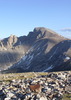
La Barge Canyon
Moderator: HAZ - Moderators
Linked Guides none
Linked Area, etc none
-
 rally_toadGuides: 22 | Official Routes: 3Triplogs Last: 1,063 d | RS: 60Water Reports 1Y: 0 | Last: never
 - Joined: May 17 2007 8:06 pm
- City, State: CA
La Barge Canyon
"Who are you guys??!!" -Farnsworth
contribute to this member driven resource
ie: RS > Save/Share after hikes 

-
 SuperstitionGuyGuides: 0 | Official Routes: 0Triplogs Last: 1,831 d | RS: 0Water Reports 1Y: 0 | Last: never
 - Joined: Dec 25 2005 8:24 pm
- City, State: Queen Creek, Arizona
Re: La Barge Canyon
If your not an experienced summer desert hiker/packbacker plan this trip for after October 1st!!
If you still want to do this trip, hike it at night starting about 1 AM in the morning and packing it in under a shade tree by 9 AM. And be sure to use a GPS that you are familiar with so you can avoid taking the wrong trails/washes etc. And drink mucho water the day before you start and every hour on the hour while you are out there...
If you still want to do this trip, hike it at night starting about 1 AM in the morning and packing it in under a shade tree by 9 AM. And be sure to use a GPS that you are familiar with so you can avoid taking the wrong trails/washes etc. And drink mucho water the day before you start and every hour on the hour while you are out there...
A man's body may grow old, but inside his spirit can still be as young and restless as ever.
- Garth McCann from the movie Second Hand Lions
Another victim of Pixel Trivia.
Current avatar courtesy of Snakemarks
- Garth McCann from the movie Second Hand Lions
Another victim of Pixel Trivia.
Current avatar courtesy of Snakemarks
contribute to this member driven resource
ie: RS > Save/Share after hikes
-
 te_waGuides: 3 | Official Routes: 0Triplogs Last: 4 d | RS: 2Water Reports 1Y: 0 | Last: 2,101 d
 - Joined: Aug 22 2003 9:16 pm
- City, State: Mesa
Re: La Barge Canyon
I would agree to stay out of the Supes entirely. I am quite experienced in that area and I wont be back there until late September. Its just a foolish endeavor IMO, and not worth the risk(s)
but, if you insist, take the Boulder trail down to Labarge, go left upstream across a boulder strewn creekbed until you see 2 pyramid shaped rocky hills on the left of creek, and you will find water here. At this point you are in the Lower LaBarge Box. I have never seen it dry, and the minnows in the creek tell me it stays all year. You can expect solitude after reaching the creekbed. There might be nice photo ops of Chuckwallas, Tortoise (if youre lucky) and birds of all sorts.
but, if you insist, take the Boulder trail down to Labarge, go left upstream across a boulder strewn creekbed until you see 2 pyramid shaped rocky hills on the left of creek, and you will find water here. At this point you are in the Lower LaBarge Box. I have never seen it dry, and the minnows in the creek tell me it stays all year. You can expect solitude after reaching the creekbed. There might be nice photo ops of Chuckwallas, Tortoise (if youre lucky) and birds of all sorts.
squirrel!
contribute to this member driven resource
ie: RS > Save/Share after hikes
-
rally_toadGuides: 22 | Official Routes: 3Triplogs Last: 1,063 d | RS: 60Water Reports 1Y: 0 | Last: never
- Joined: May 17 2007 8:06 pm
- City, State: CA
Re: La Barge Canyon
Thanks for the info. Obviously I will not be doing this during the heat of the day! I plan to get up very early and be out before noon. I am an experienced summer hiker and backpacker. Any more information would be appreciated.
"Who are you guys??!!" -Farnsworth
contribute to this member driven resource
ie: RS > Save/Share after hikes
-
 djui5Guides: 0 | Official Routes: 0Triplogs Last: none | RS: 0Water Reports 1Y: 0 | Last: never
 - Joined: May 18 2006 1:59 am
- City, State: Apache Junction, AZ
Re: La Barge Canyon
Please Please Please reconsider hiking into that range right now. Unless you've hiked into the main Superstition Mountain range during the summer, I'd highly recommend waiting at least until September. There isn't much open range back there, it's all valleys and canyons which hold heat in. It doesn't cool off at night back there, but stays hot 24 hrs a day. It starts getting really hot around 10AM, and won't cool down at all until well past 4-5PM if your lucky. You'll break a sweat at night hiking as it'll be 85-95 degrees at night. The rocks hold the heat in very well. It's like an oven, literally. There is no water in the canyons at all. The only place you'll find water is in the year round springs, and there are only a few in the entire range, tens of miles apart. The creeks back there don't flow unless it's been pouring rain for 2 days. It's DESERT. Hope I don't offend you as I saw your experienced, I'd tell anyone the same thing. It's not worth the risk as posted above, even if your only going a few miles. It only takes half a mile to dehydrate and pass out, then you're in serious trouble, especially back there.
On that note,
I'm attaching a map of the area you want to hike into. You'll probably see some snakes, but look in the shaded areas. They don't like the heat much.
On that note,
I'm attaching a map of the area you want to hike into. You'll probably see some snakes, but look in the shaded areas. They don't like the heat much.
- Attachments
-
- 1mormon_flat_dam.pdf
- (1.19 MiB) Downloaded 145 times
contribute to this member driven resource
ie: RS > Save/Share after hikes
-
 hikeazGuides: 6 | Official Routes: 0Triplogs Last: 1,245 d | RS: 0Water Reports 1Y: 0 | Last: 1,245 d
 - Joined: May 13 2002 10:07 am
- City, State: Tempe, AZ
- Contact:
Re: La Barge Canyon
Might I suggest this book.
It includes maps, detailed written descriptions and some history of the area(s) as well.
I'd suggest BUYING it if you plan to head out in the Sups much, but most libraries have a copy as well. Check it out! (no pun intended)
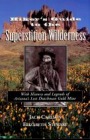
It includes maps, detailed written descriptions and some history of the area(s) as well.
I'd suggest BUYING it if you plan to head out in the Sups much, but most libraries have a copy as well. Check it out! (no pun intended)
"The censorship method ... is that of handing the job over to some frail and erring mortal man, and making him omnipotent on the assumption that his official status will make him infallible and omniscient."
George Bernard Shaw
George Bernard Shaw
contribute to this member driven resource
ie: RS > Save/Share after hikes
-
rally_toadGuides: 22 | Official Routes: 3Triplogs Last: 1,063 d | RS: 60Water Reports 1Y: 0 | Last: never
- Joined: May 17 2007 8:06 pm
- City, State: CA
Re: La Barge Canyon
Might anyone suggest a better place this time of year? I have been in the Sups just not that area I usually go in from Peralta Trailhead. I dont want to drive far because of gas prices. I am heading to Fossil Creek on the 22nd and 23rd. I dont want to drive far to the higher elevations. I am used to hiking in th desert this time of year. I have been hiking almost every weekend since the beginning of April at some of the Regional Parks and I just returned from a backpacking trip to Joshua Tree National Park.
I know the hazards that are involved with desert hiking (especially this time of year) and I am always well prepared. Thanks for posting you advice and concerns! This website is really useful!
I know the hazards that are involved with desert hiking (especially this time of year) and I am always well prepared. Thanks for posting you advice and concerns! This website is really useful!
"Who are you guys??!!" -Farnsworth
contribute to this member driven resource
ie: RS > Save/Share after hikes
-
te_waGuides: 3 | Official Routes: 0Triplogs Last: 4 d | RS: 2Water Reports 1Y: 0 | Last: 2,101 d
- Joined: Aug 22 2003 9:16 pm
- City, State: Mesa
Re: La Barge Canyon
You dont have to drive far to reach higher elevations and interesting places. You can do Mazatzal peak via Barnhardt trail or check into the Sierra Ancha. The Jug is an amazing place and has water for relaxing. Hells Hole is a nice spot too.
Fossil Springs is over 2x further than Browns Peak, and you can explore Four Peaks from miles of trails in that wilderness.
I was at fossil creek this past weekend and have to admit Im disgusted by the trash the (mostly) dayhikers leave behind. its a shame, and I hope the forest service initiates a permit-only entry such as Aravaipa. among the debris were Salt River Recreation inner tubes, rafts, old clothing and the dozens of water bottles that of course are way too heavy to take out now that they're empty. used toilet paper everywhere.
squirrel!
contribute to this member driven resource
ie: RS > Save/Share after hikes
-
djui5Guides: 0 | Official Routes: 0Triplogs Last: none | RS: 0Water Reports 1Y: 0 | Last: never
- Joined: May 18 2006 1:59 am
- City, State: Apache Junction, AZ
Re: La Barge Canyon
Well if you really hike that much in the intense heat, you'll probably be ok hiking a few miles down Boulder Canyon trail from the North by Canyon Lake. Just take it really really easy, and pay special attention to your hydration and heat level. Don't hike in too far either, keep it to a few miles one way at most.
Maybe take a trip up there and a small hike to see what it's like first.
Maybe take a trip up there and a small hike to see what it's like first.
contribute to this member driven resource
ie: RS > Save/Share after hikes
-
 HoffmasterGuides: 0 | Official Routes: 0Triplogs Last: 6,327 d | RS: 0Water Reports 1Y: 0 | Last: never
 - Joined: Oct 04 2002 11:13 pm
- City, State: Canton, OH
- Contact:
Re: La Barge Canyon
Dude, you sound like you know what you are doing, so I will answer your questions. Yes, it is about 3 miles to La Barge Canyon on the Boulder Canyon Trail. If you get to the Indian Paint Mine, you went too far. You will probably find water in the La Barge Box in some isolated pools and that is about it.rally_toad wrote: I am used to hiking in th desert this time of year. I just returned from a backpacking trip to Joshua Tree National Park. I know the hazards that are involved with desert hiking (especially this time of year) and I am always well prepared.
I would say that your chances of running into reptiles are fairly good. I've seen 3 or 4 different kinds of snakes and a variety of lizards in that area. Have fun! I hope you find what you are looking for.
Hopefully you aren't offended by the "Supes?! You're gonna die!" attitude in all of the previous posts. Most of us would shrivel up and die in about 10 minutes this time year (me included). So we are just concerned; we look out for each other on this site. I think we forget that there are people out there that can tolerate the heat.
"I'm not a vegetarian because I love animals; I'm a vegetarian because I hate plants." A. Whitney Brown
contribute to this member driven resource
ie: RS > Save/Share after hikes
-
SuperstitionGuyGuides: 0 | Official Routes: 0Triplogs Last: 1,831 d | RS: 0Water Reports 1Y: 0 | Last: never
- Joined: Dec 25 2005 8:24 pm
- City, State: Queen Creek, Arizona
Re: La Barge Canyon
To Rally_Toad:
Well did you go - we have been looking for your trip report and pictures...
Well did you go - we have been looking for your trip report and pictures...
A man's body may grow old, but inside his spirit can still be as young and restless as ever.
- Garth McCann from the movie Second Hand Lions
Another victim of Pixel Trivia.
Current avatar courtesy of Snakemarks
- Garth McCann from the movie Second Hand Lions
Another victim of Pixel Trivia.
Current avatar courtesy of Snakemarks
contribute to this member driven resource
ie: RS > Save/Share after hikes
-
rally_toadGuides: 22 | Official Routes: 3Triplogs Last: 1,063 d | RS: 60Water Reports 1Y: 0 | Last: never
- Joined: May 17 2007 8:06 pm
- City, State: CA
Re: La Barge Canyon
I havent been up yet. I plan to head up there this weekend. Hopefully it is cloudy and nice like it was today. I logged my first trip though. This site is awesome its got great info I wish I would have joined earlier. As over the weekend I did a early morning hike around Pass Mountain. The Pass Mountain Trail is a really nice, easy enjoyable hike, I also ended up finding a Regal Horned Lizard my first ever Regal! When I saw the Superstitions from the trail it really got me excited to go up and check out La Barge Canyon. Maybe it'll rain between now and when I go so we can find some water in the Creek!
"Who are you guys??!!" -Farnsworth
contribute to this member driven resource
ie: RS > Save/Share after hikes
-
rally_toadGuides: 22 | Official Routes: 3Triplogs Last: 1,063 d | RS: 60Water Reports 1Y: 0 | Last: never
- Joined: May 17 2007 8:06 pm
- City, State: CA
Re: La Barge Canyon
I headed out today!! It was quite an adventure!!!! The box was amazing and there was still quite a bit of water in 4-5 pools. Saw tons of Lizards and also tadpoles and amphibians... it was awesome to see aquatic leopard frogs somehow find a way to live in the hot , dry desert. Didnt see even one other hiker the entire day.
On the way up it was really tough because of the heat. When we got to the car... it wouldnt turn on! Turns out I left the lights on. Luckily some very nice Canyon Lake employee was kind enough to help jump start the car!!
It was fun but if you are going to do this hike (especially this time of year) be prepared. Train by doing some other easier hikes and work your way up. Bring plenty of water you will go through it quick!!
"Who are you guys??!!" -Farnsworth
contribute to this member driven resource
ie: RS > Save/Share after hikes