 Route Editor

Myself and another teacher have some time that we would like take and do a 3 day trip at lower elevation and over the Christmas holiday period. We had thought about the Verde River trail # 11, but neither of us has a vehicle that could make it to the trailhead based on the description of the access roads.
Do people have any hikes in mind that can be used as a 3 day trip, that hopefully have water on them, and are going to be somewhere below 3000' so they are warm?
Backpacking: end of year & @ low elevation
Moderator: HAZ - Moderators
Linked Guides none
Linked Area, etc none
-
 JimGuides: 76 | Official Routes: 39Triplogs Last: 5 d | RS: 94Water Reports 1Y: 7 | Last: 5 d
 - Joined: Sep 08 2006 8:14 pm
contribute to this member driven resource
ie: RS > Save/Share after hikes 

-
 rally_toadGuides: 22 | Official Routes: 3Triplogs Last: 1,063 d | RS: 60Water Reports 1Y: 0 | Last: never
 - Joined: May 17 2007 8:06 pm
- City, State: CA
Re: Backpacking: end of year & @ low elevation
Join us on the trans superstition hike on Jan 2-5!
"Who are you guys??!!" -Farnsworth
contribute to this member driven resource
ie: RS > Save/Share after hikes
-
JimGuides: 76 | Official Routes: 39Triplogs Last: 5 d | RS: 94Water Reports 1Y: 7 | Last: 5 d
- Joined: Sep 08 2006 8:14 pm
Re: Backpacking: end of year & @ low elevation
What elevations do you plan to cover? Still, that may be pushing it for him since its getting close to being back to school.
contribute to this member driven resource
ie: RS > Save/Share after hikes
-
rally_toadGuides: 22 | Official Routes: 3Triplogs Last: 1,063 d | RS: 60Water Reports 1Y: 0 | Last: never
- Joined: May 17 2007 8:06 pm
- City, State: CA
Re: Backpacking: end of year & @ low elevation
It would be mostly under 3000 feet elevation, or right at 3000 feet. We will be going above 3000 for the last stretch on the eastern side of the wilderness. But still not very high in elevation.
"Who are you guys??!!" -Farnsworth
contribute to this member driven resource
ie: RS > Save/Share after hikes
-
 Davis2001r6Guides: 6 | Official Routes: 14Triplogs Last: 5,912 d | RS: 0Water Reports 1Y: 0 | Last: never
 - Joined: Dec 06 2003 3:27 am
- City, State: Bordeaux, France
- Contact:
Re: Backpacking: end of year & @ low elevation
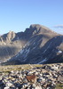
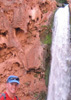
How about the Grand Canyon? Lots of options for 3 day trips down there along the tonto or the river. You'll be below 3k at the river, a little higher on the tonto though. I still wouldn't call it warm though as a lot of the side canyons don't see a lot of sun this time of year.
contribute to this member driven resource
ie: RS > Save/Share after hikes
-
JimGuides: 76 | Official Routes: 39Triplogs Last: 5 d | RS: 94Water Reports 1Y: 7 | Last: 5 d
- Joined: Sep 08 2006 8:14 pm
Re: Backpacking: end of year & @ low elevation
Since we will have a spring break at the same time we thought that the Canyon would be better left for slightly warmer and sunnier conditions in March. I can ask about the other trip but odds are its getting too late in the break to get out on the 5th.
contribute to this member driven resource
ie: RS > Save/Share after hikes
-
 JeffshadowsGuides: 28 | Official Routes: 7Triplogs Last: 4,282 d | RS: 0Water Reports 1Y: 0 | Last: 4,440 d
 - Joined: Jan 30 2008 8:46 am
- City, State: Old Pueblo
Re: Backpacking: end of year & @ low elevation
If the lower elevation is the goal, I'd suggest Cabeza Prieta or Aravaipa...
AD-AVGVSTA-PER-ANGVSTA
contribute to this member driven resource
ie: RS > Save/Share after hikes