the awesome hike....

Moderator: HAZ - Moderators

 Linked Guides none
 Linked Area, etc none
Post Reply
User avatar
Hikergirl81
Triplogs Last: 1,944 d | RS: 0
Water Reports 1Y: 0 | Last: never
Joined: Mar 03 2009 4:41 pm
City, State: Flagstaff, AZ

the awesome hike....

Post by Hikergirl81 »

So, I am sure this may be posted somewhere else but I couldn't find it. If you had to hike somewhere for the rest of your life OR you had 4 more hours to spend hiking in your life. (I know I am a nerd....) WHERE IS THE BEST PLACE TO HIKE IS ARIZONA?!
-JANELLE :A1:
*Note added: I have always been to shy to post a topic, however that night I had a little too much wine and decided to go for it. I REALLY thought I had deleted it but apparently not. :o I was glad to see the responses and I added my favorite place too! :)
Last edited by Hikergirl81 on Apr 23 2009 11:52 pm, edited 2 times in total.
I don't have a computer… Not because I'm against having one. Really just hasn't been a top priority on my gear list.
I am now attempting to navigate, post, reply (etc..) this site with only an iPhone… Wish me luck!
contribute to this member driven resource
ie: RS > Save/Share after hikes Route Scout GPS Topo Mapper on the App Store Route Scout GPS Topo Mapper on Google Play
User avatar
Jim
Guides: 73 | Official Routes: 36
Triplogs Last: 12 d | RS: 67
Water Reports 1Y: 9 | Last: 148 d
Joined: Sep 08 2006 8:14 pm

Re: the awesome hike....

Post by Jim »

In Arizona only? Sedona, because its nice year round, has good views, and offers a wide variety of types of hikes. It's also one of only 2 areas in the state I am pretty familiar with.
🍭
contribute to this member driven resource
ie: RS > Save/Share after hikes Route Scout GPS Topo Mapper on the App Store Route Scout GPS Topo Mapper on Google Play
User avatar
Jeffshadows
Guides: 28 | Official Routes: 7
Triplogs Last: 4,053 d | RS: 0
Water Reports 1Y: 0 | Last: 4,211 d
Joined: Jan 30 2008 8:46 am
City, State: Old Pueblo

Re: the awesome hike....

Post by Jeffshadows »

I suppose I'd die happy atop Mount Kimball...:D
AD-AVGVSTA-PER-ANGVSTA
contribute to this member driven resource
ie: RS > Save/Share after hikes Route Scout GPS Topo Mapper on the App Store Route Scout GPS Topo Mapper on Google Play
User avatar
Sredfield
Guides: 4 | Official Routes: 4
Triplogs Last: 55 d | RS: 0
Water Reports 1Y: 0 | Last: 509 d
Joined: Sep 08 2002 1:07 pm
City, State: Ahwatukee, AZ

Re: the awesome hike....

Post by Sredfield »

Oh, that's a very tough question because there are soooo many great places to hike in AZ, and elsewhere.
Shawn
The bear went over the mountain to see what he could see.
contribute to this member driven resource
ie: RS > Save/Share after hikes Route Scout GPS Topo Mapper on the App Store Route Scout GPS Topo Mapper on Google Play
User avatar
big_load
Guides: 0 | Official Routes: 1
Triplogs Last: 600 d | RS: 3
Water Reports 1Y: 0 | Last: 2,489 d
Joined: Oct 28 2003 11:20 am
City, State: Andover, NJ

Re: the awesome hike....

Post by big_load »

AZ has lots of best places. The best thing about it is not any particular one of them, but the endless variety of high-quality hiking.
contribute to this member driven resource
ie: RS > Save/Share after hikes Route Scout GPS Topo Mapper on the App Store Route Scout GPS Topo Mapper on Google Play
User avatar
Al_HikesAZ
Guides: 11 | Official Routes: 14
Triplogs Last: 1,042 d | RS: 0
Water Reports 1Y: 0 | Last: 3,182 d
Joined: May 16 2005 1:01 pm
City, State: Scottsdale, AZ
Contact:

Re: the awesome hike....

Post by Al_HikesAZ »

It depends on the season. And it depends on your fitness, skills and personality. Heaven for someone could be hell for another. There are hikes that jhodlof does that if I were 30 years younger would be heavenly but at my age might be deadly.
Anybody can make a hike harder. The real skill comes in making the hike easier.
life is like a roll of toilet paper. The closer it gets to the end, the faster it goes. Andy Rooney
contribute to this member driven resource
ie: RS > Save/Share after hikes Route Scout GPS Topo Mapper on the App Store Route Scout GPS Topo Mapper on Google Play
User avatar
Jim
Guides: 73 | Official Routes: 36
Triplogs Last: 12 d | RS: 67
Water Reports 1Y: 9 | Last: 148 d
Joined: Sep 08 2006 8:14 pm

Re: the awesome hike....

Post by Jim »

Al_HikesAZ wrote: There are hikes that jhodlof does that if I were 30 years younger would be heavenly but at my age might be deadly.
You're too kind.
🍭
contribute to this member driven resource
ie: RS > Save/Share after hikes Route Scout GPS Topo Mapper on the App Store Route Scout GPS Topo Mapper on Google Play
User avatar
nonot
Guides: 107 | Official Routes: 108
Triplogs Last: 23 d | RS: 0
Water Reports 1Y: 7 | Last: 23 d
Joined: Nov 18 2005 11:52 pm
City, State: Phoenix, AZ

Re: the awesome hike....

Post by nonot »

Before the flash flood, I would have said the 4 hours from Havasu campground to the Colorado, but that will take a half decade or more to recover.

Some great trips I've taken or want to do...and the time of year I should have done them if I went some other time.
Fish Creek backpack in January.
Labarge Box Loop in Feb.
20+ miles can be done in a day Sedona on a warmer day in March.
7 day,70+ mile backpack in the Grand Canyon in early April.
3.5 day, 45 mile backpack Wire Pass/Buckskin Gulch/Paria in late April.
Several Days Zion in May.
Inner Basin trail to the peak in June
Stay in Air/Conditioning July/Aug.
West Fork in September(still need to do this one).
Woods Canyon trail in September. (too hot in June)
Havasu Canyon in October (when it recovers).
Reavis Ranch/Circlestone in November.
Full Peter's Canyon in December.

So that's like a hiking calendar :D

One day I would like to do a big loop from Fossil Creek over to the Verde trail, I think that would take about 4 days though.

Also, a full descent of the Tonto from 87 through the Narrows might be a 3 day trip, but that would be fun.

Caves can be done any time of the year. Canyons are really fun when they aren't creating hypothermic conditions.

<edited>, I keep remembering more great hikes.
http://hikearizona.com/garmin_maps.php

Hike Arizona it is full of sharp, pointy, ankle-twisting, HAZmaster crushing ROCKS!!
Hike Arizona it is full of sharp, pointy, shin-stabbing, skin-shredding plants!
Hike Arizona it is full of striking, biting, stabbing, venomous wildlife!
contribute to this member driven resource
ie: RS > Save/Share after hikes Route Scout GPS Topo Mapper on the App Store Route Scout GPS Topo Mapper on Google Play
User avatar
Davis2001r6
Guides: 6 | Official Routes: 15
Triplogs Last: 5,683 d | RS: 0
Water Reports 1Y: 0 | Last: never
Joined: Dec 06 2003 3:27 am
City, State: Bordeaux, France
Contact:

Re: the awesome hike....

Post by Davis2001r6 »

The grand canyon has never disappointed me in 20+ trips there. Although some places I've seen in the Sierra's equally as nice just a further drive away.
contribute to this member driven resource
ie: RS > Save/Share after hikes Route Scout GPS Topo Mapper on the App Store Route Scout GPS Topo Mapper on Google Play
User avatar
RedRoxx44
Guides: 5 | Official Routes: 0
Triplogs Last: 5 d | RS: 0
Water Reports 1Y: 0 | Last: 6,298 d
Joined: Feb 15 2003 8:07 am
City, State: outside, anywhere

Re: the awesome hike....

Post by RedRoxx44 »

100 miles in the Gila
Highline trail in the Uintahs
Gannet Peak area in the Winds ( this one might happen this July)
Float the Dirty Devil River ( working on it)
A full week in the Galiuros and do both East and West Divide and down the middle.
Get past the sump in a long water cave on the rim and do some photography, the one time we backwalled it I had no camera---and it's one of the most beautiful caves I've seen.
Three backpacking trips in Utah pending.
Go back to a place I was on this weekend Sun and check more of that out--it's always something
contribute to this member driven resource
ie: RS > Save/Share after hikes Route Scout GPS Topo Mapper on the App Store Route Scout GPS Topo Mapper on Google Play
User avatar
nonot
Guides: 107 | Official Routes: 108
Triplogs Last: 23 d | RS: 0
Water Reports 1Y: 7 | Last: 23 d
Joined: Nov 18 2005 11:52 pm
City, State: Phoenix, AZ

Re: the awesome hike....

Post by nonot »

Float the Dirty Devil River ( working on it)
The logistics of this one are difficult, I'd be interested in hearing what you are planning??
http://hikearizona.com/garmin_maps.php

Hike Arizona it is full of sharp, pointy, ankle-twisting, HAZmaster crushing ROCKS!!
Hike Arizona it is full of sharp, pointy, shin-stabbing, skin-shredding plants!
Hike Arizona it is full of striking, biting, stabbing, venomous wildlife!
contribute to this member driven resource
ie: RS > Save/Share after hikes Route Scout GPS Topo Mapper on the App Store Route Scout GPS Topo Mapper on Google Play
User avatar
RedRoxx44
Guides: 5 | Official Routes: 0
Triplogs Last: 5 d | RS: 0
Water Reports 1Y: 0 | Last: 6,298 d
Joined: Feb 15 2003 8:07 am
City, State: outside, anywhere

Re: the awesome hike....

Post by RedRoxx44 »

This thought has come about because I know another crazy person who is willing to go along, logistics aren't that bad. Need high water which will be about May, and maybe later in summer after monsoons. Put in out of Hanksville then take out at either Poison Springs Canyon or near Hite at Lake Powell.
Web account of a guy who did this solo and hitchhiked back to Hanksville. I've backpacked along several sections of this river, in the Robbers Roost system, down to No Mans and Larry and from Poison Springs road to Fiddler Cove and Hatch canyons and into Happy Canyon narrows.
My partner in crime is not available this May---my plan is to be in Utah from about May 9-19th---so I have a backpack planned in the Swell, then if all goes well a return to Dark Canyon and I would like to get into Sam Mesa Box and Twin Corral canyons along the Dirty Devil from Burr Point.
But, as per my usual, who knows what will happen, I'll know as I drive up there.
contribute to this member driven resource
ie: RS > Save/Share after hikes Route Scout GPS Topo Mapper on the App Store Route Scout GPS Topo Mapper on Google Play
User avatar
hippiepunkpirate
Guides: 25 | Official Routes: 23
Triplogs Last: 278 d | RS: 0
Water Reports 1Y: 0 | Last: 3,651 d
Joined: May 30 2008 7:43 am
City, State: Peoria, AZ
Contact:

Re: the awesome hike....

Post by hippiepunkpirate »

I agree with Jim....you can't beat Sedona for the year-round credentials.
contribute to this member driven resource
ie: RS > Save/Share after hikes Route Scout GPS Topo Mapper on the App Store Route Scout GPS Topo Mapper on Google Play
User avatar
azbackpackr
Guides: 27 | Official Routes: 23
Triplogs Last: 83 d | RS: 0
Water Reports 1Y: 0 | Last: 776 d
Joined: Jan 21 2006 6:46 am
City, State: Eagar AZ

Re: the awesome hike....

Post by azbackpackr »

The trouble with Sedona is having to suffer from looking at all the honky, pretentious eyesores on the hillsides before you get to the hike. It always makes me feel a little ill. That whole area SHOULD have been a National Park, but the government didn't buy it all up back when they had the chance.

About a quarter of the hikes on the lists were not in Arizona! Hmmmm....

In a perfect world without Indian Reservations, I'd pick Havasu Falls/Mooney Falls.

In a less-than-perfect world I'd have to agree it is hard to choose. Time of year, mood, etc.

Sometimes the best hike is the one where you are feeling the best. Maybe your health, fitness and well-being at that moment, combined with whatever good landscape is at hand makes for the greatest joy and satisfaction. Throw in a couple of great pals, or alternatively, a blissful solo experience, and you have what I like best about hiking.

I do have a real affinity for the Canyon. Didn't go last year, alas. Plan to go in Oct. I always feel very elated upon arrival, and often stay that way for a good portion of the trip, unless I get extremely tired.
There is a point of no return unremarked at the time in most lives. Graham Greene The Comedians
A clean house is a sign of a misspent life.
contribute to this member driven resource
ie: RS > Save/Share after hikes Route Scout GPS Topo Mapper on the App Store Route Scout GPS Topo Mapper on Google Play
User avatar
BobP
Guides: 2 | Official Routes: 17
Triplogs Last: today | RS: 58
Water Reports 1Y: 4 | Last: 234 d
Joined: Feb 26 2008 3:43 pm
City, State: Scottsdale, AZ

Re: the awesome hike....

Post by BobP »

I'd go back to where I just came from
Keebler's HQ(Elves Chasm)
https://www.seeitourway.org
Always pronounce Egeszsegedre properly......
If you like this triplog you must be a friend of BrunoP
contribute to this member driven resource
ie: RS > Save/Share after hikes Route Scout GPS Topo Mapper on the App Store Route Scout GPS Topo Mapper on Google Play
User avatar
JoelHazelton
Guides: 16 | Official Routes: 1
Triplogs Last: 21 d | RS: 1
Water Reports 1Y: 2 | Last: 82 d
Joined: Mar 22 2006 7:45 am
City, State: Phoenix, AZ
Contact:

Re: the awesome hike....

Post by JoelHazelton »

I'm inspired by new exploration, not going back to places I know, so I'd choose anywhere remote with a waterfall that I've never seen before. Preferably in Arizona.
"Arizona is the land of contrast... You can go from Minnesota to California in a matter of minutes, then have Mexican food that night." -Jack Dykinga

http://www.joelhazelton.com
contribute to this member driven resource
ie: RS > Save/Share after hikes Route Scout GPS Topo Mapper on the App Store Route Scout GPS Topo Mapper on Google Play
User avatar
writelots
Guides: 19 | Official Routes: 3
Triplogs Last: 1,167 d | RS: 3
Water Reports 1Y: 0 | Last: 1,167 d
Joined: Nov 22 2005 2:20 pm
City, State: Tucson, AZ
Contact:

Re: the awesome hike....

Post by writelots »

azpride wrote:I'm inspired by new exploration, not going back to places I know, so I'd choose anywhere remote with a waterfall that I've never seen before. Preferably in Arizona.
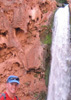
Did I include this one in my photo set? I don't remember. Now, I'm not much of a bushwacker by history - but it would be amazing to find a way out to this waterfall in the Catalinas (I think on Lemmon Creek)
Zoomed in
Zoomed in
Zoomed Out
Zoomed Out
Other than that... well, it is hard to beat the GC - I mean, we are SO lucky to have one of the wonders of the natural world in our backyard. But, then, there are lesser known, hidden jewels that I love in different ways, too. The Chiricahuas are one of my favorite destinations, and I intend to spend a lot more time down there soon. Even the National Monument almost never feels "crowded" like the more visited parts of the GC.

Jordan Hot Springs NM is my favorite weekend backpacking trip as well as my favorite place to hike with my dog.
-----------------------------------
Change will not come if we wait for some other person or some other time. We are the ones we've been waiting for. We are the change that we seek.- Barack Obama
contribute to this member driven resource
ie: RS > Save/Share after hikes Route Scout GPS Topo Mapper on the App Store Route Scout GPS Topo Mapper on Google Play
User avatar
Jim
Guides: 73 | Official Routes: 36
Triplogs Last: 12 d | RS: 67
Water Reports 1Y: 9 | Last: 148 d
Joined: Sep 08 2006 8:14 pm

Re: the awesome hike....

Post by Jim »

I hear a lot of people say the Red Rocks area around Sedona should have been a National Park. I'm glad its not a park. I don't like the Red Rocks Pass (which is only $20 for a yearly pass at the Bashas or Safeway), but think of how annoying access would be if it were a park, how much more expensive it would be to visit there from outside the area, and how much busier it would be if it were a NP since that designation always seems to attract the fat, slack jawed, gawking tourists who drive around in their RV's and Minivans to do nothing more than take a picture at a designated view point. Its bad enough as it is in Sedona with those people clogging up trailheads for Wilson Mt, Doe and Bear Mt, and Boynton Canyon, or doing 20 mph through Oak Creek Canyon. Uptown Sedona is a ridiculous monstrosity of so called upscale restaurants and boutiques, but think of how annoying it would be if I could think of how bad it would be if that area were a NP! I guess it would be less pretentious, and that would definetly be a good thing.
I like Sedona the way it is. Its an attractive town, far more attractive than run down, worn out railroad towns like Flag. Compare 89A to RT 66 and its like Scottsdale to some valley town which is ugly. There are some good restaurants, and access is pretty good to most points I want to visit. Plus, the development is pushing south on 89A so it isn't having much impact on Sedona from my perspective. Its also nice to think that there is potentially the option to live in the Sedona area, without having to stoop to Cottonwood. I couldn't live in Sedona if were a park.
🍭
contribute to this member driven resource
ie: RS > Save/Share after hikes Route Scout GPS Topo Mapper on the App Store Route Scout GPS Topo Mapper on Google Play
User avatar
Davis2001r6
Guides: 6 | Official Routes: 15
Triplogs Last: 5,683 d | RS: 0
Water Reports 1Y: 0 | Last: never
Joined: Dec 06 2003 3:27 am
City, State: Bordeaux, France
Contact:

Re: the awesome hike....

Post by Davis2001r6 »

I stay away from Sedona as much as I can. Sure it's "only $20" for a pass. But guess what, $75? for a NP Pass, AZ State Parks Pass, Catalina, Madera Canyon, Red Rock, Tonto Pass, West Fork....all those little passes and fee's add up to a lot of money. Sedona is a tourist trap in my book, having to pay money to park on the side of the road to take a picture is ridiculous.
contribute to this member driven resource
ie: RS > Save/Share after hikes Route Scout GPS Topo Mapper on the App Store Route Scout GPS Topo Mapper on Google Play
User avatar
Dschur
Guides: 13 | Official Routes: 0
Triplogs Last: 3,205 d | RS: 0
Water Reports 1Y: 0 | Last: never
Joined: Oct 25 2002 4:29 pm
City, State: Payson, AZ
Contact:

Re: the awesome hike....

Post by Dschur »

davis2001r6 wrote:having to pay money to park on the side of the road to take a picture is ridiculous.
The pass isn't intended for these people
A pass is not required for incidental stopping to take a photograph or to enjoy a scenic vista (approximately 15 minutes or less).
This is from the Redrock Pass website....

Also if you have the America the Beautiful Pass you don't need a Redrock Pass only the National one...
Dawn
--On the loose to climb a mountain, on the loose where I am free. On the loose to live my life the way I think my life should be...For we only have a moment and a whole world yet to see...I'll be looking for tomorrow on the loose. ---unknown--
contribute to this member driven resource
ie: RS > Save/Share after hikes Route Scout GPS Topo Mapper on the App Store Route Scout GPS Topo Mapper on Google Play
Post Reply

Return to “Looking for a Hike”