 Route Editor

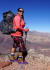
Shawn & I plan on hiking AZ Trail Passage #36 - Coconino Rim on July 11-12 with a car camp mid way on FR310 breaking up the distance into 2 days for some moderate hiking. Come hike with us for a day or 2...
Location: Grandview Lookout to Moqui Stage Stop
Length: 19.0 miles
We will be hiking from Grandview Lookout to Moqui Stage Stop -- Its all downhill -- from about 7500ft down to 6800 ft or so. Northern segements pass through Ponderosa Pine /Gambel Oaks; Southern section is more scrub and grasslands.
Day1) Coconino Rim Trail: GrandView Lookout Tower to crossing of Forest Road 310 (9.1 miles) The road back to start point is 6.8 miles on FR310 ( so we can camp along FR 310 or at suitably located campground in the area in a nice wooded area - Precise location TBD)
Day 2) Russell Wash Trail: FR 310 to Moqui Stage Station (8.2 miles)We will have figure out car tricks
Likely Camp somewhere on Friday night so we can start early on Saturday. Saturday night will be a car camp as well
AZT Segment #36 - Grandview Lookout to Moqui Stage Stop
Moderators: HAZ Group Coordinators, HAZ - Moderators
Linked Guides none
-
 desertgirlGuides: 20 | Official Routes: 0Triplogs Last: 389 d | RS: 8Water Reports 1Y: 0 | Last: 3,987 d
 - Joined: Mar 31 2002 5:44 pm
- City, State: Chandler, AZ
AZT Segment #36 - Grandview Lookout to Moqui Stage Stop
- Attachments
-
- Look See
contribute to this member driven resource
ie: RS > Save/Share after hikes 

-
 chumleyGuides: 94 | Official Routes: 239Triplogs Last: 6 d | RS: 71Water Reports 1Y: 98 | Last: 6 d
 - Joined: Sep 18 2002 8:59 am
- City, State: Tempe, AZ
Re: AZT Segment #36 - Grandview Lookout to Moqui Stage Stop
Be advised that there is a closure there right now due to an active fire. It is likely that they will try to reopen the trail at the conclusion of the fire but sometimes it takes time for them to clear the trail and cut down any dangerous burned trees. Make sure to call the FS before heading out.
June 10, 2009
PUBLIC SAFETY ADVISORY
RUBY FIRE
WILLIAMS, Ariz. – Please be advised that the Ruby Fire is burning near the Arizona Trail approximately 2 miles southwest of Grandview Lookout on the Tusayan Ranger District. Concern for public safety makes it necessary to close a 4-mile section of the Arizona Trail until conditions change.
Until further notice, the trail is closed from Watson Tank to Grandview trailhead. Signs are in place advising trail users of an alternate route until this segment can be re-opened. The re-route is south on FR 303 right before Watson Tank to FR 302. Follow road 302 to Skinner Tank, and then go north on the closed portion of FR 302 to Grandview trailhead.
The Ruby Fire is 1,550 acres, 6 miles southeast of Tusayan and moving north toward the Arizona Trail.
For further information, please visit http://www.inciweb.org/incident/1669/ or contact the Kaibab National Forest, (928-635-5653)
I'm not sure what my spirit animal is, but I'm confident it has rabies.
contribute to this member driven resource
ie: RS > Save/Share after hikes
-
 SredfieldGuides: 4 | Official Routes: 4Triplogs Last: 62 d | RS: 0Water Reports 1Y: 0 | Last: 691 d
 - Joined: Sep 08 2002 1:07 pm
- City, State: Ahwatukee, AZ
Re: AZT Segment #36 - Grandview Lookout to Moqui Stage Stop
That stinks!
Shawn
The bear went over the mountain to see what he could see.
The bear went over the mountain to see what he could see.
contribute to this member driven resource
ie: RS > Save/Share after hikes
-
 sirenaGuides: 2 | Official Routes: 2Triplogs Last: 3,634 d | RS: 0Water Reports 1Y: 0 | Last: 3,715 d
 - Joined: Feb 12 2008 8:04 pm
- City, State: Tucson, AZ
- Contact:
Re: AZT Segment #36 - Grandview Lookout to Moqui Stage Stop
This fire doesn't affect the passage you are planning, it sounds like the closure is on the beginning of the next segment north #37.
contribute to this member driven resource
ie: RS > Save/Share after hikes
-
SredfieldGuides: 4 | Official Routes: 4Triplogs Last: 62 d | RS: 0Water Reports 1Y: 0 | Last: 691 d
- Joined: Sep 08 2002 1:07 pm
- City, State: Ahwatukee, AZ
Re: AZT Segment #36 - Grandview Lookout to Moqui Stage Stop
Oh, the pleasing aroma!
Shawn
The bear went over the mountain to see what he could see.
The bear went over the mountain to see what he could see.
contribute to this member driven resource
ie: RS > Save/Share after hikes
-
desertgirlGuides: 20 | Official Routes: 0Triplogs Last: 389 d | RS: 8Water Reports 1Y: 0 | Last: 3,987 d
- Joined: Mar 31 2002 5:44 pm
- City, State: Chandler, AZ
Re: AZT Segment #36 - Grandview Lookout to Moqui Stage Stop
I drove the route 6/27-- Day 1 should be easy. The terrain is very flat ( really) & should be quite shady. There is good camping near the trail head ( Grandview Lookout).
My recommendation : We camp at TH -- catch sunset at Grandview point and then head to camp. Excellent road to TH from within park.
The trail keeps with in 1/4 mile or so of the road. There is parking on FR 310 where AZ trail crosses. We can camp in the vicinity as well ....
Day 2: It will likely be more challenging than Day 1 ( trail follows the wash) - rocky since the road bed was more rough after Russell tank (Road's nice upto Russell Wash & there's a pit toilet at Russell tank). Roads get more rough -- I did make it to Moqui Stage Stop and back out via Red Butte. Some rough roads (ruts) that will get muddy after rains. I think taking 320 in will be best bet -- minimize driving on rougher roads getting to Moqui..( I drove 305B and 319 and these were rather rough n rutted --- nothing I had issues with but after a good rain it will be a mud pit for sure). Significant portions of the trail will be in shade from what I can tell...trail is well signed wherver it crosses the roads and in general roads are well signed as well.
There was no sign of fires in the area or any damage due the recent fire.
I am hoping for no fires and limited rain and a great hike. Full moon is 7th so we should have some good moonlight as well
Note: Cars will not do well on Day 2 -- need high clearance
If folks that are signed up are still interested -- contact me via Pm with a way to reach you & we can discuss details.
contribute to this member driven resource
ie: RS > Save/Share after hikes
-
 suzazGuides: 1 | Official Routes: 0Triplogs Last: 3,212 d | RS: 0Water Reports 1Y: 0 | Last: never
 - Joined: Nov 23 2003 1:19 pm
- City, State: Gold Canyon, AZ
Re: AZT Segment #36 - Grandview Lookout to Moqui Stage Stop
Posting this for Ambika as she is in route.
-- Camp is just past the Lookout tower. Its just where the 1st road that heads to the right off FR 310 as you head south on FR310. Its a nice site with fire ring etc! Linda will have her tent up. I am car camping
http://maps.google.com/maps?f=q&source= ... 2&t=p&z=15
Meeting at the Grandview Lookout Tower trailhead @ 7am on Saturday, July 11th.
contribute to this member driven resource
ie: RS > Save/Share after hikes
-
desertgirlGuides: 20 | Official Routes: 0Triplogs Last: 389 d | RS: 8Water Reports 1Y: 0 | Last: 3,987 d
- Joined: Mar 31 2002 5:44 pm
- City, State: Chandler, AZ
Re: AZT Segment #36 - Grandview Lookout to Moqui Stage Stop
This is a delightfully easy segement of the AZ trail -- the entire segment can easily be done as a day hike. The trail is well marked, generally flat and not rocky at all...Access to both start and end is straight forward. From Moqui heading back to Bucklar & taking FR320 to exit is the quickest way out from Moqui Stage Stop.
contribute to this member driven resource
ie: RS > Save/Share after hikes