Bag Me a Peak!

Day Hiking & general trail related

Moderator: HAZ - Moderators

 Linked Guides none
 Linked Area, etc none
User avatar
Hippy
Guides: 8 | Official Routes: 1
Triplogs Last: 863 d | RS: 8
Water Reports 1Y: 0 | Last: 1,034 d
Joined: Dec 02 2009 10:08 am
City, State: Grand Canyon
Contact:

Bag Me a Peak!

Post by Hippy »

My Bucket List...peakbaggers.com lists 89 Arizona Wilderness Peaks from Humphrey's at 12,637ft down to Imperial Refuge at peak 1085ft.
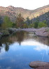
http://www.peakbagger.com/list.aspx?lid=18412

'I'm sure there are many others and perhaps some of these are not as tasty but I think I'd like to bag a couple...
what are your thoughts on the list (starting with 10 to choose from) and the selected routes.
don't mind all the little notes, those are for myself later on when i forget things :D

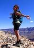
10. Humphrey's Peak via Summit Trail 151 (12,637 ft)
9. Mount Baldy via Mount Baldy Loop (11,400 ft)
8. Escudilla via Government Trail (10,912 ft)
7. Mount Trumbull via Mount Trumbull Trail (8029 ft)
6. Mazatzal Peak via Mazatzal Summit trail (7903 ft)
5. Aztec Peak via Abbey's Way 151 Loop (7748 ft)
4. Baboquivari Peak via western approach (7734 ft) *technical climb to reach peak*
3. Mar Benchmark (7355 ft) unknown route?! - highest point in Paria Canyon-Vermilon cliffs wilderness
2. Mound Mountain via Peak trail (6266 ft) 18 miles **Superstitions!** :D

and...hmmmm
Signal Peak? Table Top? Mount Ajo? Sugarloaf Mountain? I can't decide...

for arugments sake and my love of the area...I choose.

1. Sugarloaf Mountain via the peak trail (3418 ft) a whole mile long peak hike :sweat:

i think highest recorded hike we've done recently is 5057 at Superstition Peak...looks like it's time we join in with the BIG kokopellis for some big mountains!
contribute to this member driven resource
ie: RS > Save/Share after hikes Route Scout GPS Topo Mapper on the App Store Route Scout GPS Topo Mapper on Google Play
User avatar
Tortoise_Hiker
Guides: 1 | Official Routes: 5
Triplogs Last: 2 d | RS: 68
Water Reports 1Y: 0 | Last: 3,115 d
Joined: Apr 02 2005 1:30 pm
City, State: Mesa, AZ

Re: Bag Me a Peak!

Post by Tortoise_Hiker »

:o Wow I got some work to do. I have only 5 of those. Escudilla burned last year(a shame) and I'm not sure if they let hikers up there. Good luck!
Tortoise Hiking. Stop and smell the Petrichor.
contribute to this member driven resource
ie: RS > Save/Share after hikes Route Scout GPS Topo Mapper on the App Store Route Scout GPS Topo Mapper on Google Play
User avatar
hippiepunkpirate
Guides: 25 | Official Routes: 23
Triplogs Last: 279 d | RS: 0
Water Reports 1Y: 0 | Last: 3,652 d
Joined: May 30 2008 7:43 am
City, State: Peoria, AZ
Contact:

Re: Bag Me a Peak!

Post by hippiepunkpirate »

Tortoise Hiker wrote: Wow I got some work to do. I have only 5 of those.
Well get on it already, Denny
contribute to this member driven resource
ie: RS > Save/Share after hikes Route Scout GPS Topo Mapper on the App Store Route Scout GPS Topo Mapper on Google Play
User avatar
PatrickL
Guides: 7 | Official Routes: 32
Triplogs Last: 3 d | RS: 0
Water Reports 1Y: 1 | Last: 14 d
Joined: Jan 10 2010 4:25 pm
City, State: Pomona, CA
Contact:

Re: Bag Me a Peak!

Post by PatrickL »

Tortoise Hiker wrote:Escudilla burned last year(a shame) and I'm not sure if they let hikers up there.
Didn't realize it was closed. I was looking forward to heading there over the summer. :(
contribute to this member driven resource
ie: RS > Save/Share after hikes Route Scout GPS Topo Mapper on the App Store Route Scout GPS Topo Mapper on Google Play
User avatar
azbackpackr
Guides: 27 | Official Routes: 23
Triplogs Last: 84 d | RS: 0
Water Reports 1Y: 0 | Last: 777 d
Joined: Jan 21 2006 6:46 am
City, State: Eagar AZ

Re: Bag Me a Peak!

Post by azbackpackr »

Not much to see up Escudilla other than the view, even if they do open it. It really took a beating. The backside of it (the New Mexico side) didn't burn, I'm told. A family member took a drive around the "backside" dirt road, said it's still really nice over there. But the popular side with the trails did burn. Here's a list of Alpine Ranger District areas open and closed. (Note this list is only the Alpine District. There are 4 other RD's in the Apache-Sitgreaves.)
http://www.fs.usda.gov/Internet/FSE_DOC ... 316295.pdf
Attachments
images.jpg
There is a point of no return unremarked at the time in most lives. Graham Greene The Comedians
A clean house is a sign of a misspent life.
contribute to this member driven resource
ie: RS > Save/Share after hikes Route Scout GPS Topo Mapper on the App Store Route Scout GPS Topo Mapper on Google Play
User avatar
PatrickL
Guides: 7 | Official Routes: 32
Triplogs Last: 3 d | RS: 0
Water Reports 1Y: 1 | Last: 14 d
Joined: Jan 10 2010 4:25 pm
City, State: Pomona, CA
Contact:

Re: Bag Me a Peak!

Post by PatrickL »

Man, that photo is so bleak. I had looked at some of the photosets of Escudilla and later realized it was blazed in the fire. That said, I still want to hike it. I'll be patiently waiting out the trail closures...
contribute to this member driven resource
ie: RS > Save/Share after hikes Route Scout GPS Topo Mapper on the App Store Route Scout GPS Topo Mapper on Google Play
User avatar
mazatzal
Guides: 0 | Official Routes: 6
Triplogs Last: 51 d | RS: 1
Water Reports 1Y: 0 | Last: 625 d
Joined: Jul 28 2004 2:18 pm
City, State: Scottsdale, AZ

Re: Bag Me a Peak!

Post by mazatzal »

@Tortoise Hiker
5 summits out of 9 for me - let's go... except prob different ones. :lol:
contribute to this member driven resource
ie: RS > Save/Share after hikes Route Scout GPS Topo Mapper on the App Store Route Scout GPS Topo Mapper on Google Play
User avatar
azbackpackr
Guides: 27 | Official Routes: 23
Triplogs Last: 84 d | RS: 0
Water Reports 1Y: 0 | Last: 777 d
Joined: Jan 21 2006 6:46 am
City, State: Eagar AZ

Re: Bag Me a Peak!

Post by azbackpackr »

Mark Nichols of Benson used to have the ultimate peak list for AZ, would send it to you if you email him. He compiled it along with Bob Martin who wrote the book Arizona's Mountains. Bob died a couple of years ago. The list divides the state into quadrants. There are over 4,000 peaks on it.

That Peakbaggers list is only for ones that are in a designated wilderness area. I have to say, who cares if it's in one of those silly little wildernesses? I like to hike peaks, I don't ask if they have a mostly useless government designation (useless because most of the wilderness areas in AZ are too small to do the job of preserving an ecosystem.)

Here are peaks listed by elevation: http://www.mountainzone.com/mountains/h ... s.asp?s=AZ As you can see, very different than the wilderness-only list. Here's a wiki list, extremely incomplete: http://en.wikipedia.org/wiki/List_of_mo ... _5000_feet

Southern Arizona Hiking Club has a list of 400 peaks you can climb with the club. They give out patches for 400. Also for 25, 50, 100 and so forth.) If you're a member and the club isn't doing a peak you want, you can become one of their guides fairly easily, and lead the hikes yourself. http://www.sahcinfo.org

County Highpointers go all over the US, climb the county high points. http://www.cohp.org/

I personally think Kendrick Peak is a pretty good replacement for Escudilla. It really kind of reminds me of Escudilla, and is a more substantial hike as well. I have made it up the Escudilla trail in less than an hour. It's only 3 miles one way. Kendrick is more, 4.5.
There is a point of no return unremarked at the time in most lives. Graham Greene The Comedians
A clean house is a sign of a misspent life.
contribute to this member driven resource
ie: RS > Save/Share after hikes Route Scout GPS Topo Mapper on the App Store Route Scout GPS Topo Mapper on Google Play
User avatar
Hippy
Guides: 8 | Official Routes: 1
Triplogs Last: 863 d | RS: 8
Water Reports 1Y: 0 | Last: 1,034 d
Joined: Dec 02 2009 10:08 am
City, State: Grand Canyon
Contact:

Re: Bag Me a Peak!

Post by Hippy »

thanks az! Good info! I personally like the "wilderness" destinations myself, but you're right about Kendrick Peak! I might edit that in there, and i did not even think about Escudilla being closed due to the fire! *doh!*

I'll look into that list of 4000 as well! AWESOME! I love peaks, sadly I don't get enough time to hike as many as I want and my daughter (she's only 4 years old!) can't quite come along on all of them but I still wanna bag as many as i can.
contribute to this member driven resource
ie: RS > Save/Share after hikes Route Scout GPS Topo Mapper on the App Store Route Scout GPS Topo Mapper on Google Play
User avatar
Tough_Boots
Guides: 0 | Official Routes: 6
Triplogs Last: 2,464 d | RS: 20
Water Reports 1Y: 0 | Last: 2,604 d
Joined: Mar 28 2008 7:08 pm
City, State: Phoenix, AZ

Re: Bag Me a Peak!

Post by Tough_Boots »

That's a good list to shoot for. I've only hit three of those. Mound Mountain is getting bagged very very soon though :D
contribute to this member driven resource
ie: RS > Save/Share after hikes Route Scout GPS Topo Mapper on the App Store Route Scout GPS Topo Mapper on Google Play
User avatar
Hippy
Guides: 8 | Official Routes: 1
Triplogs Last: 863 d | RS: 8
Water Reports 1Y: 0 | Last: 1,034 d
Joined: Dec 02 2009 10:08 am
City, State: Grand Canyon
Contact:

Re: Bag Me a Peak!

Post by Hippy »

I've done Mound Mtn & Sugarloaf before but I want them on my list anyway because I was but a youngling! Maybe 10 or 11 when my dad and his hiking buddies to me up, it was fuuun! Hence my love of the area I think.
When are you bagging Mound Mtn Tough Boots?
contribute to this member driven resource
ie: RS > Save/Share after hikes Route Scout GPS Topo Mapper on the App Store Route Scout GPS Topo Mapper on Google Play
User avatar
Hippy
Guides: 8 | Official Routes: 1
Triplogs Last: 863 d | RS: 8
Water Reports 1Y: 0 | Last: 1,034 d
Joined: Dec 02 2009 10:08 am
City, State: Grand Canyon
Contact:

Re: Bag Me a Peak!

Post by Hippy »

I think I'd like to hit Sugarloaf sometime soon, it's pretty much "in season" right now...right?

Also, as to Aztec peak, i know it's in the Sierra Anchan area? Would anyone think it would make a better day hike or a 2 day/1 night trip with a side trip to some surrounding ruins or anything? Any ideas on that?
contribute to this member driven resource
ie: RS > Save/Share after hikes Route Scout GPS Topo Mapper on the App Store Route Scout GPS Topo Mapper on Google Play
User avatar
CannondaleKid
Guides: 44 | Official Routes: 47
Triplogs Last: 5 d | RS: 0
Water Reports 1Y: 3 | Last: 66 d
Joined: May 04 2004 8:39 pm
City, State: Mesa, AZ
Contact:

Re: Bag Me a Peak!

Post by CannondaleKid »

HippyHaley wrote:Also, as to Aztec peak, i know it's in the Sierra Anchan area? Would anyone think it would make a better day hike or a 2 day/1 night trip with a side trip to some surrounding ruins or anything? Any ideas on that?
Although I've been easily able to do the Abbey's Way 151 loop to Aztec Peak in a day, due to the length of the drive to get there you'll have much more time for side trips if you stay overnight.

Late October '10 Tracey and I hiked Pueblo Canyon from below on one day, then drove back to Young Highway and up to Workman Falls, camped there overnight and hiked to the Murphy Overlook the next day. That way we got to see the ruins from above and below.

I think Aztec Peak one day then Coon Creek and Nordhoff-Hope ruins the next day would get you to two ruins. Or even add the lower Coon Creek ruins and have 3 in one day. If you have a reasonable clearance 4x4 you can cheat a little (like we did on another occasion driving my Pathfinder) and save time by driving within .5 mile of the upper Coon Creek ruins.
CannondaleKid
contribute to this member driven resource
ie: RS > Save/Share after hikes Route Scout GPS Topo Mapper on the App Store Route Scout GPS Topo Mapper on Google Play
User avatar
Hippy
Guides: 8 | Official Routes: 1
Triplogs Last: 863 d | RS: 8
Water Reports 1Y: 0 | Last: 1,034 d
Joined: Dec 02 2009 10:08 am
City, State: Grand Canyon
Contact:

Re: Bag Me a Peak!

Post by Hippy »

CK that sounds perfect and a fun trip too. I'll suggest it to my "crew" and see what comes up.
We plan on doing Pueblo Canyon Ruins (again) along with Devil's Chasm and one of the other ruins that is "down the hill" from the Pueblo Canyon Ruin's "trailhead" I always forget the name of that one, i do believe i read about it in "Ruins Seldom Seen" though.

So I'm currently splaying out a map of AZ and thumb tacking the 10 peaks I want to beg first, I seem to favor certain areas :D
Any other exceptional peaks that I should bag?
Seeing as I live in Peoria, AZ I figure I'll just top off every mountain around here first but why not think big right?

I really want to do Humphrey's this summer...before its TOO hot but after it's "cold".
Anyone interested in making an event out of it with me?
Unfortunately I do have weak lungs and any degree of uphill climb will wind me, usually doesn't stop me but it can slow me down after a while. So with that in mind who wants to help me push my lungs to the limit and pag Humphrey's?! :sweat:
contribute to this member driven resource
ie: RS > Save/Share after hikes Route Scout GPS Topo Mapper on the App Store Route Scout GPS Topo Mapper on Google Play
User avatar
Hippy
Guides: 8 | Official Routes: 1
Triplogs Last: 863 d | RS: 8
Water Reports 1Y: 0 | Last: 1,034 d
Joined: Dec 02 2009 10:08 am
City, State: Grand Canyon
Contact:

Re: Bag Me a Peak!

Post by Hippy »

ok, just saying...i think I just fell in love...
http://www.az2020.org/challenge.html
contribute to this member driven resource
ie: RS > Save/Share after hikes Route Scout GPS Topo Mapper on the App Store Route Scout GPS Topo Mapper on Google Play
User avatar
CannondaleKid
Guides: 44 | Official Routes: 47
Triplogs Last: 5 d | RS: 0
Water Reports 1Y: 3 | Last: 66 d
Joined: May 04 2004 8:39 pm
City, State: Mesa, AZ
Contact:

Re: Bag Me a Peak!

Post by CannondaleKid »

HippyHaley wrote:ok, just saying...i think I just fell in love...
http://www.az2020.org/challenge.html
Looks like you hit pay-dirt there!
HippyHaley wrote:one of the other ruins that is "down the hill" from the Pueblo Canyon Ruin's "trailhead" I always forget the name of that one
Cold Spring Canyon is the other one.
http://hikearizona.com/decoder.php?ZTN=1260
Just keep going straight instead of turning right at the boulder that takes you up the path toward Pueblo Canyon.
CannondaleKid
contribute to this member driven resource
ie: RS > Save/Share after hikes Route Scout GPS Topo Mapper on the App Store Route Scout GPS Topo Mapper on Google Play
User avatar
Hippy
Guides: 8 | Official Routes: 1
Triplogs Last: 863 d | RS: 8
Water Reports 1Y: 0 | Last: 1,034 d
Joined: Dec 02 2009 10:08 am
City, State: Grand Canyon
Contact:

Re: Bag Me a Peak!

Post by Hippy »

I'd love to complete that 20-20 challenge CK! That's awesome! I HAVE A DREAM! :wlift:

The boulder that leads to Pueblo Canyon Ruings meaning the "GIANT BOULDER" or the one with the "arrow" on it? Cold Canyon might not be the one I'm thinking of though, this ruin was down hill from Pueblo Canyon Ruins...

you know that "aluminum pipe" in the middle of the road? apparently you park at that and nstead of heading up the road to Pueblo Canyon "trailhead" you head DOWN into the canyon??? toward another one?? I hear it's not a big ruin but its worth a looksee. maybe i'm remembering wrong, i'll have to dig the boook out after we move!

but for now, my sights are set on Sugarloaf and Humphreys! :pray:
contribute to this member driven resource
ie: RS > Save/Share after hikes Route Scout GPS Topo Mapper on the App Store Route Scout GPS Topo Mapper on Google Play
User avatar
CannondaleKid
Guides: 44 | Official Routes: 47
Triplogs Last: 5 d | RS: 0
Water Reports 1Y: 3 | Last: 66 d
Joined: May 04 2004 8:39 pm
City, State: Mesa, AZ
Contact:

Re: Bag Me a Peak!

Post by CannondaleKid »

HippyHaley wrote:you know that "aluminum pipe" in the middle of the road? apparently you park at that and nstead of heading up the road to Pueblo Canyon "trailhead" you head DOWN into the canyon??? toward another one??
The only other ruins I'm aware of in the immediate vicinity is the Cooper Forks cliff dwellings, which is above the east side of Cherry Creek. It's also included in Ruins Seldom Seen.
http://hikearizona.com/decoder.php?ZTN=795
CannondaleKid
contribute to this member driven resource
ie: RS > Save/Share after hikes Route Scout GPS Topo Mapper on the App Store Route Scout GPS Topo Mapper on Google Play
User avatar
Hippy
Guides: 8 | Official Routes: 1
Triplogs Last: 863 d | RS: 8
Water Reports 1Y: 0 | Last: 1,034 d
Joined: Dec 02 2009 10:08 am
City, State: Grand Canyon
Contact:

Re: Bag Me a Peak!

Post by Hippy »

maybe that's the same one, i was under the impression that its very close to PC Ruins. I'll double check my book, I might just be thinking 2 different things.

By the way! I'm considering leading a Greenhorn hike up Humphreys in July! Any thoughts on that? I want to bag that peak but my lungs are not up to par to go along with stronger hikers.
Anything that goes up hill for more than half a mile WILL knock me on my feet :oops:
so I figure if I lead an event hike for Greenhorns, other hikers who also have my lack of lungs or who perhaps are beginners in general...it would be perfect because the pace would be comfortable for everyone, I could lead a nature talk along the way and we'd all bag that peak together!
Anyone know if July is an ok time? Most of the reviews I've read say may is stll chilly late june is perfect and late july be wary of monsoons? is that pretty accurate?
contribute to this member driven resource
ie: RS > Save/Share after hikes Route Scout GPS Topo Mapper on the App Store Route Scout GPS Topo Mapper on Google Play
User avatar
BobP
Guides: 2 | Official Routes: 17
Triplogs Last: 2 d | RS: 58
Water Reports 1Y: 4 | Last: 235 d
Joined: Feb 26 2008 3:43 pm
City, State: Scottsdale, AZ

Re: Bag Me a Peak!

Post by BobP »

HippyHaley wrote:Anyone know if July is an ok time? Most of the reviews I've read say may is stll chilly late june is perfect and late july be wary of monsoons? is that pretty accurate?
I would say thats pretty accurate..but you never know year to year or week to week... the weather changes fast and you don't want to be up high during the monsoons.

Beware of August...Read the caption on Dennys pic here...http://hikearizona.com/photo.php?ZIP=102946
https://www.seeitourway.org
Always pronounce Egeszsegedre properly......
If you like this triplog you must be a friend of BrunoP
contribute to this member driven resource
ie: RS > Save/Share after hikes Route Scout GPS Topo Mapper on the App Store Route Scout GPS Topo Mapper on Google Play
Post Reply

Return to “Trail Chat”