 Route Editor

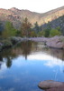
Notjulia and I headed out to the western Supes for a simple, short, relaxing, nothing-to-extreme hike off hieroglyphics, there is a trail on top of the mountain due east of the hiero trail,but south of and well above the giant balancing rock, its well marked easy follow but not at commonly used and it has some sweet moments of hoodoo hoppin and some fun full body non tech climbing sections and takes you directly up to the west side of 5057...what is that trail???
We never found the start of it cuz we had bushwhacked up, i'd be willing to go that route again but might help to know where it begins and all that jazz. Any ideas??
Where were we?!
Moderator: HAZ - Moderators
Linked Guides none
Linked Area, etc none
-
 HippyGuides: 8 | Official Routes: 1Triplogs Last: 1,087 d | RS: 8Water Reports 1Y: 0 | Last: 1,258 d
 - Joined: Dec 02 2009 10:08 am
- City, State: Grand Canyon
- Contact:
contribute to this member driven resource
ie: RS > Save/Share after hikes 

-
 gummoGuides: 13 | Official Routes: 0Triplogs Last: 75 d | RS: 0Water Reports 1Y: 0 | Last: never
 - Joined: Oct 23 2010 10:07 am
- City, State: mesa
Re: Where were we?!
Sounds like it's Turk's Head trail just by your description but I'm not familiar with that area.
contribute to this member driven resource
ie: RS > Save/Share after hikes
contribute to this member driven resource
ie: RS > Save/Share after hikes
-
HippyGuides: 8 | Official Routes: 1Triplogs Last: 1,087 d | RS: 8Water Reports 1Y: 0 | Last: 1,258 d
- Joined: Dec 02 2009 10:08 am
- City, State: Grand Canyon
- Contact:
Re: Where were we?!
@mazatzal that might be it but we avoided the creek, not sure where it began though we whacked up and ran into an arrow! Hehe i'll have to compare that route to what I marked on the map.
contribute to this member driven resource
ie: RS > Save/Share after hikes
-
 rwstormGuides: 1 | Official Routes: 12Triplogs Last: 606 d | RS: 1Water Reports 1Y: 0 | Last: 2,820 d
 - Joined: Feb 28 2003 5:45 pm
- City, State: Tucson, AZ
- Contact:
Re: Where were we?!
You took the route I did on my 3 ridgeline hikes. I couldn't believe a trail up there in places above balanced rock, but it makes a beeline for 5057 and works quite well.
contribute to this member driven resource
ie: RS > Save/Share after hikes
-
 mazatzalGuides: 0 | Official Routes: 6Triplogs Last: 13 d | RS: 1Water Reports 1Y: 0 | Last: 849 d
 - Joined: Jul 28 2004 2:18 pm
- City, State: Scottsdale, AZ
Re: Where were we?!
@The Hippy
Yep, it avoids the creek quite a bit. Starts from the glyphs. It's been there a while but was a fainter route 18 years ago
Yep, it avoids the creek quite a bit. Starts from the glyphs. It's been there a while but was a fainter route 18 years ago
contribute to this member driven resource
ie: RS > Save/Share after hikes
-
 outdoor_loverGuides: 7 | Official Routes: 6Triplogs Last: 114 d | RS: 2Water Reports 1Y: 29 | Last: 127 d
 - Joined: Aug 19 2011 7:49 pm
- City, State: Scottsdale, AZ
Re: Where were we?!
@mazatzal
They must have blazed a newer one further up the Canyon, as the one (that was Cairned), that Van and I followed didn't take us directly up to 5057. So somewhere up there is another side Trail. It probably follows the other Drainage and dumps you right at the west base of 5057. The one we followed took us straight to the Ridgeline at a large Saddle, and then we had to take a right and follow the Ridgeline Trail around to where you would normally go up 5057. The Official Routes all show the way we went....
They must have blazed a newer one further up the Canyon, as the one (that was Cairned), that Van and I followed didn't take us directly up to 5057. So somewhere up there is another side Trail. It probably follows the other Drainage and dumps you right at the west base of 5057. The one we followed took us straight to the Ridgeline at a large Saddle, and then we had to take a right and follow the Ridgeline Trail around to where you would normally go up 5057. The Official Routes all show the way we went....
Life is not a journey to the grave with the intention of arriving safely in a pretty & well preserved body, but rather to skid in broadside, totally worn out & proclaiming, "Wow What a Ride!"
contribute to this member driven resource
ie: RS > Save/Share after hikes
-
HippyGuides: 8 | Official Routes: 1Triplogs Last: 1,087 d | RS: 8Water Reports 1Y: 0 | Last: 1,258 d
- Joined: Dec 02 2009 10:08 am
- City, State: Grand Canyon
- Contact:
Re: Where were we?!
@RWStorm that sounds right, we went directly east up the side of the mountain from the glyphs and the big pool (the "beach" as lizard called it" we whacked up right next to the giant balancing rock then kept heading east, pretty much up over the hoodoos, we climbed a crap ton until we found the annoying "arrow" this was on the south side of the hoodoos, we followed it staying on the southern "face" of that smaller mountain the whole time then right up 5057, really neat, we were nowhere near the ridgeline where it connects to hiero, though i might have to go figure that one out next time...
i think maz hit this one on the head with that link he posted, it matches up pretty close. thanks!
i think maz hit this one on the head with that link he posted, it matches up pretty close. thanks!
contribute to this member driven resource
ie: RS > Save/Share after hikes
-
HippyGuides: 8 | Official Routes: 1Triplogs Last: 1,087 d | RS: 8Water Reports 1Y: 0 | Last: 1,258 d
- Joined: Dec 02 2009 10:08 am
- City, State: Grand Canyon
- Contact:
Re: Where were we?!
meh, my only question now is....if we went up hiero, whacked up the side of the mountain of hoodoos between 5057 and hiero... bagged 5057 then came down to carney TH (we hitched a ride back to hiero TH)....how many miles is that??? i need to get a friggin gps, i swear 
contribute to this member driven resource
ie: RS > Save/Share after hikes
-
rwstormGuides: 1 | Official Routes: 12Triplogs Last: 606 d | RS: 1Water Reports 1Y: 0 | Last: 2,820 d
- Joined: Feb 28 2003 5:45 pm
- City, State: Tucson, AZ
- Contact:
Re: Where were we?!
@The Hippy
The answer is here: http://hikearizona.com/map.php?GPS=7329
Difference being Joe stayed in the canyon to the ridgeline. The breakaway to the ridge east of the petroglyphs to 5057 is about the same distance. If you were to end the hike by hitting the Peralta Road by Carney, it would be a little over 7.5 miles. Much better to stay on the Lost Goldmine back to Hiero than hitchhiking IMO.
contribute to this member driven resource
ie: RS > Save/Share after hikes
-
 Tough_BootsGuides: 0 | Official Routes: 6Triplogs Last: 2,688 d | RS: 20Water Reports 1Y: 0 | Last: 2,828 d
 - Joined: Mar 28 2008 7:08 pm
- City, State: Phoenix, AZ
Re: Where were we?!
maybe you should start with a plan and a sense of direction first.The Hippy wrote:i need to get a friggin gps, i swear
contribute to this member driven resource
ie: RS > Save/Share after hikes
-
HippyGuides: 8 | Official Routes: 1Triplogs Last: 1,087 d | RS: 8Water Reports 1Y: 0 | Last: 1,258 d
- Joined: Dec 02 2009 10:08 am
- City, State: Grand Canyon
- Contact:
Re: Where were we?!
I caught up with an elderly gentleman and his son and grandson, they were really nice guys and we shared some awesome hiking stories, they were very nice and gave Lizard and I a lift down to the Hiero TH. Plus, the elderly gentleman's son is one of my latest HAZ recruitmentsRWStorm wrote:Much better to stay on the Lost Goldmine back to Hiero than hitchhiking IMO.
@Tough_Boots that doesn't even make sense, my plan was to go up 5057 from Hiero, just not on a trail

contribute to this member driven resource
ie: RS > Save/Share after hikes
-
 KilgoreTroutGuides: 0 | Official Routes: 0Triplogs Last: none | RS: 0Water Reports 1Y: 0 | Last: never
 - Joined: Feb 11 2013 7:37 pm
- City, State: Chandler, Az
Re: Where were we?!
Dearest Hippie & Lizard, I'm not sure if I was the elderly gentleman or his father in the above post. As I was hiking with my friend and my son when you stumbled upon us. Note my friend is 2 years older than me, so I'm not sure how you assumed one of us was the grandfather. Anyhow, it was nice meeting you y su amiga. By the time you saw me I was pretty beaten down by the hike as I'd bitten off way more than I could handle. That plus pulling a muscle in my quad about halfway through the hike didn't help me either. Now had I known you were going to call me elderly, I would have made you walk the last mile to your car. ;)
contribute to this member driven resource
ie: RS > Save/Share after hikes
-
 The_EagleGuides: 42 | Official Routes: 365Triplogs Last: 10 d | RS: 766Water Reports 1Y: 76 | Last: 18 d
 - Joined: Jan 20 2009 2:46 pm
- City, State: Far NE Phoenix, Az
- Contact:

contribute to this member driven resource
ie: RS > Save/Share after hikes
-
 GrasshopperGuides: 48 | Official Routes: 143Triplogs Last: 318 d | RS: 0Water Reports 1Y: 0 | Last: 1,043 d
 - Joined: Dec 28 2006 5:06 pm
- City, State: Scottsdale, AZ
Re: Where were we?!
(Outside.. "there is No Place Like It!!")
contribute to this member driven resource
ie: RS > Save/Share after hikes
-
 big_loadGuides: 0 | Official Routes: 1Triplogs Last: 511 d | RS: 3Water Reports 1Y: 0 | Last: 2,714 d
 - Joined: Oct 28 2003 11:20 am
- City, State: Andover, NJ
Re: Where were we?!
contribute to this member driven resource
ie: RS > Save/Share after hikes
-
KilgoreTroutGuides: 0 | Official Routes: 0Triplogs Last: none | RS: 0Water Reports 1Y: 0 | Last: never
- Joined: Feb 11 2013 7:37 pm
- City, State: Chandler, Az
Re: Where were we?!
After re-reading The Hippy's post I realized that she thinks I was the grandfather of the group. Ouch! Still not exactly sure how she thought my 53 yr old friend was my son (and that my son was his son since we look alot a like). I will just shrug off her impaired cognitive abilities to a lack of red meat in her diet or the stress from running down the mountain trying to find someone to bum a ride from - quien sabe. ;) At least I didn't fall waist deep into a dead big horn sheep.
contribute to this member driven resource
ie: RS > Save/Share after hikes
-
Tough_BootsGuides: 0 | Official Routes: 6Triplogs Last: 2,688 d | RS: 20Water Reports 1Y: 0 | Last: 2,828 d
- Joined: Mar 28 2008 7:08 pm
- City, State: Phoenix, AZ
Re: Where were we?!
this is getting better than the feral cat thread 
contribute to this member driven resource
ie: RS > Save/Share after hikes
-
HippyGuides: 8 | Official Routes: 1Triplogs Last: 1,087 d | RS: 8Water Reports 1Y: 0 | Last: 1,258 d
- Joined: Dec 02 2009 10:08 am
- City, State: Grand Canyon
- Contact:
Re: Where were we?!
@KilgoreTrout well, i'm only 26, shoot my boyfriend can seem "elderly" to me sometimes... 
I'm hoping you are the Kevin or the Dave we met! THANKS AGAIN!!! I realized after we sank into the subaru I was going to give you $5 for letting us hitchhike!!! I'll get you next time!
I'm an awful judge of age...most people think I'm 17....which could also be attributed to my lack of red meat
by the way...
contribute to this member driven resource
ie: RS > Save/Share after hikes
-
KilgoreTroutGuides: 0 | Official Routes: 0Triplogs Last: none | RS: 0Water Reports 1Y: 0 | Last: never
- Joined: Feb 11 2013 7:37 pm
- City, State: Chandler, Az
Re: Where were we?!
I was the one slowly limping down the mountain using his hiking poles like crutches. You can pay the $5 forward..... I was more taken back by the fact that you though my friend (who is older than me) was my son, and that my son was his son. I showed your post to my son last night and he cracked up laughing. I do have daughters in your age range that could produce a grandchild, but not have emerged yet. Happy trails
contribute to this member driven resource
ie: RS > Save/Share after hikes