| | -
| 1 label |  |
|
2 |
-
| |  |
|
1 |
-
| 2 labels | 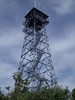 |
|
3 |
-
-
| 1 label |  |
|
1 |
|
| | |
|
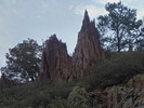
| Hiking | 15.50 Miles |
4,108 AEG |
| | Hiking | 15.50 Miles | 4 Hrs 44 Mns | | 3.27 mph |
| 4,108 ft AEG | | | | |
|
|
| |
| Linked |
|
none
[ show ]
| no linked trail guides |
| Partners |
|
none
[ show ]
| no partners | | | apparently this member prefers to keep an air of mystery... | | _____________________
| Tortoise Hiking. Stop and smell the Petrichor. |
| | |
|
|
|
|
|
| |
 Route Editor


