| | -
-
| |  |
|
1 |
-
-
-
-
|
| | |
|
| Hiking | 1.00 Miles |
40 AEG |
| | Hiking | 1.00 Miles | 25 Mns | | 2.40 mph |
| 40 ft AEG | | | | |
|
|
| |
| Linked |
|
none
[ show ]
| no linked trail guides |
| Partners |
|
none
[ show ]
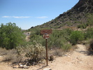
| no partners | | Simple trail in the foothills of the White Tank Mountains. Just far enough out of the city to feel a nice cool breeze but not far enough to be hard on the gas tank.
This hike was my first utilizing my new GPS. I was able to verify that my unit worked, although my location showed up too far east on the GPS map than my actual location. Uploading it to MapSource revealed that it was still wrong. When I uploaded it to the web, it showed up correct. I still have no idea why. |
| _____________________
| | |
|
|
|
|
|
| |
 Route Editor


