 Route Editor


| ||||||||||||||||||||||||||||||||||||||||||||||||||||||||||||||||||||||||||||||||||
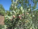
DESTINATION Gold Ridge Trail #47 44 Photosets 2026-02-14 2025-05-03 2025-04-11 2024-06-01 2024-06-01 2023-12-09 2023-11-04 2022-10-03 2022-04-11 2022-02-14 2021-11-06 2021-07-26 2021-04-03 2021-03-29 2021-02-14 2020-11-09 2020-04-24 2020-04-21 2020-03-30 2020-03-27
|
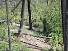
| HAZ Member wallyfrack's 763 Photosets 2024-06-22 2024-06-19 2024-06-08 2024-06-01 2024-05-25 2024-05-23 2024-05-20 2024-05-11 2024-05-04 2024-04-27 2024-04-20 2024-03-30 2024-03-23 2024-03-16 2024-03-10 2024-02-11 2024-02-03 2023-12-28 2023-12-19 2023-12-09
| |||||||||||||||||||||||||||||||||||||||||||||||||||||||||||||||||||||||||||||||||||||
|
|
|
|


